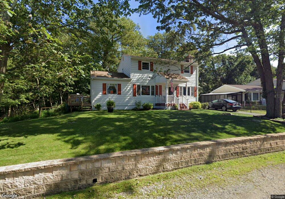
313 Dupont Ave Hopatcong, NJ 07843
Estimated Value: $464,000 - $556,000
--
Bed
--
Bath
1,776
Sq Ft
$277/Sq Ft
Est. Value
About This Home
This home is located at 313 Dupont Ave, Hopatcong, NJ 07843 and is currently estimated at $491,844, approximately $276 per square foot. 313 Dupont Ave is a home located in Sussex County with nearby schools including Hudson Maxim Elementary School, Durban Avenue Elementary School, and Tulsa Trail Elementary School.
Ownership History
Date
Name
Owned For
Owner Type
Purchase Details
Closed on
Feb 10, 1999
Sold by
Goode Brian P and Caruso Judith Goode
Bought by
Goode Brian P and Caruso Judith Goode
Current Estimated Value
Home Financials for this Owner
Home Financials are based on the most recent Mortgage that was taken out on this home.
Original Mortgage
$88,000
Interest Rate
6.75%
Mortgage Type
Stand Alone First
Purchase Details
Closed on
Dec 29, 1997
Sold by
Diamond Leasing & Management Corp
Bought by
Boltuch Bruce
Create a Home Valuation Report for This Property
The Home Valuation Report is an in-depth analysis detailing your home's value as well as a comparison with similar homes in the area
Home Values in the Area
Average Home Value in this Area
Purchase History
| Date | Buyer | Sale Price | Title Company |
|---|---|---|---|
| Goode Brian P | $59,677 | -- | |
| Boltuch Bruce | $125,000 | -- |
Source: Public Records
Mortgage History
| Date | Status | Borrower | Loan Amount |
|---|---|---|---|
| Closed | Goode Brian P | $88,000 |
Source: Public Records
Tax History Compared to Growth
Tax History
| Year | Tax Paid | Tax Assessment Tax Assessment Total Assessment is a certain percentage of the fair market value that is determined by local assessors to be the total taxable value of land and additions on the property. | Land | Improvement |
|---|---|---|---|---|
| 2025 | $9,278 | $445,000 | $134,700 | $310,300 |
| 2024 | $8,205 | $445,000 | $134,700 | $310,300 |
| 2023 | $8,205 | $234,500 | $78,300 | $156,200 |
| 2022 | $8,043 | $234,500 | $78,300 | $156,200 |
| 2021 | $7,907 | $234,500 | $78,300 | $156,200 |
| 2020 | $7,825 | $234,500 | $78,300 | $156,200 |
| 2019 | $7,792 | $234,500 | $78,300 | $156,200 |
| 2018 | $7,776 | $234,500 | $78,300 | $156,200 |
| 2017 | $7,764 | $234,500 | $78,300 | $156,200 |
| 2016 | $7,781 | $234,500 | $78,300 | $156,200 |
| 2015 | $7,605 | $233,400 | $78,300 | $155,100 |
| 2014 | $7,543 | $233,400 | $78,300 | $155,100 |
Source: Public Records
Map
Nearby Homes
- 4 Kansas Way
- 23 Fordham Trail
- 114 Rollins Trail
- 8 Oneida Ave
- 34 Oklahoma Trail
- 35 Mountain Trail
- 121 Bucknell Trail
- 354 Maxim Dr
- 14 Marshall Trail
- 116 Bucknell Trail
- 66 Sutton Trail
- 496 River Styx Rd
- 10 N River Styx Rd
- 38 W River Styx Rd
- 8 Walton Rd
- 167 Marne Rd
- 208 Maxim Dr
- 5 W Unit 204
- 5 W River Styx Rd Unit 302
- 9 Papoose Trail
- 311 Dupont Ave
- 315 Dupont Ave
- 314 Dupont Ave
- 317 Dupont Ave
- 316 Dupont Ave
- 312 Dupont Ave
- 309 Dupont Ave
- 318 Dupont Ave
- 319 Dupont Ave
- 308 Dupont Ave
- 133 Rollins Trail
- 131 Rollins Trail
- 307 Dupont Ave
- 129 Rollins Trail
- 321 Dupont Ave
- 137 Rollins Trail
- 305 Dupont Ave
- 127 Rollins Trail
- 125 Rollins Trail
- 139 Rollins Trail