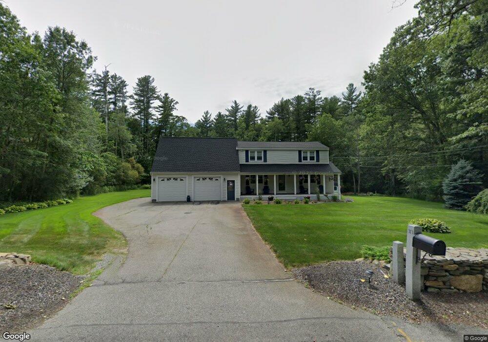
313 Forest St Dunstable, MA 01827
Estimated Value: $596,021 - $689,000
4
Beds
2
Baths
2,016
Sq Ft
$325/Sq Ft
Est. Value
About This Home
This home is located at 313 Forest St, Dunstable, MA 01827 and is currently estimated at $655,005, approximately $324 per square foot. 313 Forest St is a home located in Middlesex County with nearby schools including Groton Dunstable Regional High School, 2nd Nature Academy, and Academy of Notre Dame - Upper School.
Ownership History
Date
Name
Owned For
Owner Type
Purchase Details
Closed on
May 31, 2001
Sold by
Lemonias Dev Co Inc
Bought by
Lotane Philip S and Lotane Nancy J
Current Estimated Value
Purchase Details
Closed on
Jul 24, 2000
Sold by
Treibick Theodore
Bought by
Lemonias Dev Co
Purchase Details
Closed on
Mar 1, 1995
Sold by
Ledin Philip
Bought by
Ferrari Shawn and Sawicki Dawn
Create a Home Valuation Report for This Property
The Home Valuation Report is an in-depth analysis detailing your home's value as well as a comparison with similar homes in the area
Home Values in the Area
Average Home Value in this Area
Purchase History
| Date | Buyer | Sale Price | Title Company |
|---|---|---|---|
| Lotane Philip S | $929,900 | -- | |
| Lemonias Dev Co | $275,000 | -- | |
| Ferrari Shawn | $141,000 | -- |
Source: Public Records
Mortgage History
| Date | Status | Borrower | Loan Amount |
|---|---|---|---|
| Open | Ferrari Shawn | $249,000 | |
| Closed | Ferrari Shawn | $247,500 |
Source: Public Records
Tax History
| Year | Tax Paid | Tax Assessment Tax Assessment Total Assessment is a certain percentage of the fair market value that is determined by local assessors to be the total taxable value of land and additions on the property. | Land | Improvement |
|---|---|---|---|---|
| 2025 | $7,014 | $510,100 | $212,000 | $298,100 |
| 2024 | $6,699 | $479,900 | $195,700 | $284,200 |
| 2023 | $6,756 | $451,300 | $195,700 | $255,600 |
| 2022 | $6,307 | $413,600 | $195,700 | $217,900 |
| 2021 | $6,280 | $382,700 | $179,400 | $203,300 |
| 2020 | $6,315 | $375,000 | $179,400 | $195,600 |
| 2019 | $6,215 | $364,300 | $179,400 | $184,900 |
| 2018 | $9,416 | $351,700 | $179,400 | $172,300 |
| 2017 | $5,948 | $349,500 | $179,400 | $170,100 |
| 2016 | $5,624 | $339,800 | $171,200 | $168,600 |
| 2015 | $5,292 | $316,300 | $143,500 | $172,800 |
| 2014 | $4,783 | $303,300 | $143,500 | $159,800 |
Source: Public Records
Map
Nearby Homes
- 0 Lowell St
- 16 Cannongate Rd Unit 16
- 160 Westford Rd
- 153 Off Pond St
- 103 Pondview Place Unit 103
- 319 Pleasant St
- 62 Brook St
- 2 Strawberry Bank Rd Unit 17
- 0 Dunstable Rd
- 4 Heritage Village Dr
- 14 Centercrest Dr Unit 14
- 6 Green Heron Ln Unit U22
- 38 Georgetown Dr
- 22 Highland Rd
- 3 Black Oak Dr Unit C
- 56 Frost Rd
- 11 Lojko Dr
- 20 Georgetown Dr
- 24 Old Tyng Rd
- 141 Ridge Rd
Your Personal Tour Guide
Ask me questions while you tour the home.