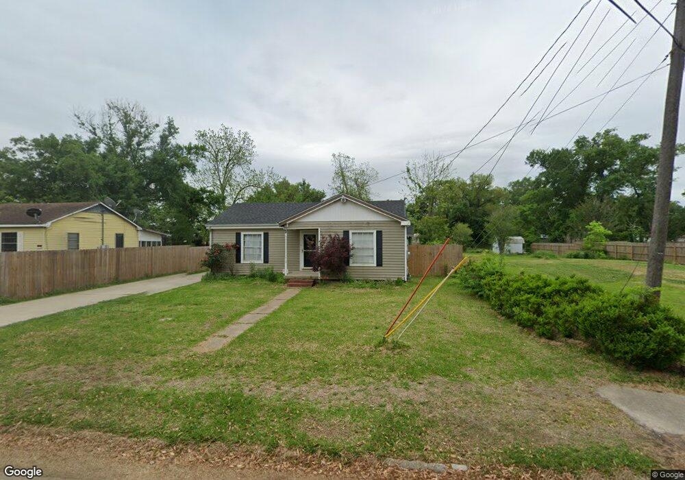
313 Leland St Sulphur, LA 70663
Estimated Value: $120,388 - $156,000
3
Beds
2
Baths
1,706
Sq Ft
$82/Sq Ft
Est. Value
About This Home
This home is located at 313 Leland St, Sulphur, LA 70663 and is currently estimated at $140,097, approximately $82 per square foot. 313 Leland St is a home located in Calcasieu Parish with nearby schools including W.T. Henning Elementary School, W.W. Lewis Middle School, and Sulphur High School.
Ownership History
Date
Name
Owned For
Owner Type
Purchase Details
Closed on
Jan 5, 2023
Sold by
Gilbert Lauren
Bought by
Ltg Rentals La Llc
Current Estimated Value
Purchase Details
Closed on
Aug 8, 2013
Sold by
Andrews Brandon J and Andrews Kristin M
Bought by
Taylor Lauren Ann
Home Financials for this Owner
Home Financials are based on the most recent Mortgage that was taken out on this home.
Original Mortgage
$104,500
Interest Rate
4.49%
Mortgage Type
Unknown
Create a Home Valuation Report for This Property
The Home Valuation Report is an in-depth analysis detailing your home's value as well as a comparison with similar homes in the area
Home Values in the Area
Average Home Value in this Area
Purchase History
| Date | Buyer | Sale Price | Title Company |
|---|---|---|---|
| Ltg Rentals La Llc | -- | -- | |
| Taylor Lauren Ann | $110,000 | Old Republic National Title |
Source: Public Records
Mortgage History
| Date | Status | Borrower | Loan Amount |
|---|---|---|---|
| Previous Owner | Taylor Lauren Ann | $104,500 |
Source: Public Records
Tax History Compared to Growth
Tax History
| Year | Tax Paid | Tax Assessment Tax Assessment Total Assessment is a certain percentage of the fair market value that is determined by local assessors to be the total taxable value of land and additions on the property. | Land | Improvement |
|---|---|---|---|---|
| 2024 | $866 | $8,050 | $1,300 | $6,750 |
| 2023 | $866 | $8,050 | $1,300 | $6,750 |
| 2022 | $859 | $8,050 | $1,300 | $6,750 |
| 2021 | $741 | $8,050 | $1,300 | $6,750 |
| 2020 | $781 | $7,330 | $1,250 | $6,080 |
| 2019 | $857 | $7,950 | $1,200 | $6,750 |
| 2018 | $166 | $7,950 | $1,200 | $6,750 |
| 2017 | $891 | $7,950 | $1,200 | $6,750 |
| 2016 | $921 | $7,950 | $1,200 | $6,750 |
| 2015 | $921 | $7,950 | $1,200 | $6,750 |
Source: Public Records
Map
Nearby Homes
- 319 Landry St
- 400 Landry St
- 321 W Parish Rd
- 1713 Ewel St
- 1740 Owens St
- 719 Landry St
- 1605 Ruth St
- 509 Henning Dr
- 217 Darbonne St
- 112 Darbonne St
- 0 Eddie St Unit SWL24005544
- 0 Eddie St Unit SWL23005682
- 1515 Picard Rd
- 1641 Eddie St
- 0 Arena Rd Unit SWL21005814
- 0 Arena Rd Unit SWL21009044
- 284 E Roddam St
- 1406 Carol St
- 1009 Sara St
- 0 Thomason St