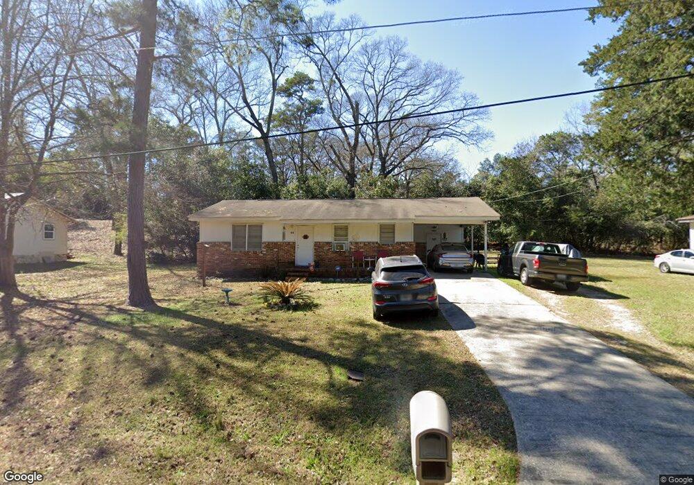
313 Mauk Cir Warner Robins, GA 31093
Estimated Value: $112,000 - $203,410
2
Beds
1
Bath
975
Sq Ft
$157/Sq Ft
Est. Value
About This Home
This home is located at 313 Mauk Cir, Warner Robins, GA 31093 and is currently estimated at $153,103, approximately $157 per square foot. 313 Mauk Cir is a home located in Houston County with nearby schools including Westside Elementary School, Northside Middle School, and Northside High School.
Ownership History
Date
Name
Owned For
Owner Type
Purchase Details
Closed on
Feb 28, 2013
Sold by
Harrington Walter E
Bought by
American Prospector Corporation
Current Estimated Value
Purchase Details
Closed on
Mar 20, 2003
Sold by
Harrington Walter E
Bought by
Chivas Properties Llc
Purchase Details
Closed on
Dec 27, 2002
Sold by
Byrd Mark S As Trustee
Bought by
Chivas Properties Llc & Harrington W Jr
Purchase Details
Closed on
Feb 8, 1991
Sold by
Pinckney Martin B
Bought by
Byrd Robert S and Harrington Walter E
Purchase Details
Closed on
Feb 9, 1978
Sold by
Evans Geraldine G Trustee
Bought by
Byrd Robert S and Pinckney Martin
Purchase Details
Closed on
Feb 6, 1975
Sold by
Snellgrove M R
Bought by
Evans Geraldine B Trustee
Purchase Details
Closed on
Nov 24, 1969
Sold by
Pike David F
Bought by
Snellgrove M R
Create a Home Valuation Report for This Property
The Home Valuation Report is an in-depth analysis detailing your home's value as well as a comparison with similar homes in the area
Home Values in the Area
Average Home Value in this Area
Purchase History
| Date | Buyer | Sale Price | Title Company |
|---|---|---|---|
| American Prospector Corporation | -- | -- | |
| Chivas Properties Llc | -- | -- | |
| Chivas Properties Llc & Harrington W Jr | -- | -- | |
| Byrd Mark S | -- | -- | |
| Byrd Robert S | -- | -- | |
| Byrd Robert S | -- | -- | |
| Evans Geraldine B Trustee | -- | -- | |
| Snellgrove M R | -- | -- |
Source: Public Records
Tax History Compared to Growth
Tax History
| Year | Tax Paid | Tax Assessment Tax Assessment Total Assessment is a certain percentage of the fair market value that is determined by local assessors to be the total taxable value of land and additions on the property. | Land | Improvement |
|---|---|---|---|---|
| 2024 | $651 | $27,200 | $5,560 | $21,640 |
| 2023 | $566 | $23,400 | $5,560 | $17,840 |
| 2022 | $508 | $21,000 | $4,480 | $16,520 |
| 2021 | $446 | $18,360 | $4,480 | $13,880 |
| 2020 | $405 | $19,840 | $4,480 | $15,360 |
| 2019 | $484 | $19,840 | $4,480 | $15,360 |
| 2018 | $258 | $19,840 | $4,480 | $15,360 |
| 2017 | $485 | $19,840 | $4,480 | $15,360 |
| 2016 | $485 | $19,840 | $4,480 | $15,360 |
| 2015 | $486 | $19,840 | $4,480 | $15,360 |
| 2014 | -- | $19,840 | $4,480 | $15,360 |
| 2013 | -- | $20,800 | $5,000 | $15,800 |
Source: Public Records
Map
Nearby Homes
- 209 Knodishall Dr
- 501 Pinecrest Dr
- 129 Maryjay Dr
- 110 Westcliff Cir Unit C
- 106 Westcliff Cir
- 111 Hawthorne Rd
- 103 Westcliff Cir Unit A
- 103 Westcliff Cir Unit A
- 112 Peacock Dr
- 221 Gilchrist Dr
- 301 Millside Dr
- 725 B East Side Dr
- 86 Westcliff Cir
- 102 Westcliff Center St Unit D
- 110 Westcliff Center St
- 141 Peacock Dr
- 303 Pinecrest Dr
- 110 Foxfire Dr
- 102 Williams St
- 123 Tanglewood Dr
- 311 Mauk Cir
- 315 Mauk Cir
- 210 Knodishall Dr
- 214 Knodishall Dr
- 309 Mauk Cir
- 208 Knodishall Dr
- 216 Knodishall Dr
- 307 Mauk Cir
- 206 Knodishall Dr
- 218 Knodishall Dr
- 213 Knodishall Dr
- 215 Knodishall Dr
- 305 Mauk Cir
- 220 Knodishall Dr
- 217 Knodishall Dr
- 207 Knodishall Dr
- 219 Knodishall Dr
- 303 Mauk Cir
- 202 Knodishall Dr
- 222 Knodishall Dr