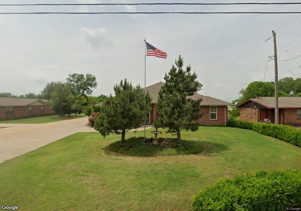
313 N Carol Terrace Mustang, OK 73064
Estimated Value: $268,000 - $359,000
3
Beds
2
Baths
2,195
Sq Ft
$147/Sq Ft
Est. Value
About This Home
This home is located at 313 N Carol Terrace, Mustang, OK 73064 and is currently estimated at $323,557, approximately $147 per square foot. 313 N Carol Terrace is a home with nearby schools including Mustang Elementary School, Mustang Horizon Intermediate School, and Mustang Middle School.
Ownership History
Date
Name
Owned For
Owner Type
Purchase Details
Closed on
Jan 7, 2015
Sold by
Burke Michael D and Burke Jo Ellen
Bought by
Burke Michael D and Burke Jo Ellen
Current Estimated Value
Home Financials for this Owner
Home Financials are based on the most recent Mortgage that was taken out on this home.
Original Mortgage
$187,500
Outstanding Balance
$143,085
Interest Rate
3.74%
Mortgage Type
VA
Estimated Equity
$180,472
Purchase Details
Closed on
Apr 22, 1996
Sold by
Burke Herbert E and Burke Opal
Create a Home Valuation Report for This Property
The Home Valuation Report is an in-depth analysis detailing your home's value as well as a comparison with similar homes in the area
Home Values in the Area
Average Home Value in this Area
Purchase History
| Date | Buyer | Sale Price | Title Company |
|---|---|---|---|
| Burke Michael D | -- | American Eagle Title Group | |
| -- | -- | -- |
Source: Public Records
Mortgage History
| Date | Status | Borrower | Loan Amount |
|---|---|---|---|
| Open | Burke Michael D | $187,500 |
Source: Public Records
Tax History Compared to Growth
Tax History
| Year | Tax Paid | Tax Assessment Tax Assessment Total Assessment is a certain percentage of the fair market value that is determined by local assessors to be the total taxable value of land and additions on the property. | Land | Improvement |
|---|---|---|---|---|
| 2024 | $2,373 | $25,527 | $1,296 | $24,231 |
| 2023 | $2,373 | $24,784 | $1,296 | $23,488 |
| 2022 | $2,329 | $24,062 | $1,296 | $22,766 |
| 2021 | $2,338 | $24,062 | $1,296 | $22,766 |
| 2020 | $2,325 | $23,797 | $1,296 | $22,501 |
| 2019 | $2,255 | $23,104 | $1,296 | $21,808 |
| 2018 | $2,234 | $22,431 | $1,296 | $21,135 |
| 2017 | $2,239 | $22,730 | $1,388 | $21,342 |
| 2016 | $2,197 | $22,283 | $1,388 | $20,895 |
| 2015 | -- | $1,388 | $1,388 | $0 |
| 2014 | -- | $1,336 | $1,336 | $0 |
Source: Public Records
Map
Nearby Homes
- 321 N Carol Terrace
- 201 S Monocoupe Ln
- 1712 E Cottonwood Terrace
- 1713 E Frontier Terrace
- 307 S Morgan Rd
- 1738 E Frontier Terrace
- 531 S Monocoupe Ln
- 1740 E Lake Park Ln
- 1885 E Sherwood Terrace
- 424 N Mitchell Terrace
- 1423 E Twin Brook Terrace
- 1209 E Stetson Ln
- 1213 E Stetson Ln
- 1228 E Ruger Ln
- ELGIN Plan at Wild Horse Canyon
- BELLEVUE Plan at Wild Horse Canyon
- DENTON Plan at Wild Horse Canyon
- KINGSTON Plan at Wild Horse Canyon
- CALI Plan at Wild Horse Canyon
- 925 S Buffalo Ln
- 317 N Carol Terrace
- 309 N Carol Terrace
- 308 N Carol Terrace
- 228 N Carol Terrace
- 220 N Carol Terrace
- 407 N Carol Terrace
- 403 N Carol Terrace
- 330 N Hunker Terrace
- 405 N Monocoupe Terrace
- 214 N Carol Terrace
- 319 N Monocoupe Terrace
- 310 N Hunker Terrace
- 414 N Carol Terrace
- 208 N Carol Terrace
- 215 N Monocoupe Terrace
- 419 N Carol Terrace
- 324 N Monocoupe Terrace
- 207 N Monocoupe Terrace
- 316 N Monocoupe Terrace