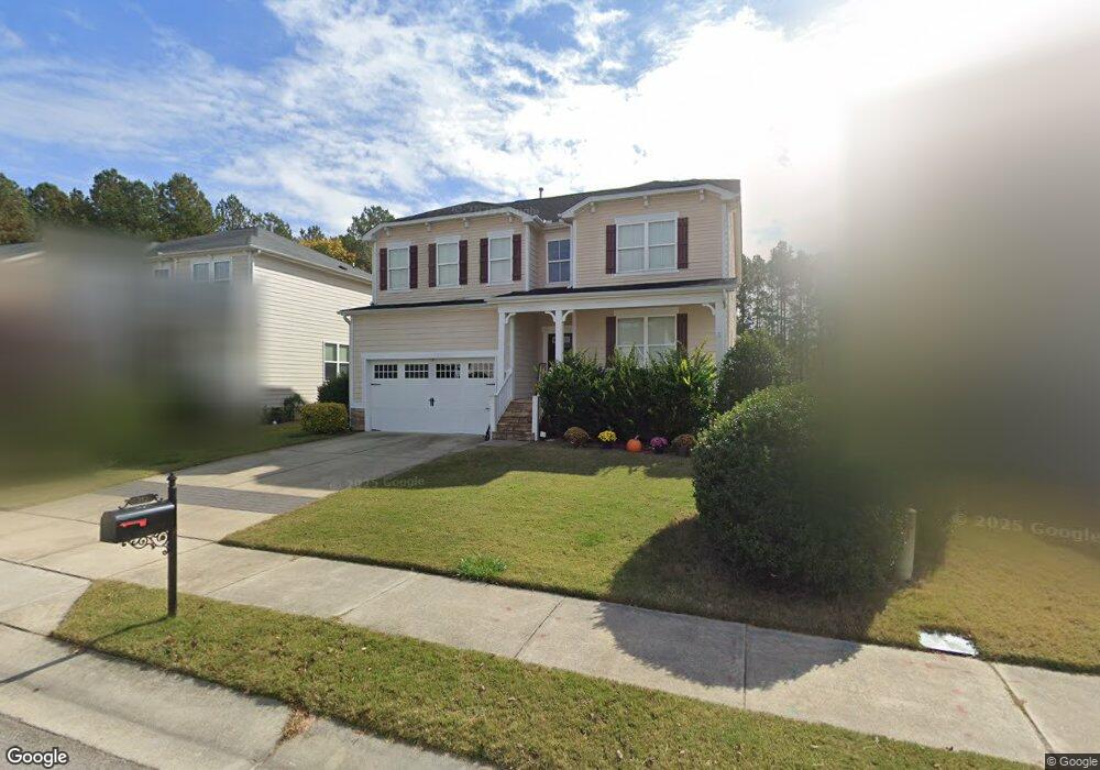
313 Plott Hound Ln Wake Forest, NC 27587
Estimated Value: $440,000 - $569,000
5
Beds
3
Baths
2,988
Sq Ft
$170/Sq Ft
Est. Value
About This Home
This home is located at 313 Plott Hound Ln, Wake Forest, NC 27587 and is currently estimated at $507,597, approximately $169 per square foot. 313 Plott Hound Ln is a home located in Wake County with nearby schools including Sanford Creek Elementary School, Wake Forest-Rolesville Middle School, and Wake Forest High School.
Ownership History
Date
Name
Owned For
Owner Type
Purchase Details
Closed on
Jun 5, 2014
Sold by
The Secretary Of Veterans Affairs
Bought by
Colfin Ah North Carolina I Llc
Current Estimated Value
Purchase Details
Closed on
Feb 7, 2014
Sold by
Campbell Tayinikia D
Bought by
Secretary Of Veterans Affairs
Purchase Details
Closed on
Mar 20, 2008
Sold by
Beazer Homes Corp
Bought by
Campbell Tayinikia D
Home Financials for this Owner
Home Financials are based on the most recent Mortgage that was taken out on this home.
Original Mortgage
$223,731
Interest Rate
4.75%
Mortgage Type
VA
Create a Home Valuation Report for This Property
The Home Valuation Report is an in-depth analysis detailing your home's value as well as a comparison with similar homes in the area
Home Values in the Area
Average Home Value in this Area
Purchase History
| Date | Buyer | Sale Price | Title Company |
|---|---|---|---|
| Colfin Ah North Carolina I Llc | -- | None Available | |
| Secretary Of Veterans Affairs | $201,338 | None Available | |
| Campbell Tayinikia D | $224,000 | None Available |
Source: Public Records
Mortgage History
| Date | Status | Borrower | Loan Amount |
|---|---|---|---|
| Previous Owner | Campbell Tayinikia D | $223,731 |
Source: Public Records
Tax History
| Year | Tax Paid | Tax Assessment Tax Assessment Total Assessment is a certain percentage of the fair market value that is determined by local assessors to be the total taxable value of land and additions on the property. | Land | Improvement |
|---|---|---|---|---|
| 2025 | $4,771 | $494,066 | $80,000 | $414,066 |
| 2024 | $4,753 | $494,066 | $80,000 | $414,066 |
Source: Public Records
Map
Nearby Homes
- 336 Plott Hound Ln
- 1824 Longmont Dr
- 1837 Longmont Dr
- 2236 Longmont Dr
- 320 Kavanaugh Rd
- 1736 Fern Hollow Trail
- 1369 Bessie Ct
- 1352 Bessie Ct
- 1365 Bessie Ct
- 117 Dry Gully Ct
- 1363 Bessie Ct
- 1628 Fern Hollow Trail
- 104 Whey Ct
- 565 Marthas View Way
- 317 Murray Grey Ln
- 540 Marthas View Way
- 1709 Glazebrook Dr
- 1665 Fern Hollow Trail
- 357 Murray Grey Ln
- 266 Shingle Oak Rd
- 317 Plott Hound Ln
- 309 Plott Hound Ln
- 321 Plott Hound Ln
- 305 Plott Hound Ln
- 308 Plott Hound Ln
- 312 Plott Hound Ln
- 304 Plott Hound Ln
- 325 Plott Hound Ln
- 301 Plott Hound Ln
- 316 Plott Hound Ln
- 320 Plott Hound Ln
- 300 Plott Hound Ln
- 329 Plott Hound Ln
- 324 Plott Hound Ln
- 237 Plott Hound Ln
- 241 Austin View Blvd
- 237 Austin View Blvd
- 301 Austin View Blvd
- 333 Plott Hound Ln
- 328 Plott Hound Ln
Your Personal Tour Guide
Ask me questions while you tour the home.