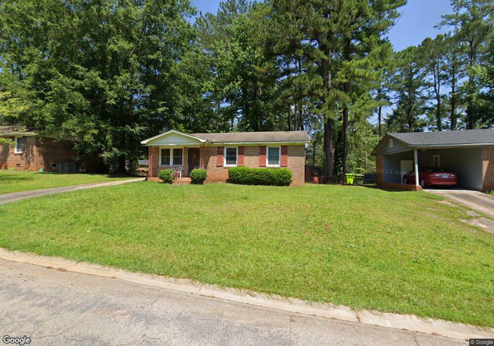
313 Stanford St Columbia, SC 29203
Far North Columbia NeighborhoodEstimated Value: $91,933 - $142,000
3
Beds
1
Bath
988
Sq Ft
$114/Sq Ft
Est. Value
About This Home
This home is located at 313 Stanford St, Columbia, SC 29203 and is currently estimated at $112,233, approximately $113 per square foot. 313 Stanford St is a home located in Richland County with nearby schools including J.P. Thomas Elementary School, Alcorn Middle School, and W.J. Keenan High School.
Ownership History
Date
Name
Owned For
Owner Type
Purchase Details
Closed on
Aug 26, 1999
Sold by
Roberts Hugh S and Walker Daniel
Bought by
Wilson Carrie J
Current Estimated Value
Home Financials for this Owner
Home Financials are based on the most recent Mortgage that was taken out on this home.
Original Mortgage
$39,500
Interest Rate
7.85%
Purchase Details
Closed on
Aug 10, 1999
Sold by
Wilson Stacey T and Wilson Sherman F
Bought by
Wilson Carrie J
Home Financials for this Owner
Home Financials are based on the most recent Mortgage that was taken out on this home.
Original Mortgage
$39,500
Interest Rate
7.85%
Create a Home Valuation Report for This Property
The Home Valuation Report is an in-depth analysis detailing your home's value as well as a comparison with similar homes in the area
Home Values in the Area
Average Home Value in this Area
Purchase History
| Date | Buyer | Sale Price | Title Company |
|---|---|---|---|
| Wilson Carrie J | $2,468 | -- | |
| Wilson Carrie J | -- | -- |
Source: Public Records
Mortgage History
| Date | Status | Borrower | Loan Amount |
|---|---|---|---|
| Previous Owner | Wilson Carrie J | $39,500 |
Source: Public Records
Tax History Compared to Growth
Tax History
| Year | Tax Paid | Tax Assessment Tax Assessment Total Assessment is a certain percentage of the fair market value that is determined by local assessors to be the total taxable value of land and additions on the property. | Land | Improvement |
|---|---|---|---|---|
| 2024 | $482 | $30,200 | $0 | $0 |
| 2023 | $482 | $1,052 | $0 | $0 |
| 2022 | $436 | $26,300 | $3,400 | $22,900 |
| 2021 | $412 | $1,050 | $0 | $0 |
| 2020 | $414 | $1,050 | $0 | $0 |
| 2019 | $377 | $1,050 | $0 | $0 |
| 2018 | $332 | $920 | $0 | $0 |
| 2017 | $329 | $920 | $0 | $0 |
| 2016 | $329 | $920 | $0 | $0 |
| 2015 | $326 | $920 | $0 | $0 |
| 2014 | $323 | $22,900 | $0 | $0 |
| 2013 | -- | $920 | $0 | $0 |
Source: Public Records
Map
Nearby Homes
- 321 Stanford St
- 413 Beaverbrook Dr
- 112 Woodcrest Dr
- 304 Beaver Brook Rd
- 313 Woodcrest Dr
- 0 Stanford St
- 6746 Wakefield Rd
- 0 Roosevelt Rd
- 305 Bertha Ave
- 233 Bowling Ave
- 404 Meadowlake Dr
- 0 Jerome Dr
- 1 Addy Ct
- 1280 Mosser Dr
- 1276 Mosser Dr
- 0 W S Winnsboro Rd
- 0 W S Wakefield Rd
- 536 Sedgewood Dr
- 523 Torwood Dr
- 0 Lakeridge Pkwy
- 309 Stanford St
- 317 Stanford St
- 130 Woodvale Cir
- 134 Woodvale Cir
- 305 Stanford St
- 126 Woodvale Cir
- 118 Woodvale Cir
- 316 Stanford St
- 312 Stanford St
- 138 Woodvale Cir
- 320 Stanford St
- 100 Woodvale Cir
- 108 Woodvale Cir
- 325 Stanford St
- 308 Stanford St
- 324 Stanford St
- 137 Woodvale Cir
- 142 Woodvale Cir
- 304 Stanford St
- 133 Woodvale Cir