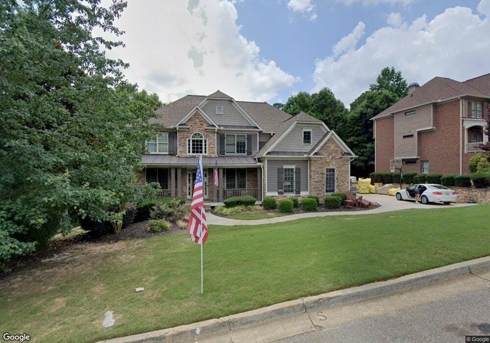
313 Westbridge Ln Unit 4J Canton, GA 30114
Sutallee NeighborhoodEstimated Value: $784,137 - $793,000
6
Beds
5
Baths
4,956
Sq Ft
$159/Sq Ft
Est. Value
About This Home
This home is located at 313 Westbridge Ln Unit 4J, Canton, GA 30114 and is currently estimated at $788,569, approximately $159 per square foot. 313 Westbridge Ln Unit 4J is a home located in Cherokee County with nearby schools including Liberty Elementary School, Freedom Middle School, and Cherokee High School.
Ownership History
Date
Name
Owned For
Owner Type
Purchase Details
Closed on
Jun 1, 2005
Sold by
Weatherby & Assocs Inc
Bought by
Lucas Ted T and Lucas Jennifer
Current Estimated Value
Home Financials for this Owner
Home Financials are based on the most recent Mortgage that was taken out on this home.
Original Mortgage
$64,850
Outstanding Balance
$48,550
Interest Rate
5.69%
Mortgage Type
New Conventional
Estimated Equity
$740,019
Create a Home Valuation Report for This Property
The Home Valuation Report is an in-depth analysis detailing your home's value as well as a comparison with similar homes in the area
Home Values in the Area
Average Home Value in this Area
Purchase History
| Date | Buyer | Sale Price | Title Company |
|---|---|---|---|
| Lucas Ted T | $432,400 | -- |
Source: Public Records
Mortgage History
| Date | Status | Borrower | Loan Amount |
|---|---|---|---|
| Open | Lucas Ted T | $64,850 | |
| Open | Lucas Ted T | $345,870 |
Source: Public Records
Tax History Compared to Growth
Tax History
| Year | Tax Paid | Tax Assessment Tax Assessment Total Assessment is a certain percentage of the fair market value that is determined by local assessors to be the total taxable value of land and additions on the property. | Land | Improvement |
|---|---|---|---|---|
| 2025 | $8,039 | $306,120 | $72,000 | $234,120 |
| 2024 | $7,337 | $282,320 | $56,000 | $226,320 |
| 2023 | $6,856 | $263,840 | $52,000 | $211,840 |
| 2022 | $5,351 | $203,600 | $42,000 | $161,600 |
| 2021 | $4,848 | $170,760 | $30,000 | $140,760 |
| 2020 | $4,595 | $161,720 | $30,000 | $131,720 |
| 2019 | $4,368 | $153,720 | $30,000 | $123,720 |
| 2018 | $4,181 | $146,240 | $30,000 | $116,240 |
| 2017 | $4,157 | $360,700 | $30,000 | $114,280 |
| 2016 | $4,055 | $348,200 | $30,000 | $109,280 |
| 2015 | $3,994 | $339,600 | $30,000 | $105,840 |
| 2014 | $3,947 | $335,000 | $30,000 | $104,000 |
Source: Public Records
Map
Nearby Homes
- 510 Millwood Ct
- 339 Westbridge Ln
- 192 Saxon Ct
- 601 Shelter Cove
- 305 Blake Dr Unit 1
- 202 Van Walk
- 537 Oriole Farm Trail Unit 4L
- 328 Allatoona Shores Dr
- 619 Blackwater Ridge
- 402 Eileen Cir
- 435 Lake Point Trace Unit 3J
- 6261 Knox Bridge Hwy
- 148 Copper Hills Dr
- 7840 Knox Bridge Hwy
- 133 Copper Hills Dr
- 313 Meadow Lark Crossing Unit 31
- 710 Bedford Trace Unit 3
- 520 Waterside Ct
- 251 Brookwood Dr
- 3092 Woodbridge Ln Unit 3L
- 315 Westbridge Ln Unit 4J
- 311 Westbridge Ln Unit 4J
- 317 Westbridge Ln Unit 4J
- 309 Westbridge Ln
- 314 Westbridge Ln
- 401 Westbridge Ct
- 316 Westbridge Ln Unit 4095
- 316 Westbridge Ln
- 319 Westbridge Ln Unit 4J
- 307 Westbridge Ln Unit 4J
- 308 Westbridge Ln
- 403 Westbridge Ct Unit 4596
- 403 Westbridge Ct
- 139 Gold Springs Ct Unit 4600
- 139 Gold Springs Ct
- 321 Westbridge Ln
- 402 Westbridge Ct
- 509 Millwood Ct
- 142 Gold Springs Ct
- 305 Westbridge Ln