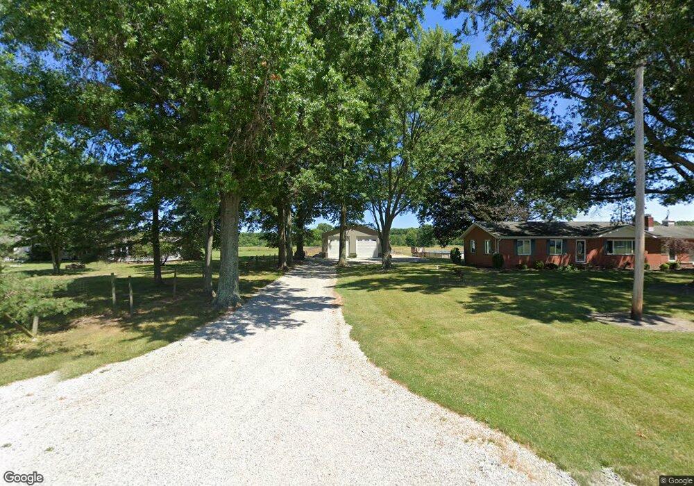
3130 Alliance Rd Rootstown, OH 44272
Estimated Value: $390,000
3
Beds
1
Bath
1,512
Sq Ft
$258/Sq Ft
Est. Value
About This Home
This home is located at 3130 Alliance Rd, Rootstown, OH 44272 and is currently estimated at $390,000, approximately $257 per square foot. 3130 Alliance Rd is a home located in Portage County with nearby schools including Southeast High School.
Ownership History
Date
Name
Owned For
Owner Type
Purchase Details
Closed on
Aug 21, 2013
Sold by
Day Roland M and Day Diana L
Bought by
Day Joseph L
Current Estimated Value
Purchase Details
Closed on
Jan 7, 1999
Sold by
Eiber Hazel Carolyn
Bought by
Zavara Alexander M and Zavara Lisa Dawn
Home Financials for this Owner
Home Financials are based on the most recent Mortgage that was taken out on this home.
Original Mortgage
$52,022
Interest Rate
6.83%
Purchase Details
Closed on
Dec 30, 1998
Sold by
Eiber Hazel Carolyn
Bought by
Schumann David F and Schumann Kathleen M
Home Financials for this Owner
Home Financials are based on the most recent Mortgage that was taken out on this home.
Original Mortgage
$52,022
Interest Rate
6.83%
Purchase Details
Closed on
Dec 22, 1998
Sold by
Eiber Hazel Carolyn
Bought by
Hughes Thomas E
Home Financials for this Owner
Home Financials are based on the most recent Mortgage that was taken out on this home.
Original Mortgage
$52,022
Interest Rate
6.83%
Create a Home Valuation Report for This Property
The Home Valuation Report is an in-depth analysis detailing your home's value as well as a comparison with similar homes in the area
Purchase History
We collect this data history from publicly available records. To have your information removed, we recommend requesting removal directly through your county’s website.
| Date | Buyer | Sale Price | Title Company |
|---|---|---|---|
| Day Joseph L | -- | None Available | |
| Zavara Alexander M | $42,400 | -- | |
| Zavara Alexander M | $42,400 | -- | |
| Schumann David F | $17,400 | -- | |
| Hughes Thomas E | $16,100 | -- | |
| Hughes Thomas E | $16,100 | -- | |
| Beaber Jeri A | $60,000 | -- |
Source: Public Records
Mortgage History
We collect this data history from publicly available records. To have your information removed, we recommend requesting removal directly through your county’s website.
| Date | Status | Borrower | Loan Amount |
|---|---|---|---|
| Previous Owner | Zavara Alexander M | $52,022 |
Source: Public Records
Tax History
| Year | Tax Paid | Tax Assessment Tax Assessment Total Assessment is a certain percentage of the fair market value that is determined by local assessors to be the total taxable value of land and additions on the property. | Land | Improvement |
|---|---|---|---|---|
| 2025 | $3,392 | $105,430 | $21,040 | $84,390 |
| 2024 | $3,312 | $105,430 | $21,040 | $84,390 |
| 2023 | $2,819 | $80,290 | $15,400 | $64,890 |
| 2022 | $2,928 | $80,290 | $15,400 | $64,890 |
| 2021 | $2,953 | $80,290 | $15,400 | $64,890 |
| 2020 | $2,487 | $66,500 | $15,400 | $51,100 |
| 2019 | $2,493 | $66,500 | $15,400 | $51,100 |
| 2018 | $2,227 | $57,260 | $15,400 | $41,860 |
| 2017 | $2,227 | $57,260 | $15,400 | $41,860 |
| 2016 | $2,612 | $57,260 | $15,400 | $41,860 |
| 2015 | $2,504 | $57,260 | $15,400 | $41,860 |
| 2014 | $2,037 | $45,820 | $15,400 | $30,420 |
| 2013 | $2,060 | $45,820 | $15,400 | $30,420 |
Source: Public Records
Map
Nearby Homes
- 2443 Alliance Rd
- 3545 Porter Rd
- 8742 Henderson Rd
- 2591 Wayland Rd
- 8464 & 8446 Tallmadge Rd
- 8492 & 8476 Tallmadge Rd
- 2316 Deerfield Dr
- 8965 Corbett Rd
- 6915 Clark Rd
- 8406 Whippoorwill Rd
- 8466 Whipporwill Rd
- 3798 State Route 183
- 0 Ohio 225 Unit 5174573
- 4133 State Route 225
- 4039 Ohio 14
- 9800 Williams Rd
- 0 Wayland Rd Unit 5191883
- 9669 Tallmadge Rd
- 1731 Ohio 225
- 8412 State Route 224
- 3140 Alliance Rd
- 3107 Alliance Rd
- 3177 Alliance Rd
- 3041 Alliance Rd
- 3091 Alliance Rd
- 3036 Alliance Rd
- 3064 Alliance Rd
- V/L Alliance Rd
- 3221 Alliance Rd
- 3205 Alliance Rd
- 3222 Alliance Rd
- 3003 Alliance Rd
- 3037 Alliance Rd
- 2985 Alliance Rd
- 3254 Alliance Rd
- 2961 Alliance Rd
- 2947 Alliance Rd
- 2933 Alliance Rd
- v/l Alliance Rd
- 2914 Alliance Rd
Your Personal Tour Guide
Ask me questions while you tour the home.