Estimated Value: $675,000 - $922,914
3
Beds
4
Baths
2,467
Sq Ft
$332/Sq Ft
Est. Value
About This Home
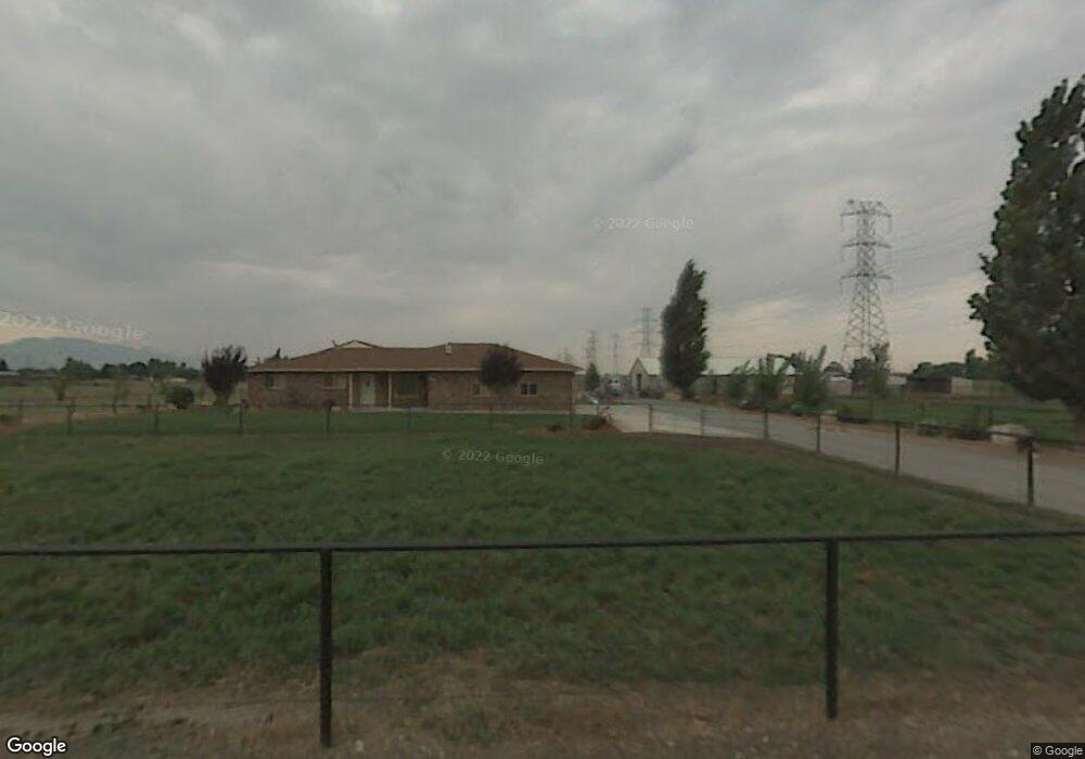
This home is located at 3131 W 2200 N, Ogden, UT 84404 and is currently estimated at $818,479, approximately $331 per square foot. 3131 W 2200 N is a home located in Weber County with nearby schools including Plain City School, Wahlquist Junior High School, and Fremont High School.
Ownership History
Date
Name
Owned For
Owner Type
Purchase Details
Closed on
Jan 22, 2013
Sold by
Brinkerhoff Linda L and Brinkerhoff Owen B
Bought by
Mcbride John D and Mcbride Melita A
Current Estimated Value
Purchase Details
Closed on
May 16, 2008
Sold by
Brinkerhoff Owen B and Brinkerhoff Linda L
Bought by
Mcbride John P and Mcbride Melita A
Home Financials for this Owner
Home Financials are based on the most recent Mortgage that was taken out on this home.
Original Mortgage
$340,000
Interest Rate
5.87%
Mortgage Type
Unknown
Purchase Details
Closed on
Jan 26, 2007
Sold by
Utah Smith Lc
Bought by
L & O Investments Llc
Purchase Details
Closed on
Oct 23, 2006
Sold by
Brinkerhoff Owen B and Brinkerhoff Linda L
Bought by
Brinkerhoff Owen B and Brinkerhoff Linda L
Purchase Details
Closed on
Jun 7, 2001
Sold by
Christensen Darrell J
Bought by
Brinkerhoff Owen B and Brinkerhoff Linda L
Create a Home Valuation Report for This Property
The Home Valuation Report is an in-depth analysis detailing your home's value as well as a comparison with similar homes in the area
Home Values in the Area
Average Home Value in this Area
Purchase History
| Date | Buyer | Sale Price | Title Company |
|---|---|---|---|
| Mcbride John D | -- | Mountain View Title Ogden | |
| Mcbride John P | -- | Mountain View Title Ogden | |
| L & O Investments Llc | -- | Weber Title | |
| Brinkerhoff Owen B | -- | None Available | |
| Brinkerhoff Linda L | -- | None Available | |
| Brinkerhoff Owen B | -- | First American Title Insuran |
Source: Public Records
Mortgage History
| Date | Status | Borrower | Loan Amount |
|---|---|---|---|
| Previous Owner | Mcbride John P | $340,000 | |
| Previous Owner | Mcbride John P | $300,000 |
Source: Public Records
Tax History Compared to Growth
Tax History
| Year | Tax Paid | Tax Assessment Tax Assessment Total Assessment is a certain percentage of the fair market value that is determined by local assessors to be the total taxable value of land and additions on the property. | Land | Improvement |
|---|---|---|---|---|
| 2025 | $3,494 | $813,272 | $391,900 | $421,372 |
| 2024 | $3,347 | $350,045 | $94,222 | $255,823 |
| 2023 | $3,251 | $335,522 | $75,199 | $260,323 |
| 2022 | $3,687 | $436,823 | $175,176 | $261,647 |
| 2021 | $2,963 | $649,341 | $243,500 | $405,841 |
| 2020 | $2,990 | $587,804 | $201,800 | $386,004 |
| 2019 | $2,741 | $525,000 | $201,811 | $323,189 |
| 2018 | $2,851 | $524,154 | $186,800 | $337,354 |
| 2017 | $2,715 | $452,360 | $155,116 | $297,244 |
| 2016 | $2,586 | $204,181 | $25,523 | $178,658 |
| 2015 | $2,386 | $186,273 | $25,459 | $160,814 |
| 2014 | $2,185 | $166,604 | $26,766 | $139,838 |
Source: Public Records
Map
Nearby Homes
- 2950 W 1975 N
- 3148 N 2875 W Unit 29
- 3080 N 2875 W Unit 25
- 2443 W 2950 N
- 2443 W 2950 N Unit 99
- 2068 N 2850 W
- 2801 W 2325 N
- 2495 N 2850 W
- 2801 W 1900 N
- 2673 W 2125 N
- Newport Plan at Diamond E
- 3594 W 2200 N Unit 3
- 2233 N 3600 St W Unit 22
- 2255 N 3600 St W Unit 21
- 2172 N 2625 W
- 3462 W 2565 N
- 2124 Heritage Dr
- 1663 N 3500 W
- 2761 N 3225 W Unit 203
- 2777 N Buckskin Dr Unit 211
- 3051 W 2200 N
- 3211 W 2200 N
- 2159 N 3000 W Unit 45
- 2173 N 3000 W
- 2173 N 3000 W Unit 46
- 2143 N 3000 W Unit 44
- 2113 N 3000 W Unit 42
- 2187 N 3000 W Unit 47
- 2900 W 2200 N
- 3006 W 2200 St N
- 3225 W 2200 N
- 2129 N 3000 W
- 2152 N 3000 W
- 3224 W 2200 N
- 3212 W 2200 N
- 2134 N 3000 W
- 2170 N 3000 W Unit 25
- 2114 N 3000 W
- 2184 N 3000 W Unit 24
- 2970 W 2200 N