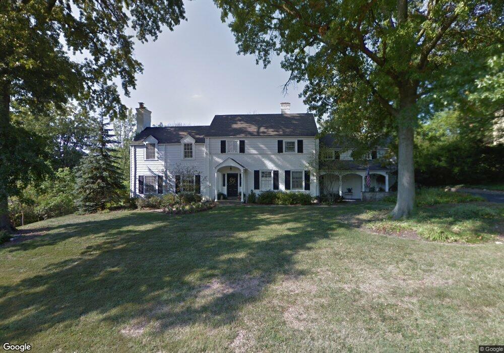
3132 N Farmcrest Dr Cincinnati, OH 45213
Estimated Value: $572,000 - $839,000
4
Beds
4
Baths
3,122
Sq Ft
$227/Sq Ft
Est. Value
About This Home
This home is located at 3132 N Farmcrest Dr, Cincinnati, OH 45213 and is currently estimated at $709,252, approximately $227 per square foot. 3132 N Farmcrest Dr is a home located in Hamilton County with nearby schools including Pleasant Ridge Montessori School, Shroder High School, and Clark Montessori High School.
Ownership History
Date
Name
Owned For
Owner Type
Purchase Details
Closed on
May 7, 1993
Sold by
Condon A Jack Trustee
Bought by
Gurney D Scott
Current Estimated Value
Create a Home Valuation Report for This Property
The Home Valuation Report is an in-depth analysis detailing your home's value as well as a comparison with similar homes in the area
Home Values in the Area
Average Home Value in this Area
Purchase History
| Date | Buyer | Sale Price | Title Company |
|---|---|---|---|
| Gurney D Scott | $210,000 | -- |
Source: Public Records
Tax History Compared to Growth
Tax History
| Year | Tax Paid | Tax Assessment Tax Assessment Total Assessment is a certain percentage of the fair market value that is determined by local assessors to be the total taxable value of land and additions on the property. | Land | Improvement |
|---|---|---|---|---|
| 2024 | $10,697 | $182,844 | $36,376 | $146,468 |
| 2023 | $10,937 | $182,844 | $36,376 | $146,468 |
| 2022 | $11,930 | $172,845 | $35,739 | $137,106 |
| 2021 | $11,619 | $172,845 | $35,739 | $137,106 |
| 2020 | $11,802 | $172,845 | $35,739 | $137,106 |
| 2019 | $11,517 | $152,957 | $31,626 | $121,331 |
| 2018 | $11,537 | $152,957 | $31,626 | $121,331 |
| 2017 | $11,017 | $152,957 | $31,626 | $121,331 |
| 2016 | $8,435 | $112,169 | $25,498 | $86,671 |
| 2015 | $7,651 | $112,169 | $25,498 | $86,671 |
| 2014 | $7,703 | $112,169 | $25,498 | $86,671 |
| 2013 | $7,063 | $101,294 | $25,498 | $75,796 |
Source: Public Records
Map
Nearby Homes
- 6442 Crestview Ave
- 2834 Cortelyou Place
- 6458 Crestview Ave
- 6462 Crestview Ave
- 6466 Crestview Ave
- 6470 Crestview Ave
- 6454 Crestview Ave
- 2783 Losantiridge Ave
- 2758 Losantiridge Ave
- 6215 Grand Vista Ave
- 3131 Troy Ave
- 6303 Montgomery Rd
- 3142 Schubert Ave
- 6416 Fairhurst Ave
- 6244 Montgomery Rd
- 6317 Girard Ave
- 6250 Beech View Cir
- 3543 Amberacres Dr
- 6256 Rogers Park Place
- 2652 Cedarbrook Dr
- 3138 N Farmcrest Dr
- 3126 N Farmcrest Dr
- 3126 S Farmcrest Dr
- 3118 N Farmcrest Dr
- 3146 N Farmcrest Dr
- 3127 N Farmcrest Dr
- 3119 N Farmcrest Dr
- 3135 N Farmcrest Dr
- 3110 N Farmcrest Dr
- 3143 N Farmcrest Dr
- 3109 N Farmcrest Dr
- 3116 S Farmcrest Dr
- 6744 Hudson Pkwy
- 3160 N Farmcrest Dr
- 3134 S Farmcrest Dr
- 3151 N Farmcrest Dr
- 3144 S Farmcrest Dr
- 3165 N Farmcrest Dr
- 6750 Hudson Pkwy
- 6725 Hudson Pkwy