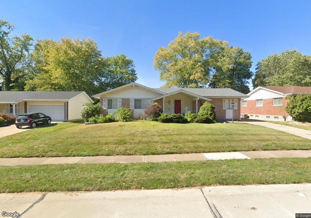
3135 Matlock Dr Florissant, MO 63031
Estimated Value: $210,000 - $223,000
4
Beds
2
Baths
1,616
Sq Ft
$133/Sq Ft
Est. Value
About This Home
This home is located at 3135 Matlock Dr, Florissant, MO 63031 and is currently estimated at $215,588, approximately $133 per square foot. 3135 Matlock Dr is a home located in St. Louis County with nearby schools including North Middle School, Hazelwood Central High School, and Oak Bridge.
Ownership History
Date
Name
Owned For
Owner Type
Purchase Details
Closed on
Jan 30, 2003
Sold by
Craff Bedoya John and Craff Bedoya Elizabeth
Bought by
Collins Mildred L
Current Estimated Value
Home Financials for this Owner
Home Financials are based on the most recent Mortgage that was taken out on this home.
Original Mortgage
$120,000
Outstanding Balance
$51,205
Interest Rate
5.9%
Estimated Equity
$164,383
Purchase Details
Closed on
Oct 25, 2002
Sold by
Owens Steven R and Owens Saundra M
Bought by
Deutsche Bank Trust Company Americas
Purchase Details
Closed on
Oct 9, 2001
Sold by
Muenter Patricia A
Bought by
Craff Bedoya John and Craff Bedoya Elizabeth
Create a Home Valuation Report for This Property
The Home Valuation Report is an in-depth analysis detailing your home's value as well as a comparison with similar homes in the area
Home Values in the Area
Average Home Value in this Area
Purchase History
| Date | Buyer | Sale Price | Title Company |
|---|---|---|---|
| Collins Mildred L | $159,000 | -- | |
| Deutsche Bank Trust Company Americas | $42,500 | -- | |
| Craff Bedoya John | $117,000 | -- |
Source: Public Records
Mortgage History
| Date | Status | Borrower | Loan Amount |
|---|---|---|---|
| Open | Collins Mildred L | $120,000 |
Source: Public Records
Tax History Compared to Growth
Tax History
| Year | Tax Paid | Tax Assessment Tax Assessment Total Assessment is a certain percentage of the fair market value that is determined by local assessors to be the total taxable value of land and additions on the property. | Land | Improvement |
|---|---|---|---|---|
| 2025 | $2,920 | $36,120 | $6,730 | $29,390 |
| 2024 | $2,920 | $33,440 | $2,680 | $30,760 |
| 2023 | $2,916 | $33,440 | $2,680 | $30,760 |
| 2022 | $2,533 | $25,860 | $4,390 | $21,470 |
| 2021 | $2,497 | $25,860 | $4,390 | $21,470 |
| 2020 | $2,641 | $25,480 | $6,730 | $18,750 |
| 2019 | $2,601 | $25,480 | $6,730 | $18,750 |
| 2018 | $2,317 | $20,850 | $2,150 | $18,700 |
| 2017 | $2,314 | $20,850 | $2,150 | $18,700 |
| 2016 | $2,337 | $20,770 | $2,530 | $18,240 |
| 2015 | $2,287 | $20,770 | $2,530 | $18,240 |
| 2014 | -- | $19,590 | $4,100 | $15,490 |
Source: Public Records
Map
Nearby Homes
- 1807 Kilmory Dr
- 1641 Sherwood Forest Dr
- 1638 Matlock Dr
- 3035 Matlock Dr
- 1522 Sherwood Forest Dr
- 1455 Burnside Ct
- 2916 Corn Silk Ct
- 2906 Russet Ct
- 3645 Woodman Dr
- 3660 Woodman Dr
- 1323 Woodpath Dr
- 3213 Yvette Ct
- 1114 Ransome Ct
- 16787 River Stone Dr
- 16804 River Stone Dr
- 2 Aspen II at Riverstone
- 2 Berwick at Riverstone
- 2 Ashford at Riverstone
- 3819 Sonora Stone Dr
- 2 Maple at Riverstone
- 3125 Matlock Dr
- 3130 Shackelford Rd
- 3120 Shackelford Rd
- 3140 Shackelford Rd
- 3115 Matlock Dr
- 3155 Matlock Dr
- 1693 Kew Gardens Dr
- 3110 Shackelford Rd
- 3150 Shackelford Rd
- 1692 Sherwood Forest Dr
- 3165 Matlock Dr
- 3105 Matlock Dr
- 1683 Kew Gardens Dr
- 1694 Kew Gardens Dr
- 3100 Shackelford Rd
- 3160 Shackelford Rd
- 1682 Sherwood Forest Dr
- 1684 Kew Gardens Dr
- 3095 Matlock Dr
- 3175 Matlock Dr