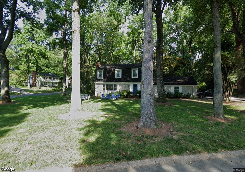
3136 Port Way Annapolis, MD 21403
Estimated Value: $770,754 - $979,000
4
Beds
3
Baths
1,824
Sq Ft
$478/Sq Ft
Est. Value
About This Home
This home is located at 3136 Port Way, Annapolis, MD 21403 and is currently estimated at $872,689, approximately $478 per square foot. 3136 Port Way is a home located in Anne Arundel County with nearby schools including Georgetown East Elementary School, Annapolis Middle School, and Annapolis High School.
Ownership History
Date
Name
Owned For
Owner Type
Purchase Details
Closed on
Apr 26, 2005
Sold by
Edward S Kotok Revocable Trust
Bought by
Pendleton Peter Nathan and Pendelton Rebecca Middleton
Current Estimated Value
Home Financials for this Owner
Home Financials are based on the most recent Mortgage that was taken out on this home.
Original Mortgage
$430,000
Outstanding Balance
$244,111
Interest Rate
7.25%
Mortgage Type
Adjustable Rate Mortgage/ARM
Estimated Equity
$628,578
Purchase Details
Closed on
Oct 9, 2001
Sold by
Kotok Edward S
Bought by
Edward S Kotok Revocable Trust
Create a Home Valuation Report for This Property
The Home Valuation Report is an in-depth analysis detailing your home's value as well as a comparison with similar homes in the area
Home Values in the Area
Average Home Value in this Area
Purchase History
| Date | Buyer | Sale Price | Title Company |
|---|---|---|---|
| Pendleton Peter Nathan | $495,000 | -- | |
| Edward S Kotok Revocable Trust | -- | -- |
Source: Public Records
Mortgage History
| Date | Status | Borrower | Loan Amount |
|---|---|---|---|
| Open | Pendleton Peter Nathan | $430,000 |
Source: Public Records
Tax History Compared to Growth
Tax History
| Year | Tax Paid | Tax Assessment Tax Assessment Total Assessment is a certain percentage of the fair market value that is determined by local assessors to be the total taxable value of land and additions on the property. | Land | Improvement |
|---|---|---|---|---|
| 2025 | $6,425 | $588,667 | -- | -- |
| 2024 | $6,425 | $540,833 | $0 | $0 |
| 2023 | $5,384 | $493,000 | $285,100 | $207,900 |
| 2022 | $5,544 | $489,400 | $0 | $0 |
| 2021 | $5,431 | $485,800 | $0 | $0 |
| 2020 | $5,431 | $482,200 | $275,100 | $207,100 |
| 2019 | $5,329 | $472,033 | $0 | $0 |
| 2018 | $5,066 | $461,867 | $0 | $0 |
| 2017 | $4,986 | $451,700 | $0 | $0 |
| 2016 | -- | $434,233 | $0 | $0 |
| 2015 | -- | $416,767 | $0 | $0 |
| 2014 | -- | $399,300 | $0 | $0 |
Source: Public Records
Map
Nearby Homes
- 3126 Port Way
- 3117 Port Way
- 1141 Mainsail Dr
- 1009 Dulaney Ln
- 2656A Queen Anne Cir
- 1003 Dulaney Ln
- 3259 Chrisland Dr
- 1230 Crummell Ave
- 3123 Arundel on The Bay Rd
- 2638 Carrollton Rd
- 1009 Pinecrest Dr
- 2644 Claibourne Rd
- 3209 Henson Ave
- 988 Breakwater Dr
- 2514 Lyon Dr
- 2512 Lyon Dr
- 962 Old Annapolis Neck Rd
- 10 Silverwood Cir Unit 10
- 1012 Carrs Rd
- 22 E Lake Dr
- 1107 Mainsail Dr
- 3134 Port Way
- 1103 Mainsail Dr
- 1110 Mainsail Dr
- 3133 Starboard Dr
- 3131 Port Way
- 1112 Mainsail Dr
- 3132 Port Way
- 1106 Mainsail Dr
- 3131 Starboard Dr
- 1114 Mainsail Dr
- 1104 Mainsail Dr
- 3129 Port Way
- 3136 Anchorage Dr
- 3130 Port Way
- 1101 Mainsail Dr
- 3129 Starboard Dr
- 3134 Anchorage Dr
- 3132 Anchorage Dr
- 1118 Mainsail Dr