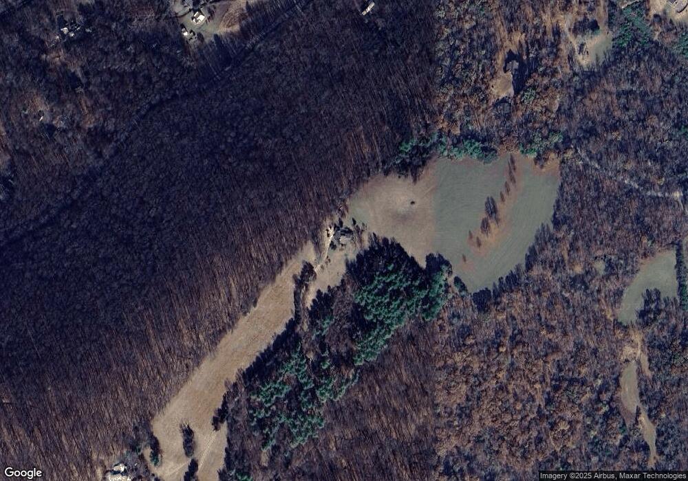
314 Almscroft Ln Lexington, VA 24450
Estimated Value: $405,000 - $614,000
4
Beds
4
Baths
2,007
Sq Ft
$264/Sq Ft
Est. Value
About This Home
This home is located at 314 Almscroft Ln, Lexington, VA 24450 and is currently estimated at $529,908, approximately $264 per square foot. 314 Almscroft Ln is a home with nearby schools including Rockbridge County High School.
Ownership History
Date
Name
Owned For
Owner Type
Purchase Details
Closed on
Nov 26, 2021
Sold by
Janet S Jarrard Trust and Jarrard Janet S
Bought by
Leonard E And Janet S Jarrad Revocable Trust and Jarrard Joint Living Trust
Current Estimated Value
Purchase Details
Closed on
Nov 2, 2021
Sold by
Jarrard Janet S and Janet S Jarrard Trust
Bought by
Jarrard Janet S and Jarrard Leonard E
Create a Home Valuation Report for This Property
The Home Valuation Report is an in-depth analysis detailing your home's value as well as a comparison with similar homes in the area
Home Values in the Area
Average Home Value in this Area
Purchase History
| Date | Buyer | Sale Price | Title Company |
|---|---|---|---|
| Leonard E And Janet S Jarrad Revocable Trust | -- | None Listed On Document | |
| Jarrard Janet S | -- | None Available |
Source: Public Records
Tax History Compared to Growth
Tax History
| Year | Tax Paid | Tax Assessment Tax Assessment Total Assessment is a certain percentage of the fair market value that is determined by local assessors to be the total taxable value of land and additions on the property. | Land | Improvement |
|---|---|---|---|---|
| 2025 | $2,702 | $449,500 | $189,500 | $260,000 |
| 2024 | $2,702 | $449,500 | $189,500 | $260,000 |
| 2023 | $2,702 | $443,000 | $183,000 | $260,000 |
| 2022 | $2,717 | $367,100 | $163,000 | $204,100 |
| 2021 | $2,717 | $367,100 | $163,000 | $204,100 |
| 2020 | $2,717 | $367,100 | $163,000 | $204,100 |
| 2019 | $2,680 | $367,100 | $163,000 | $204,100 |
| 2018 | $2,570 | $367,100 | $163,000 | $204,100 |
| 2017 | $2,570 | $367,100 | $163,000 | $204,100 |
| 2016 | $2,740 | $372,800 | $171,200 | $201,600 |
| 2015 | -- | $0 | $0 | $0 |
| 2014 | -- | $0 | $0 | $0 |
| 2013 | -- | $0 | $0 | $0 |
Source: Public Records
Map
Nearby Homes
- Lot 9 - Skyhigh Ln
- Lot 3 - Skyhigh Ln
- 11 Southfork Ln
- 0 Saddle Ridge Rd Unit 11 Reid Rd
- 599 Lindsay Ln
- .45 acres Boundary Line Ln
- 4.12 Ac. Boundary Line Ln
- 0 Park Place
- TBD Park Place
- 2068 N Lee Hwy
- 000 N Lee Hwy Unit 11
- 592 Valley Pike
- 2.02 Acres Smokey Row Rd
- 1645 N Lee Hwy
- 3111 N Lee Hwy
- 52 Seabiscuit Ct
- 20 Beverly Ct
- 49 Seabiscuit Ct
- 15 Beverly Ct
- 42 Seabiscuit Ct
- 565 Poor House Rd
- 9 Turnstone Ln
- 59 Alone Mill Rd
- 2121 Maury River Rd
- 1987 Maury River Rd
- 1987 Maury River Rd
- 39 Turnstone Ln
- 2368 Maury River
- 550 Poor House Rd
- 30 Fox Run Trail
- 62 Alone Mill Rd
- 572 Poor House Rd
- 0 Poor House Rd
- 97 Alone Mill Rd
- TBD Fox Run Trail
- 0 Fox Run Trail
- 58 Alone Mill Rd
- 116 Reid Rd
- 455 Poor House Rd
- 20 Steeplechase Dr
