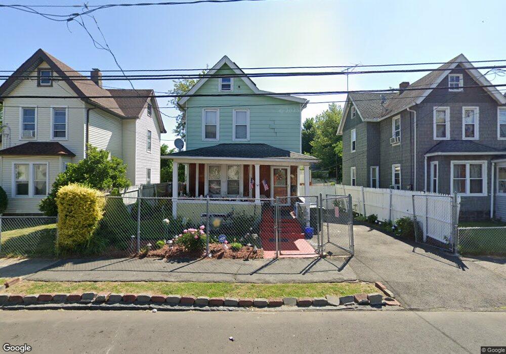
314 Carroll Ave Bridgeport, CT 06607
East End NeighborhoodEstimated Value: $277,986 - $393,000
3
Beds
2
Baths
1,222
Sq Ft
$272/Sq Ft
Est. Value
About This Home
This home is located at 314 Carroll Ave, Bridgeport, CT 06607 and is currently estimated at $331,997, approximately $271 per square foot. 314 Carroll Ave is a home located in Fairfield County with nearby schools including Jettie S. Tisdale School and Harding High School.
Ownership History
Date
Name
Owned For
Owner Type
Purchase Details
Closed on
Jul 19, 1996
Sold by
Dale Mortgage Bankers
Bought by
Mccrae Carol A
Current Estimated Value
Home Financials for this Owner
Home Financials are based on the most recent Mortgage that was taken out on this home.
Original Mortgage
$30,800
Interest Rate
8.28%
Mortgage Type
Unknown
Purchase Details
Closed on
Jan 20, 1989
Sold by
Warrell Dwight
Bought by
Lanham Calvin
Create a Home Valuation Report for This Property
The Home Valuation Report is an in-depth analysis detailing your home's value as well as a comparison with similar homes in the area
Home Values in the Area
Average Home Value in this Area
Purchase History
| Date | Buyer | Sale Price | Title Company |
|---|---|---|---|
| Mccrae Carol A | $12,500 | -- | |
| Mccrae Carol A | $12,500 | -- | |
| Lanham Calvin | $90,000 | -- |
Source: Public Records
Mortgage History
| Date | Status | Borrower | Loan Amount |
|---|---|---|---|
| Open | Lanham Calvin | $32,871 | |
| Open | Lanham Calvin | $80,000 | |
| Closed | Lanham Calvin | $48,000 | |
| Closed | Lanham Calvin | $30,800 |
Source: Public Records
Tax History
| Year | Tax Paid | Tax Assessment Tax Assessment Total Assessment is a certain percentage of the fair market value that is determined by local assessors to be the total taxable value of land and additions on the property. | Land | Improvement |
|---|---|---|---|---|
| 2025 | $4,056 | $93,340 | $30,720 | $62,620 |
| 2024 | $4,056 | $93,340 | $30,720 | $62,620 |
| 2023 | $4,056 | $93,340 | $30,720 | $62,620 |
| 2022 | $4,056 | $93,340 | $30,720 | $62,620 |
| 2021 | $4,056 | $93,340 | $30,720 | $62,620 |
| 2020 | $4,138 | $76,650 | $17,190 | $59,460 |
| 2019 | $4,138 | $76,650 | $17,190 | $59,460 |
| 2018 | $4,167 | $76,650 | $17,190 | $59,460 |
| 2017 | $4,167 | $76,650 | $17,190 | $59,460 |
| 2016 | $4,167 | $76,650 | $17,190 | $59,460 |
| 2015 | $4,533 | $107,410 | $29,460 | $77,950 |
| 2014 | $4,533 | $107,410 | $29,460 | $77,950 |
Source: Public Records
Map
Nearby Homes
- 363 Carroll Ave Unit 365
- 306 Carroll Ave
- 1440 Stratford Ave
- 73 Orange St
- 643 Newfield Ave Unit 645
- 464 Wilmot Ave
- 102 Carroll Ave
- 98-100 Carroll Ave
- 40-42 5th St
- 93 Clifford St
- 860 Connecticut Ave
- 202-204 Hewitt St
- 10 Ordnance Ct Unit 3
- 537 Hollister Ave
- 221 Bunnell St
- 384 Connecticut Ave Unit 386
- 180 Read St
- 179 4th St
- 1034 Connecticut Ave
- 188 Holly St
- 324 Carroll Ave
- 22 Carroll Ct
- 298 Carroll Ave
- 6 Yarrington Ct
- 32 Carroll Ct Unit 34
- 334 Carroll Ave
- 288 Carroll Ave
- 46 Yarrington Ct
- 309 Carroll Ave Unit 313
- 34 Yarrington Ct
- 342 Carroll Ave Unit 344
- 342-344 Carroll Ave
- 342 Carroll Ave Unit 2
- 342 Carroll Ave Unit 1
- 40 Carroll Ct
- 40 Carroll Ct Unit 1
- 40 Carroll Ct Unit 2
- 31 Carroll Ct
- 319 Carroll Ave Unit 321
- 4 Yarrington Ct
Your Personal Tour Guide
Ask me questions while you tour the home.