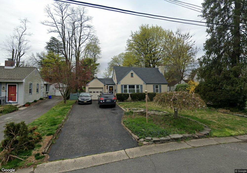
314 Evergreen Dr Moorestown, NJ 08057
Estimated Value: $445,621 - $494,000
--
Bed
--
Bath
1,328
Sq Ft
$348/Sq Ft
Est. Value
About This Home
This home is located at 314 Evergreen Dr, Moorestown, NJ 08057 and is currently estimated at $461,655, approximately $347 per square foot. 314 Evergreen Dr is a home located in Burlington County with nearby schools including George C. Baker Elementary School, Moorestown Upper Elementary School, and William Allen Middle School.
Ownership History
Date
Name
Owned For
Owner Type
Purchase Details
Closed on
Aug 10, 2023
Sold by
Mrak Anthony F and Mrak Lisa A
Bought by
Catanese Marcus and Catanese Ashley
Current Estimated Value
Home Financials for this Owner
Home Financials are based on the most recent Mortgage that was taken out on this home.
Original Mortgage
$320,000
Outstanding Balance
$312,572
Interest Rate
6.71%
Mortgage Type
New Conventional
Estimated Equity
$149,083
Purchase Details
Closed on
Sep 20, 1995
Sold by
Keating Thomas T and Keating Karen M
Bought by
Mrak Anthony F and Mrak Lisa A
Purchase Details
Closed on
Oct 18, 1994
Sold by
Cummings Edward A
Bought by
Keating Thomas T and Keating Kalen M
Create a Home Valuation Report for This Property
The Home Valuation Report is an in-depth analysis detailing your home's value as well as a comparison with similar homes in the area
Home Values in the Area
Average Home Value in this Area
Purchase History
| Date | Buyer | Sale Price | Title Company |
|---|---|---|---|
| Catanese Marcus | $400,000 | Infinity Title | |
| Mrak Anthony F | $115,000 | Lawrence Abstract Company | |
| Keating Thomas T | $80,900 | -- |
Source: Public Records
Mortgage History
| Date | Status | Borrower | Loan Amount |
|---|---|---|---|
| Open | Catanese Marcus | $320,000 |
Source: Public Records
Tax History Compared to Growth
Tax History
| Year | Tax Paid | Tax Assessment Tax Assessment Total Assessment is a certain percentage of the fair market value that is determined by local assessors to be the total taxable value of land and additions on the property. | Land | Improvement |
|---|---|---|---|---|
| 2025 | $5,768 | $203,300 | $108,700 | $94,600 |
| 2024 | $5,593 | $203,300 | $108,700 | $94,600 |
| 2023 | $5,593 | $203,300 | $108,700 | $94,600 |
| 2022 | $5,536 | $203,300 | $108,700 | $94,600 |
| 2021 | $5,463 | $203,300 | $108,700 | $94,600 |
| 2020 | $5,428 | $203,300 | $108,700 | $94,600 |
| 2019 | $5,333 | $203,300 | $108,700 | $94,600 |
| 2018 | $5,188 | $203,300 | $108,700 | $94,600 |
| 2017 | $5,233 | $203,300 | $108,700 | $94,600 |
| 2016 | $5,215 | $203,300 | $108,700 | $94,600 |
| 2015 | $5,152 | $203,300 | $108,700 | $94,600 |
| 2014 | $4,891 | $203,300 | $108,700 | $94,600 |
Source: Public Records
Map
Nearby Homes
- 423 Park Blvd
- 531 Covington Terrace
- 313 Fairview Ave
- 316 Farmdale Rd
- 308 Farmdale Rd
- 316 W 3rd St
- 493 N Church St
- 543 Bethel Ave
- 601 Stratford Dr
- 709 Manor Terrace
- 600 Stratford Dr
- 801 E Camden Ave
- 4 W Close
- 206 E Camden Ave
- 149 Chalkboard Ct
- 129 S Church St
- 308 Kenwood Dr
- 15 E 2nd St
- 14 Vincent Way
- 21 N Lenola Rd
- 312 Evergreen Dr
- 316 Evergreen Dr
- 310 Evergreen Dr
- 207 Flynn Ave
- 205 Flynn Ave
- 318 Evergreen Dr
- 209 Flynn Ave
- 325 Evergreen Dr
- 203 Flynn Ave
- 308 Evergreen Dr
- 323 Evergreen Dr
- 320 Evergreen Dr
- 327 Evergreen Dr
- 321 Evergreen Dr
- 201 Flynn Ave
- 306 Evergreen Dr
- 211 Flynn Ave
- 322 Evergreen Dr
- 319 Evergreen Dr
- 329 Evergreen Dr