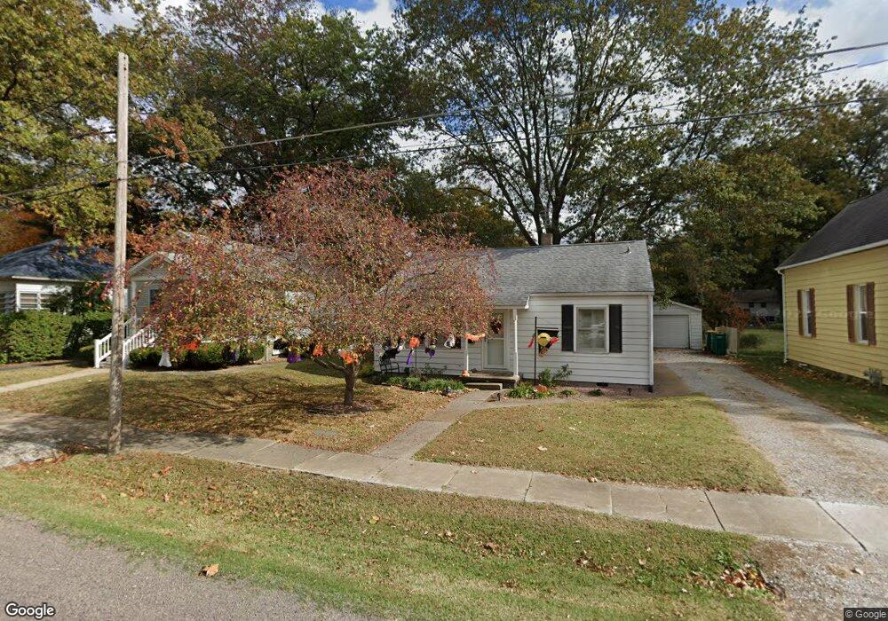
314 N John St Mascoutah, IL 62258
Estimated Value: $105,000 - $154,000
--
Bed
--
Bath
896
Sq Ft
$141/Sq Ft
Est. Value
About This Home
This home is located at 314 N John St, Mascoutah, IL 62258 and is currently estimated at $126,409, approximately $141 per square foot. 314 N John St is a home located in St. Clair County with nearby schools including Mascoutah High School and Holy Childhood of Jesus School.
Ownership History
Date
Name
Owned For
Owner Type
Purchase Details
Closed on
Jan 30, 2012
Sold by
Murphy Jack T and Murphy Patricia Ann
Bought by
Murphy Patricia Ann
Current Estimated Value
Purchase Details
Closed on
Nov 12, 2004
Sold by
Hanks Madeline Ruth
Bought by
Roper Irene E and Murphy Jack T
Home Financials for this Owner
Home Financials are based on the most recent Mortgage that was taken out on this home.
Original Mortgage
$40,000
Interest Rate
5.95%
Mortgage Type
Purchase Money Mortgage
Create a Home Valuation Report for This Property
The Home Valuation Report is an in-depth analysis detailing your home's value as well as a comparison with similar homes in the area
Home Values in the Area
Average Home Value in this Area
Purchase History
| Date | Buyer | Sale Price | Title Company |
|---|---|---|---|
| Murphy Patricia Ann | -- | None Available | |
| Roper Irene E | $42,000 | Fatic |
Source: Public Records
Mortgage History
| Date | Status | Borrower | Loan Amount |
|---|---|---|---|
| Closed | Roper Irene E | $40,000 |
Source: Public Records
Tax History Compared to Growth
Tax History
| Year | Tax Paid | Tax Assessment Tax Assessment Total Assessment is a certain percentage of the fair market value that is determined by local assessors to be the total taxable value of land and additions on the property. | Land | Improvement |
|---|---|---|---|---|
| 2024 | $859 | $31,522 | $6,608 | $24,914 |
| 2023 | $897 | $28,808 | $6,039 | $22,769 |
| 2022 | $978 | $26,218 | $5,496 | $20,722 |
| 2021 | $995 | $24,712 | $5,324 | $19,388 |
| 2020 | $993 | $23,178 | $4,993 | $18,185 |
| 2019 | $994 | $23,178 | $4,993 | $18,185 |
| 2018 | $1,001 | $22,556 | $4,859 | $17,697 |
| 2017 | $46 | $22,420 | $5,197 | $17,223 |
| 2016 | $1,474 | $22,097 | $5,122 | $16,975 |
| 2014 | -- | $21,592 | $5,005 | $16,587 |
| 2013 | $390 | $21,287 | $4,935 | $16,352 |
Source: Public Records
Map
Nearby Homes
- 601 Whetstone Ln
- 108 E Main St
- 3 W Patterson St
- 25 W Oak St
- 57 W Patterson St
- 612 N 1st St
- 118 W Green St
- 414 Turquoise Ct
- 633 Moorland Cir
- 124 W State St
- 841 Topaz Ct
- 847 Topaz Ct
- 326 S 5th St
- 500 N 9th St
- 926 W Green St
- 708 Mortar St
- 1117 Gulfstream Way
- 1125 Gulfstream Way
- 9715 Winchester St
- 344 Douglas Ave Unit B
- 310 N John St
- 318 N John St
- 320 N John St
- 302 N John St
- 309 N Bernard St
- 404 N John St
- 313 N John St
- 305 N Bernard St
- 309 N John St
- 321 N John St
- 421 E Patterson St
- 301 N Bernard St
- 502 E Patterson St
- 315 N Bernard St
- 415 E Patterson St
- 401 N John St
- 515 E Poplar St
- 603 E Oak St
- 512 E Patterson St
- 215 N Bernard St