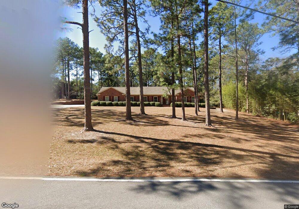
314 Pinewood Dr Statesboro, GA 30458
Estimated Value: $282,319 - $343,000
3
Beds
3
Baths
2,241
Sq Ft
$137/Sq Ft
Est. Value
About This Home
This home is located at 314 Pinewood Dr, Statesboro, GA 30458 and is currently estimated at $306,580, approximately $136 per square foot. 314 Pinewood Dr is a home located in Bulloch County with nearby schools including Mattie Lively Elementary School, Statesboro High School, and William James Middle School.
Ownership History
Date
Name
Owned For
Owner Type
Purchase Details
Closed on
Jun 30, 2010
Sold by
Hendrix Donald O
Bought by
Johns Michael W
Current Estimated Value
Home Financials for this Owner
Home Financials are based on the most recent Mortgage that was taken out on this home.
Original Mortgage
$107,200
Outstanding Balance
$71,485
Interest Rate
4.79%
Mortgage Type
New Conventional
Estimated Equity
$235,095
Purchase Details
Closed on
Oct 1, 1971
Bought by
Hendrix Donald and Hendrix Carolyn
Create a Home Valuation Report for This Property
The Home Valuation Report is an in-depth analysis detailing your home's value as well as a comparison with similar homes in the area
Home Values in the Area
Average Home Value in this Area
Purchase History
| Date | Buyer | Sale Price | Title Company |
|---|---|---|---|
| Johns Michael W | $134,000 | -- | |
| Johns Michael W | $134,000 | -- | |
| Hendrix Donald | -- | -- |
Source: Public Records
Mortgage History
| Date | Status | Borrower | Loan Amount |
|---|---|---|---|
| Open | Johns Michael W | $107,200 | |
| Closed | Johns Michael W | $107,200 |
Source: Public Records
Tax History Compared to Growth
Tax History
| Year | Tax Paid | Tax Assessment Tax Assessment Total Assessment is a certain percentage of the fair market value that is determined by local assessors to be the total taxable value of land and additions on the property. | Land | Improvement |
|---|---|---|---|---|
| 2024 | $2,430 | $94,400 | $9,720 | $84,680 |
| 2023 | $1,281 | $84,440 | $9,400 | $75,040 |
| 2022 | $1,300 | $72,794 | $9,400 | $63,394 |
| 2021 | $1,142 | $63,158 | $9,400 | $53,758 |
| 2020 | $1,129 | $60,990 | $9,400 | $51,590 |
| 2019 | $1,124 | $60,474 | $9,400 | $51,074 |
| 2018 | $1,062 | $55,367 | $9,400 | $45,967 |
| 2017 | $1,038 | $53,786 | $9,400 | $44,386 |
| 2016 | $1,144 | $52,611 | $9,400 | $43,211 |
| 2015 | $1,142 | $52,311 | $9,400 | $42,911 |
| 2014 | $1,049 | $52,311 | $9,400 | $42,911 |
Source: Public Records
Map
Nearby Homes
- 29 Jef Rd
- 197 Zetterower Rd
- 111 Zetterower Rd
- 437 Myrtle Crossing Ln
- 0 Miller Street Extension Unit 10595930
- 0 Miller Street Extension Unit LOT 18 10595926
- 0 Miller Street Extension Unit LOT 19 10595919
- 0 Miller Street Extension Unit LOT 20 10595908
- 0 Miller Street Extension Unit LOT 21 10595866
- 0 Miller Street Extension Unit LOT 22 10595860
- 0 Miller Street Extension Unit LOT 23 10594167
- 124 Pin Oak Ln
- 103 Oak Hollow Dr
- 328 N Main St
- 448 Myrtle Crossing Ln
- 318 N Main St
- 141 Williams Rd
- 113 Ladd Cir
- 208 Nesmith Way
- 5129 Georgia 67
- 312 Pinewood Dr
- 316 Pinewood Dr
- 203 Debbie Dr
- 213 Aldred Hill Rd
- 311 Pinewood Dr
- 121 Debbie Dr
- 211 Aldred Hill Rd
- 310 Pinewood Dr
- 309 Pinewood Dr
- 215 Aldred Hill Rd
- 119 Debbie Dr
- 0 Debbie Dr Unit 7241608
- 0 Debbie Dr Unit 7106698
- 0 Debbie Dr Unit 3156434
- 0 Debbie Dr Unit 8624969
- 0 Debbie Dr Unit 8502997
- 0 Debbie Dr Unit 7594014
- 0 Debbie Dr Unit 7178555
- 308 Pinewood Dr
- 305 Pinewood Dr