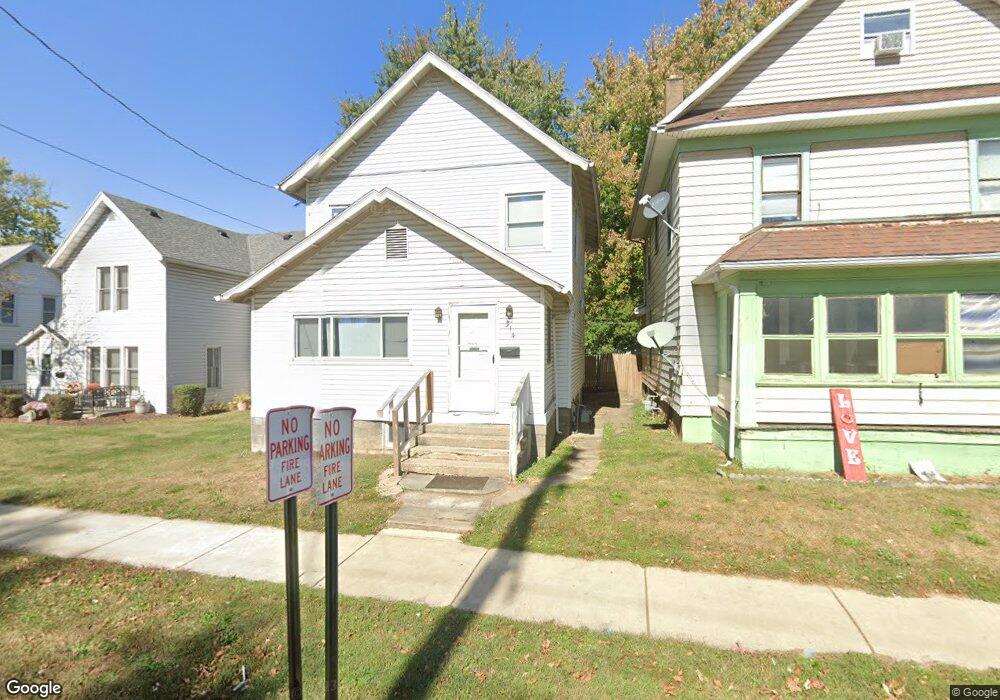
314 Silver St Marion, OH 43302
Estimated Value: $98,000 - $135,000
4
Beds
2
Baths
1,624
Sq Ft
$68/Sq Ft
Est. Value
About This Home
This home is located at 314 Silver St, Marion, OH 43302 and is currently estimated at $110,273, approximately $67 per square foot. 314 Silver St is a home located in Marion County with nearby schools including Rutherford B. Hayes Elementary School, Ulysses S. Grant Middle School, and Harding High School.
Ownership History
Date
Name
Owned For
Owner Type
Purchase Details
Closed on
Oct 24, 2014
Sold by
Hunt Ralph
Bought by
Foursouth Land Management Llc
Current Estimated Value
Purchase Details
Closed on
Jul 29, 2013
Sold by
Ebc Asset Investment Inc
Bought by
Hunt Ralph and Hunt Eula Faye
Purchase Details
Closed on
Jul 27, 2012
Sold by
Devore Insurance Agency
Bought by
Ebc Asset Investment Inc
Purchase Details
Closed on
Jun 3, 2005
Sold by
Swaney Robert L and Swaney Lynn A
Bought by
Devore Insurance Agency Ltd
Home Financials for this Owner
Home Financials are based on the most recent Mortgage that was taken out on this home.
Original Mortgage
$102,667
Interest Rate
5.82%
Mortgage Type
Future Advance Clause Open End Mortgage
Purchase Details
Closed on
Jan 31, 2003
Bought by
Foursouth Land Management Llc
Purchase Details
Closed on
Jan 7, 2000
Bought by
Foursouth Land Management Llc
Purchase Details
Closed on
Nov 17, 1999
Bought by
Foursouth Land Management Llc
Create a Home Valuation Report for This Property
The Home Valuation Report is an in-depth analysis detailing your home's value as well as a comparison with similar homes in the area
Home Values in the Area
Average Home Value in this Area
Purchase History
We collect this data history from publicly available records. To have your information removed, we recommend requesting removal directly through your county’s website.
| Date | Buyer | Sale Price | Title Company |
|---|---|---|---|
| Foursouth Land Management Llc | -- | None Available | |
| Hunt Ralph | $8,500 | Marion Title | |
| Ebc Asset Investment Inc | $16,667 | None Available | |
| Devore Insurance Agency Ltd | $86,000 | Chicago Title | |
| Foursouth Land Management Llc | $30,000 | -- | |
| Foursouth Land Management Llc | $25,000 | -- | |
| Foursouth Land Management Llc | $20,000 | -- |
Source: Public Records
Mortgage History
We collect this data history from publicly available records. To have your information removed, we recommend requesting removal directly through your county’s website.
| Date | Status | Borrower | Loan Amount |
|---|---|---|---|
| Previous Owner | Devore Insurance Agency Ltd | $102,667 |
Source: Public Records
Tax History
| Year | Tax Paid | Tax Assessment Tax Assessment Total Assessment is a certain percentage of the fair market value that is determined by local assessors to be the total taxable value of land and additions on the property. | Land | Improvement |
|---|---|---|---|---|
| 2025 | $860 | $30,460 | $1,090 | $29,370 |
| 2024 | $860 | $22,390 | $1,050 | $21,340 |
| 2023 | $860 | $22,390 | $1,050 | $21,340 |
| 2022 | $798 | $22,390 | $1,050 | $21,340 |
| 2021 | $686 | $17,330 | $910 | $16,420 |
| 2020 | $688 | $17,330 | $910 | $16,420 |
| 2019 | $688 | $17,330 | $910 | $16,420 |
| 2018 | $748 | $18,860 | $890 | $17,970 |
| 2017 | $758 | $18,860 | $890 | $17,970 |
| 2016 | $753 | $18,860 | $890 | $17,970 |
| 2015 | $753 | $18,460 | $850 | $17,610 |
| 2014 | $923 | $18,460 | $850 | $17,610 |
| 2012 | $909 | $22,100 | $910 | $21,190 |
Source: Public Records
Map
Nearby Homes
- 314 Silver St(p)
- 310 Silver St
- 322 Silver St
- 302 Silver St
- 328 Silver St
- 351 Commercial St
- 336 Silver St
- 357 Commercial St
- 292 Silver St
- 344 Commercial St
- 363 Commercial St
- 288 Silver St
- 342 Silver St
- 317 Silver St
- 321 Silver St
- 342 Fahey St Unit 344
- 327 Silver St
- 307 Silver St
- 348 Silver St
- 367 Commercial St
Your Personal Tour Guide
Ask me questions while you tour the home.