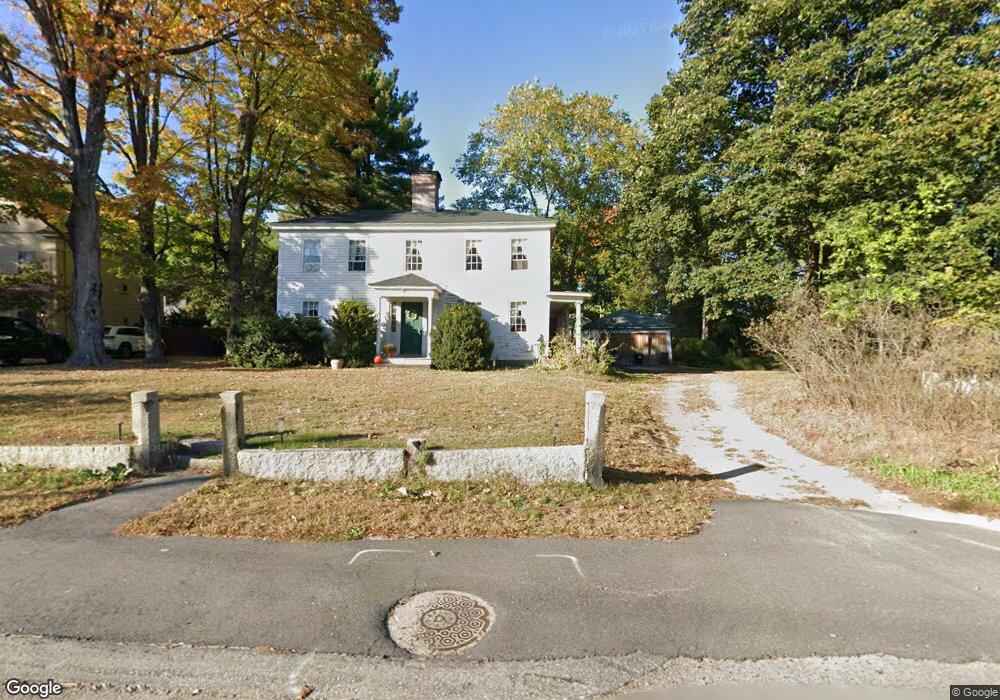
314 Village St Medway, MA 02053
Estimated Value: $589,382 - $653,000
3
Beds
2
Baths
2,032
Sq Ft
$310/Sq Ft
Est. Value
About This Home
This home is located at 314 Village St, Medway, MA 02053 and is currently estimated at $629,596, approximately $309 per square foot. 314 Village St is a home located in Norfolk County with nearby schools including John D. McGovern Elementary School, Burke-Memorial Elementary, and Medway Middle School.
Ownership History
Date
Name
Owned For
Owner Type
Purchase Details
Closed on
Jun 9, 2006
Sold by
Norris Jane T
Bought by
Norris Rt and Norris Jane T
Current Estimated Value
Purchase Details
Closed on
Aug 25, 1994
Sold by
Roberts John R and Roberts Ellice M
Bought by
Norris David A and Norris Jane T
Home Financials for this Owner
Home Financials are based on the most recent Mortgage that was taken out on this home.
Original Mortgage
$128,000
Interest Rate
8.65%
Mortgage Type
Purchase Money Mortgage
Create a Home Valuation Report for This Property
The Home Valuation Report is an in-depth analysis detailing your home's value as well as a comparison with similar homes in the area
Home Values in the Area
Average Home Value in this Area
Purchase History
| Date | Buyer | Sale Price | Title Company |
|---|---|---|---|
| Norris Rt | -- | -- | |
| Norris David A | $160,000 | -- |
Source: Public Records
Mortgage History
| Date | Status | Borrower | Loan Amount |
|---|---|---|---|
| Previous Owner | Norris David A | $128,000 |
Source: Public Records
Tax History Compared to Growth
Tax History
| Year | Tax Paid | Tax Assessment Tax Assessment Total Assessment is a certain percentage of the fair market value that is determined by local assessors to be the total taxable value of land and additions on the property. | Land | Improvement |
|---|---|---|---|---|
| 2025 | $6,950 | $487,700 | $269,600 | $218,100 |
| 2024 | $7,023 | $487,700 | $269,600 | $218,100 |
| 2023 | $6,835 | $428,800 | $232,200 | $196,600 |
| 2022 | $6,706 | $396,100 | $207,300 | $188,800 |
| 2021 | $6,408 | $367,000 | $186,600 | $180,400 |
| 2020 | $6,151 | $351,500 | $165,900 | $185,600 |
| 2019 | $5,821 | $343,000 | $165,900 | $177,100 |
| 2018 | $5,803 | $328,600 | $145,100 | $183,500 |
| 2017 | $5,677 | $316,800 | $134,800 | $182,000 |
| 2016 | $5,482 | $302,700 | $129,800 | $172,900 |
| 2015 | $4,812 | $263,800 | $122,300 | $141,500 |
| 2014 | $5,132 | $272,400 | $128,600 | $143,800 |
Source: Public Records
Map
Nearby Homes
- 28 Wellington St
- 4 Shaw St
- 280 Village St Unit D2
- 176 Main St Unit 3
- 21 Riverside Rd
- 220 Main St Unit 220
- 5 Fales St
- 6 Freedom Trail
- 22 Sunset Dr
- 18 Mary Anne Dr
- 14 Heritage Dr
- 0 Elm St
- 951 Pond St
- 7 Gloucester Dr
- 36 Lovering St
- 3 Meryl St
- 12 Lovering St
- 462 Hartford Ave
- 14 Sanford St Unit 15
- 39 West St
- 312 Village St
- 316 Village St
- 4 Norfolk Ave
- 4 Norfolk Ave
- 17 Guernsey St
- 19 Guernsey St
- 311 Village St
- 1 Norfolk Ave
- 8 Norfolk Ave
- 320 Village St
- 48 Cottage St
- 8 Lincoln St
- 6 Lincoln St
- 2 Lincoln St Unit A
- 2 Lincoln St
- 2 Lincoln St Unit B
- 10 Lincoln St
- 323 Village St
- 323 Village St Unit village st
- 323 Village St Unit 2