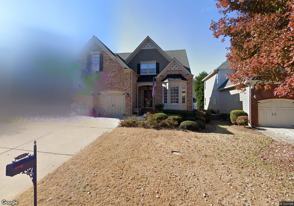
3140 the Commons Dr Cumming, GA 30041
Big Creek NeighborhoodEstimated Value: $654,994 - $757,000
5
Beds
4
Baths
2,729
Sq Ft
$257/Sq Ft
Est. Value
About This Home
This home is located at 3140 the Commons Dr, Cumming, GA 30041 and is currently estimated at $702,249, approximately $257 per square foot. 3140 the Commons Dr is a home located in Forsyth County with nearby schools including Sharon Elementary School, South Forsyth Middle School, and South Forsyth High School.
Ownership History
Date
Name
Owned For
Owner Type
Purchase Details
Closed on
Sep 21, 2021
Sold by
Ashton Atlanta Residential Llc
Bought by
Calamusa Kristie
Current Estimated Value
Purchase Details
Closed on
Jul 1, 2015
Sold by
Sampson George H
Bought by
Sandlin Stephanie
Home Financials for this Owner
Home Financials are based on the most recent Mortgage that was taken out on this home.
Original Mortgage
$268,770
Interest Rate
3.92%
Mortgage Type
New Conventional
Purchase Details
Closed on
Jul 6, 2005
Sold by
Johnson Abby J
Bought by
Sampson George H
Purchase Details
Closed on
Mar 29, 2004
Sold by
D R Horton Inc
Bought by
Johnson Abby J
Home Financials for this Owner
Home Financials are based on the most recent Mortgage that was taken out on this home.
Original Mortgage
$52,911
Interest Rate
5.55%
Mortgage Type
New Conventional
Create a Home Valuation Report for This Property
The Home Valuation Report is an in-depth analysis detailing your home's value as well as a comparison with similar homes in the area
Home Values in the Area
Average Home Value in this Area
Purchase History
| Date | Buyer | Sale Price | Title Company |
|---|---|---|---|
| Calamusa Kristie | $282,785 | -- | |
| Sandlin Stephanie | $316,200 | -- | |
| Sampson George H | $300,000 | -- | |
| Johnson Abby J | $264,600 | -- |
Source: Public Records
Mortgage History
| Date | Status | Borrower | Loan Amount |
|---|---|---|---|
| Previous Owner | Sandlin Stephanie | $268,770 | |
| Previous Owner | Johnson Abby J | $52,911 |
Source: Public Records
Tax History Compared to Growth
Tax History
| Year | Tax Paid | Tax Assessment Tax Assessment Total Assessment is a certain percentage of the fair market value that is determined by local assessors to be the total taxable value of land and additions on the property. | Land | Improvement |
|---|---|---|---|---|
| 2025 | $5,273 | $271,180 | $78,000 | $193,180 |
| 2024 | $5,273 | $257,748 | $66,000 | $191,748 |
| 2023 | $4,502 | $232,828 | $62,000 | $170,828 |
| 2022 | $4,842 | $166,848 | $40,000 | $126,848 |
| 2021 | $4,235 | $166,848 | $40,000 | $126,848 |
| 2020 | $4,119 | $161,224 | $40,000 | $121,224 |
| 2019 | $3,969 | $155,556 | $40,000 | $115,556 |
| 2018 | $3,553 | $135,092 | $26,000 | $109,092 |
| 2017 | $3,282 | $121,624 | $26,000 | $95,624 |
| 2016 | $3,282 | $121,624 | $26,000 | $95,624 |
| 2015 | $827 | $120,704 | $26,000 | $94,704 |
| 2014 | $746 | $104,560 | $18,000 | $86,560 |
Source: Public Records
Map
Nearby Homes
- 2250 Thames Ct
- 2255 Windsor Bluffs Dr
- 2260 Thames Ct
- 4345 Mantle Ridge Dr
- 355 Laurel Oak Dr
- 3275 Cherry Oak Ln Unit 11
- 4050 Homestead Ridge Dr
- 2690 Portabella Ln
- 3345 Cherry Oak Ln
- 2850 Brandy Ln
- 3440 Ronnie Ln
- 2380 Manor Creek Ct
- 3440 Canyon Oak Way
- 7065 Laurel Oak Dr
- Rosalynn with Basement Plan at Jason's Walk
- Ivywood Elite Plan at Westover
- Juneau Elite Plan at Westover
- Hillstone 3-Car Plan at Westover
- Rosalynn Plan at Jason's Walk
- Antioch Plan at CrossCreek
- 3130 the Commons Dr
- 3150 the Commons Dr
- 2300 Bentley Commons Dr
- 3370 Olivia Ct
- 3360 Olivia Ct
- 3120 the Commons Dr
- 3160 the Commons Dr
- 3135 the Commons Dr
- 3350 Olivia Ct
- 3145 the Commons Dr
- 3125 the Commons Dr
- 3110 the Commons Dr
- 3170 the Commons Dr
- 3155 the Commons Dr
- 3115 the Commons Dr
- 3340 Olivia Ct
- 3165 the Commons Dr
- 3380 Olivia Ct
- 3090 the Commons Dr
- 3180 the Commons Dr