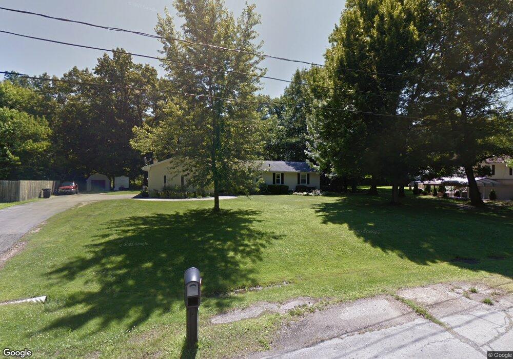
3141 Lorrie Dr Spring Arbor, MI 49283
Estimated Value: $252,135 - $287,000
Studio
1
Bath
1,820
Sq Ft
$149/Sq Ft
Est. Value
About This Home
This home is located at 3141 Lorrie Dr, Spring Arbor, MI 49283 and is currently estimated at $271,534, approximately $149 per square foot. 3141 Lorrie Dr is a home located in Jackson County with nearby schools including Western High School, Paragon Charter Academy, and Trinity Lutheran School.
Ownership History
Date
Name
Owned For
Owner Type
Purchase Details
Closed on
Jun 13, 2000
Sold by
Dodge David Allen and Dodge Joyce
Bought by
Larkins Gregory B and Larkins Tamara M
Current Estimated Value
Home Financials for this Owner
Home Financials are based on the most recent Mortgage that was taken out on this home.
Original Mortgage
$121,200
Outstanding Balance
$43,002
Interest Rate
8.31%
Mortgage Type
Purchase Money Mortgage
Estimated Equity
$228,532
Purchase Details
Closed on
Feb 4, 1997
Sold by
Dodge David and Dodge Melinda
Bought by
Dodge David and Dodge Joyce
Create a Home Valuation Report for This Property
The Home Valuation Report is an in-depth analysis detailing your home's value as well as a comparison with similar homes in the area
Purchase History
| Date | Buyer | Sale Price | Title Company |
|---|---|---|---|
| Larkins Gregory B | $151,500 | -- | |
| Dodge David | -- | -- |
Source: Public Records
Mortgage History
| Date | Status | Borrower | Loan Amount |
|---|---|---|---|
| Open | Larkins Gregory B | $121,200 |
Source: Public Records
Tax History
| Year | Tax Paid | Tax Assessment Tax Assessment Total Assessment is a certain percentage of the fair market value that is determined by local assessors to be the total taxable value of land and additions on the property. | Land | Improvement |
|---|---|---|---|---|
| 2025 | $3,351 | $118,400 | $0 | $0 |
| 2024 | $18 | $117,600 | $0 | $0 |
| 2023 | $1,830 | $106,600 | $0 | $0 |
| 2022 | $3,088 | $96,800 | $0 | $0 |
| 2021 | $3,038 | $94,210 | $0 | $0 |
| 2020 | $3,052 | $86,840 | $0 | $0 |
| 2019 | $2,895 | $79,830 | $0 | $0 |
| 2018 | $2,897 | $78,180 | $9,980 | $68,200 |
| 2017 | $2,769 | $80,080 | $0 | $0 |
| 2016 | $1,554 | $79,860 | $79,860 | $0 |
| 2015 | $63,845 | $71,970 | $71,970 | $0 |
| 2014 | $63,845 | $66,270 | $0 | $0 |
| 2013 | -- | $66,270 | $66,270 | $0 |
Source: Public Records
Map
Nearby Homes
- 6728 King Rd
- V/L S Dearing Rd Unit 40 Acres Vacant Land
- 7117 King Rd
- 7315 King Rd
- 5513 Sherwood Dr
- 7052 Gilroy Ct
- 2503 Milford Rd
- 4557 Westbrook Dr Unit 31
- 4532 Westbrook Dr Unit 47
- 7969 Brandon Dr
- 5427 Vrooman Rd
- 1035 Engelhardt Strasse
- 33 Aviara Oaks Pkwy
- 4849 Indian Creek Dr Unit 6
- 8257 Lockerbie Dr
- 2326 Pioneer Dr
- 4830 Stonewood Dr Unit 15
- 4894 Indian Creek Dr
- 68 Dickens St
- 1400 Chapel Rd
- 3137 Lorrie Dr
- 3145 Lorrie Dr
- 3133 Lorrie Dr
- 3132 Lorrie Dr
- 6578 Lorrie Dr
- 6577 Lorrie Dr
- 3129 Lorrie Dr
- 3129 Dorothy Ln
- 3128 Lorrie Dr
- 6581 Lorrie Dr
- 3125 Lorrie Dr
- 3124 Lorrie Dr
- 6585 Lorrie Dr
- 3126 Dorothy Ln
- 3125 Dorothy Ln
- 3121 Lorrie Dr
- 6890 Spring Arbor Rd
- 6589 Lorrie Dr
- 6281 King Rd
- 3405 Moscow Rd
Your Personal Tour Guide
Ask me questions while you tour the home.