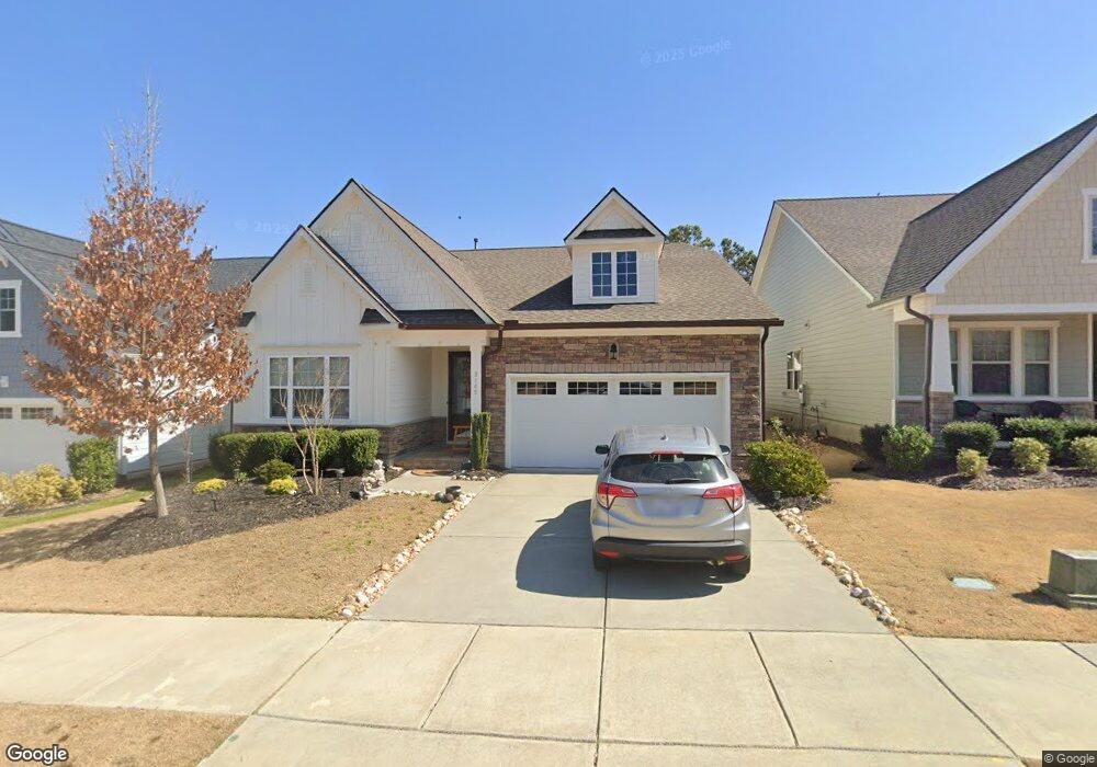
3145 Mavisbank Cir Unit G367 Apex, NC 27502
Friendship NeighborhoodEstimated Value: $629,471 - $660,000
2
Beds
3
Baths
2,093
Sq Ft
$308/Sq Ft
Est. Value
About This Home
This home is located at 3145 Mavisbank Cir Unit G367, Apex, NC 27502 and is currently estimated at $644,868, approximately $308 per square foot. 3145 Mavisbank Cir Unit G367 is a home located in Wake County with nearby schools including Apex Friendship Elementary, Apex Friendship Middle School, and Apex Friendship High School.
Ownership History
Date
Name
Owned For
Owner Type
Purchase Details
Closed on
Mar 19, 2024
Sold by
Holland Rickie D and Holland Maureen A
Bought by
Cesanelli Valeria
Current Estimated Value
Home Financials for this Owner
Home Financials are based on the most recent Mortgage that was taken out on this home.
Original Mortgage
$576,000
Outstanding Balance
$566,895
Interest Rate
6.9%
Mortgage Type
New Conventional
Estimated Equity
$77,973
Purchase Details
Closed on
Aug 9, 2019
Sold by
Calatlantic Group Inc
Bought by
Holland Maureen A and Holland Rickie D
Home Financials for this Owner
Home Financials are based on the most recent Mortgage that was taken out on this home.
Original Mortgage
$285,525
Interest Rate
3.73%
Mortgage Type
VA
Create a Home Valuation Report for This Property
The Home Valuation Report is an in-depth analysis detailing your home's value as well as a comparison with similar homes in the area
Home Values in the Area
Average Home Value in this Area
Purchase History
| Date | Buyer | Sale Price | Title Company |
|---|---|---|---|
| Cesanelli Valeria | -- | None Listed On Document | |
| Holland Maureen A | $392,000 | None Available |
Source: Public Records
Mortgage History
| Date | Status | Borrower | Loan Amount |
|---|---|---|---|
| Open | Cesanelli Valeria | $576,000 | |
| Previous Owner | Holland Maureen A | $285,525 |
Source: Public Records
Tax History Compared to Growth
Tax History
| Year | Tax Paid | Tax Assessment Tax Assessment Total Assessment is a certain percentage of the fair market value that is determined by local assessors to be the total taxable value of land and additions on the property. | Land | Improvement |
|---|---|---|---|---|
| 2025 | $5,259 | $599,995 | $130,000 | $469,995 |
| 2024 | $5,141 | $599,995 | $130,000 | $469,995 |
| 2023 | $4,375 | $397,028 | $75,000 | $322,028 |
| 2022 | $4,107 | $397,028 | $75,000 | $322,028 |
| 2021 | $3,951 | $397,028 | $75,000 | $322,028 |
| 2020 | $3,911 | $397,028 | $75,000 | $322,028 |
| 2019 | $97 | $8,500 | $8,500 | $0 |
Source: Public Records
Map
Nearby Homes
- 3112 Mavisbank Cir
- 1913 Stanlake Dr
- 3138 Curling Creek Dr
- 3156 Curling Creek Dr
- 2010 Song Breeze Ln
- 610 Cable Ct
- 616 Cable Ct
- 0-0 Mount Zion Church Rd
- 0 Mount Zion Church Rd
- 2701 Sugar Mountain Way
- 2876 MacIntosh Woods Dr
- 1608 Kythira Dr
- 2928 Murray Ridge Trail
- 2842 Lemnos Dr
- 2849 Dallas Valley Ln
- 614 Cable Ct
- 2966 Lemnos Dr
- 0 Humie Olive Rd
- 2751 Lake Waccamaw Trail
- 2905 Richardson Rd
- 3145 Mavisbank Cir
- 3141 Mavisbank Cir
- 3141 Mavisbank Cir Unit G366
- 3149 Mavisbank Cir Unit G368
- 3137 Mavisbank Cir
- 3137 Mavisbank Cir Unit G365
- 3153 Mavisbank Cir Unit G369
- 3144 Mavisbank Cir Unit G234
- 3140 Mavisbank Cir
- 3140 Mavisbank Cir Unit G235
- 3148 Mavisbank Cir Unit G233
- 3197 Mission Olive Place
- 3136 Mavisbank Cir
- 3136 Mavisbank Cir Unit G236
- 3152 Mavisbank Cir Unit G232
- 3131 Mavisbank Cir Unit G364
- 3156 Mavisbank Cir Unit G231
- 3161 Mavisbank Cir
- 3132 Mavisbank Cir Unit G237
- 3160 Mavisbank Cir Unit G230