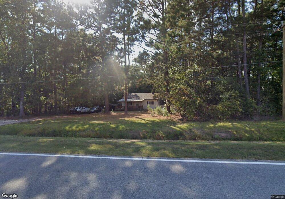
3145 Nc 39 Hwy N Louisburg, NC 27549
Estimated Value: $127,000 - $228,000
2
Beds
1
Bath
1,044
Sq Ft
$169/Sq Ft
Est. Value
About This Home
This home is located at 3145 Nc 39 Hwy N, Louisburg, NC 27549 and is currently estimated at $176,814, approximately $169 per square foot. 3145 Nc 39 Hwy N is a home located in Franklin County with nearby schools including Louisburg Elementary School, Terrell Lane Middle School, and Louisburg High School.
Ownership History
Date
Name
Owned For
Owner Type
Purchase Details
Closed on
Jun 25, 2022
Sold by
Milardo Revocable Trust
Bought by
Calamaco Anthony
Current Estimated Value
Home Financials for this Owner
Home Financials are based on the most recent Mortgage that was taken out on this home.
Original Mortgage
$116,400
Interest Rate
5.1%
Mortgage Type
Construction
Purchase Details
Closed on
Jun 7, 2018
Sold by
Milardo Sebastiano J and Milardo Simone D
Bought by
Buaiz Diane M and Milardo Revocable Trust
Purchase Details
Closed on
Oct 18, 1991
Bought by
Milardo Sebastiano J and Milardo Simone
Create a Home Valuation Report for This Property
The Home Valuation Report is an in-depth analysis detailing your home's value as well as a comparison with similar homes in the area
Home Values in the Area
Average Home Value in this Area
Purchase History
| Date | Buyer | Sale Price | Title Company |
|---|---|---|---|
| Calamaco Anthony | $120,000 | Jonathan Richardson Pllc | |
| Buaiz Diane M | -- | None Available | |
| Milardo Sebastiano J | $40,000 | -- |
Source: Public Records
Mortgage History
| Date | Status | Borrower | Loan Amount |
|---|---|---|---|
| Closed | Calamaco Anthony | $116,400 |
Source: Public Records
Tax History Compared to Growth
Tax History
| Year | Tax Paid | Tax Assessment Tax Assessment Total Assessment is a certain percentage of the fair market value that is determined by local assessors to be the total taxable value of land and additions on the property. | Land | Improvement |
|---|---|---|---|---|
| 2025 | $934 | $136,770 | $31,660 | $105,110 |
| 2024 | $934 | $136,770 | $31,660 | $105,110 |
| 2023 | $852 | $84,120 | $19,660 | $64,460 |
| 2022 | $842 | $84,120 | $19,660 | $64,460 |
| 2021 | $851 | $84,120 | $19,660 | $64,460 |
| 2020 | $847 | $84,120 | $19,660 | $64,460 |
| 2019 | $835 | $84,120 | $19,660 | $64,460 |
| 2018 | $432 | $84,120 | $19,660 | $64,460 |
| 2017 | $158 | $53,020 | $16,380 | $36,640 |
| 2016 | $161 | $53,020 | $16,380 | $36,640 |
| 2015 | $614 | $53,020 | $16,380 | $36,640 |
| 2014 | $561 | $53,020 | $16,380 | $36,640 |
Source: Public Records
Map
Nearby Homes
- 0 Beasley Rd Unit 10130664
- 0 Zinnia Ct Unit 10129898
- 0 Breedlove Rd Unit 10076336
- 642 Breedlove Rd
- 4224 Us 401 Hwy N
- 641 Rocky Ford Rd
- 35 Jonesville Ln
- 76 Sutton Rd
- 307 Wilson-Fuller Rd
- 376 T K Allen Rd
- 615 Woodland Trail
- 06 Tillery Dr
- 0 Sutton Rd
- 70 Acres Sutton Rd
- 08 Tillery Dr
- 11 Tillery Dr
- 09 Tillery Dr
- 0 Krafft Corner Unit 10130210
- 101 Briarwood Ct
- 1302 Rocky Ford Rd
- 3160 Nc 39 Hwy N
- 3160 Nc 39 Hwy N
- 3160 Nc 39 Hwy N
- 3123 Nc 39 Hwy N
- 3253 Nc 39 Hwy N
- 3071 Nc 39 Hwy N
- 3071 Nc 39 Hwy N
- TBD2 Nc 39 Hwy
- 3096 Nc 39 Hwy N
- 3063 Nc 39 Hwy N
- 2 Doe Crossing Dr
- 3063 Nc 39 Hwy N
- 30 Doe Crossing Dr
- 60 Doe Crossing Dr
- 101 Doe Crossing Dr
- 104 Doe Crossing Dr
- 00 Doe Crossing Dr
- 100 Doe Crossing Dr
- 103 Doe Crossing Dr
- 70 Doe Crossing Dr