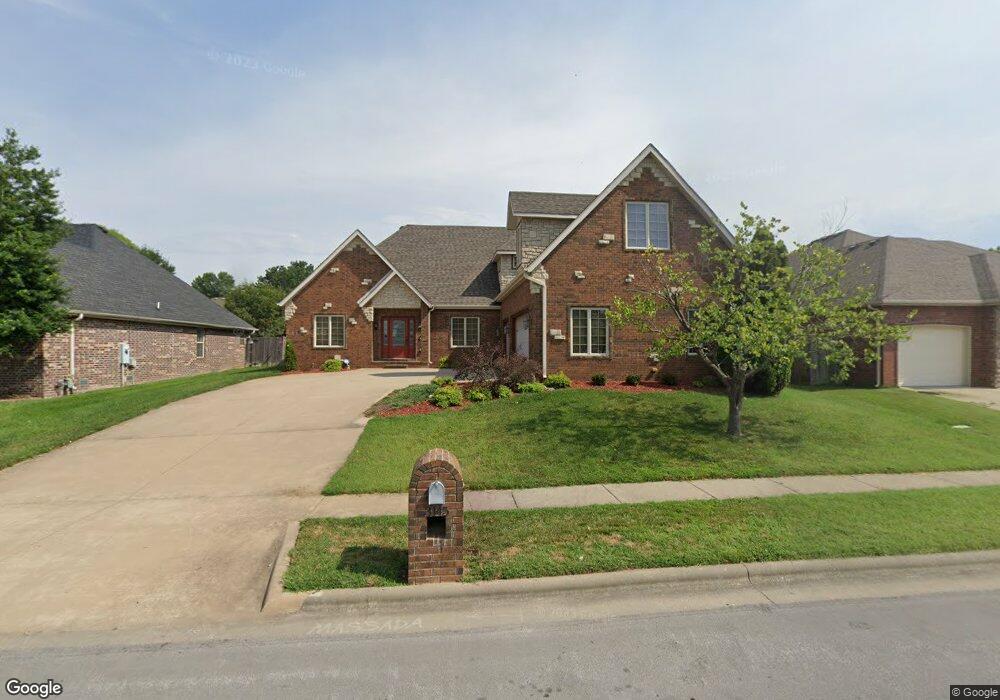
3145 W Knob Hill St Springfield, MO 65810
Southwest Springfield NeighborhoodEstimated Value: $497,446 - $584,000
4
Beds
4
Baths
3,570
Sq Ft
$148/Sq Ft
Est. Value
About This Home
This home is located at 3145 W Knob Hill St, Springfield, MO 65810 and is currently estimated at $529,612, approximately $148 per square foot. 3145 W Knob Hill St is a home located in Greene County with nearby schools including McBride Elementary School, Wilson's Creek Intermediate School, and Cherokee Middle School.
Ownership History
Date
Name
Owned For
Owner Type
Purchase Details
Closed on
Oct 3, 2012
Sold by
Livingston Joshua Brett
Bought by
Livingston Kimberly Sue
Current Estimated Value
Purchase Details
Closed on
Jun 29, 2007
Sold by
White Land Development Llc and White Crystal S
Bought by
Livingston Joshua B and Livingston Kimberly S
Home Financials for this Owner
Home Financials are based on the most recent Mortgage that was taken out on this home.
Original Mortgage
$240,500
Outstanding Balance
$147,869
Interest Rate
6.19%
Mortgage Type
New Conventional
Estimated Equity
$381,743
Purchase Details
Closed on
Apr 14, 2006
Sold by
Redbird Developments Llc
Bought by
White Land Developments Llc
Create a Home Valuation Report for This Property
The Home Valuation Report is an in-depth analysis detailing your home's value as well as a comparison with similar homes in the area
Home Values in the Area
Average Home Value in this Area
Purchase History
| Date | Buyer | Sale Price | Title Company |
|---|---|---|---|
| Livingston Kimberly Sue | -- | None Available | |
| Livingston Joshua B | -- | Fidelity Title Agency | |
| White Land Developments Llc | -- | Fidelity Title Agency |
Source: Public Records
Mortgage History
| Date | Status | Borrower | Loan Amount |
|---|---|---|---|
| Open | Livingston Joshua B | $240,500 |
Source: Public Records
Tax History Compared to Growth
Tax History
| Year | Tax Paid | Tax Assessment Tax Assessment Total Assessment is a certain percentage of the fair market value that is determined by local assessors to be the total taxable value of land and additions on the property. | Land | Improvement |
|---|---|---|---|---|
| 2025 | $3,685 | $74,630 | $7,980 | $66,650 |
| 2024 | $3,685 | $66,540 | $7,180 | $59,360 |
| 2023 | $3,666 | $66,540 | $7,180 | $59,360 |
| 2022 | $3,154 | $58,690 | $7,180 | $51,510 |
| 2021 | $3,153 | $58,690 | $7,180 | $51,510 |
| 2020 | $3,128 | $55,190 | $7,180 | $48,010 |
| 2019 | $3,037 | $55,190 | $7,180 | $48,010 |
| 2018 | $3,146 | $57,020 | $7,180 | $49,840 |
| 2017 | $3,114 | $55,040 | $7,180 | $47,860 |
| 2016 | $3,008 | $55,040 | $7,180 | $47,860 |
| 2015 | $2,984 | $55,040 | $7,180 | $47,860 |
| 2014 | $2,934 | $53,690 | $7,180 | $46,510 |
Source: Public Records
Map
Nearby Homes
- 3119 W Melbourne St
- 3192 W Melbourne St
- 3223 W Melbourne St
- 5361 S Aaron Ave
- 5349 S Aaron Ave
- 3245 W Brett Dr
- 3004 W Knob Hill St
- 5562 S Burrows Ave
- 2981 W Highpoint St
- 2973 W Knob Hill St
- 2964 W Knob Hill St
- 5345 S James Ave
- 2929 W Melbourne St
- 5150 S Tujunga Dr
- 3060 W Ellison Dr
- 2829 W Ellison Dr
- 5065 S Sycamore Ave
- 5853 S Northern Ridge Rd
- 5786 S Brightwater Trail
- 5023 S Burrows Ave
- 3133 W Knob Hill St
- 3157 W Knob Hill St
- 3146 W Knob Hill St
- 3134 W Knob Hill St
- 3158 W Knob Hill St
- 3121 W Knob Hill St
- 3169 W Knob Hill St
- 3144 W Melbourne St
- 3152 W Melbourne St
- 3136 W Melbourne St
- 3170 W Knob Hill St
- 3160 W Melbourne St
- 3128 W Melbourne St
- 3122 W Knob Hill St
- 3109 W Knob Hill St
- 3168 W Melbourne St
- 3110 W Knob Hill St
- 3181 W Knob Hill St
- 3143 W Melbourne St
- 3151 W Melbourne St