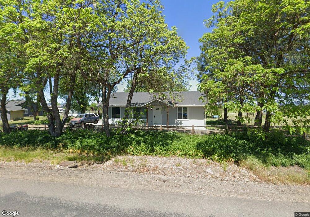
3147 Randall Ave Central Point, OR 97502
Estimated Value: $347,034 - $408,000
4
Beds
2
Baths
1,260
Sq Ft
$294/Sq Ft
Est. Value
About This Home
This home is located at 3147 Randall Ave, Central Point, OR 97502 and is currently estimated at $371,011, approximately $294 per square foot. 3147 Randall Ave is a home located in Jackson County with nearby schools including Abraham Lincoln Elementary School, Hedrick Middle School, and North Medford High School.
Ownership History
Date
Name
Owned For
Owner Type
Purchase Details
Closed on
Jan 9, 2025
Sold by
Hornbrook Phillip Scott
Bought by
Hornbrook Cole Ryan
Current Estimated Value
Home Financials for this Owner
Home Financials are based on the most recent Mortgage that was taken out on this home.
Original Mortgage
$208,600
Outstanding Balance
$206,591
Interest Rate
6.81%
Mortgage Type
New Conventional
Estimated Equity
$164,420
Purchase Details
Closed on
Aug 16, 2005
Sold by
Hornbrook Phillip Scott and Hornbrook Kimberly Anne
Bought by
Hornbrook Phillip Scott
Home Financials for this Owner
Home Financials are based on the most recent Mortgage that was taken out on this home.
Original Mortgage
$170,000
Interest Rate
5.64%
Mortgage Type
New Conventional
Create a Home Valuation Report for This Property
The Home Valuation Report is an in-depth analysis detailing your home's value as well as a comparison with similar homes in the area
Purchase History
We collect this data history from publicly available records. To have your information removed, we recommend requesting removal directly through your county’s website.
| Date | Buyer | Sale Price | Title Company |
|---|---|---|---|
| Hornbrook Cole Ryan | -- | None Listed On Document | |
| Hornbrook Cole Ryan | -- | None Listed On Document | |
| Hornbrook Phillip Scott | -- | -- |
Source: Public Records
Mortgage History
We collect this data history from publicly available records. To have your information removed, we recommend requesting removal directly through your county’s website.
| Date | Status | Borrower | Loan Amount |
|---|---|---|---|
| Open | Hornbrook Cole Ryan | $208,600 | |
| Closed | Hornbrook Cole Ryan | $208,600 | |
| Previous Owner | Hornbrook Phillip Scott | $170,000 |
Source: Public Records
Tax History
| Year | Tax Paid | Tax Assessment Tax Assessment Total Assessment is a certain percentage of the fair market value that is determined by local assessors to be the total taxable value of land and additions on the property. | Land | Improvement |
|---|---|---|---|---|
| 2026 | $2,219 | $180,860 | -- | -- |
| 2025 | $2,176 | $175,600 | $83,900 | $91,700 |
| 2024 | $2,176 | $170,490 | $71,750 | $98,740 |
| 2023 | $2,109 | $165,530 | $69,660 | $95,870 |
| 2022 | $2,059 | $165,530 | $69,660 | $95,870 |
| 2021 | $2,007 | $160,710 | $67,630 | $93,080 |
| 2020 | $1,959 | $156,030 | $65,660 | $90,370 |
| 2019 | $1,914 | $147,080 | $61,890 | $85,190 |
| 2018 | $1,866 | $142,800 | $60,090 | $82,710 |
| 2017 | $1,835 | $142,800 | $60,090 | $82,710 |
| 2016 | $1,801 | $134,620 | $56,640 | $77,980 |
| 2015 | $1,725 | $134,620 | $56,640 | $77,980 |
| 2014 | $1,700 | $126,900 | $53,400 | $73,500 |
Source: Public Records
Map
Nearby Homes
- 5900 Mcloughlin Dr
- 2885 Avenue A
- 2799 Avenue A
- 2494 Agate Meadows
- 7411 Stonefield Dr
- 2695 Avenue A
- 7515 Gladstone Ave
- 2685 Avenue A
- 3103 E Vilas Rd
- 3251 Antelope Rd
- 2422 Granite Ct
- 7414 Denman Ct
- 3265 Antelope Rd Unit SPC 47
- 3265 Antelope Rd Unit 44
- 7665 24th St
- 3444 Sonny Way
- 6915 Kershaw Rd
- 3093 Via Verde Cir
- 3635 Antelope Rd Unit SPC 19
- 1816 E Vilas Rd
- 3097 Randall Ave
- 3160 Randall Ave
- 3112 Randall Ave
- 3207 Randall Ave
- 3077 Randall Ave
- 3235 Randall Ave
- 0 McLoughlin Tl1300 2700 Dr Unit 102972200
- 6188 Mcloughlin Dr
- 6350 Mcloughlin Dr
- 6350 Mcloughlin Dr
- 6188 Mclaughlin Dr
- TL2700 Mcloughlin Dr
- 3282 Randall Ave
- 3303 Randall Ave
- 6418 Mcloughlin Dr
- 6418 Mcloughlin Dr
- 6261 Mcloughlin Dr
- 6303 Mcloughlin Dr
- 6303 Mcloughlin Dr
- 6221 Mcloughlin Dr
Your Personal Tour Guide
Ask me questions while you tour the home.