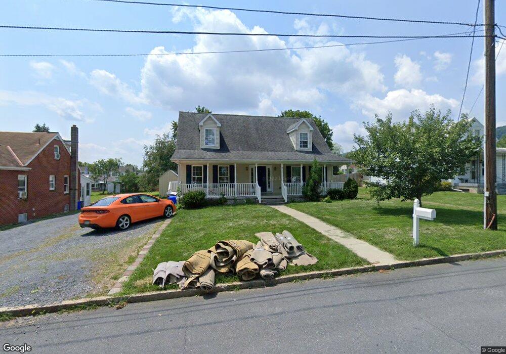
315 2nd St Summerdale, PA 17093
East Pennsboro NeighborhoodEstimated Value: $302,000 - $370,000
4
Beds
3
Baths
1,867
Sq Ft
$181/Sq Ft
Est. Value
About This Home
This home is located at 315 2nd St, Summerdale, PA 17093 and is currently estimated at $338,700, approximately $181 per square foot. 315 2nd St is a home located in Cumberland County with nearby schools including East Pennsboro Area Middle School, East Pennsboro Area Senior High School, and Silver Yeshiva Academy.
Ownership History
Date
Name
Owned For
Owner Type
Purchase Details
Closed on
Jun 3, 2021
Sold by
Fry Lucian B and Fry Kristen L
Bought by
Anderson Howard E and Anderson Mayumi K
Current Estimated Value
Home Financials for this Owner
Home Financials are based on the most recent Mortgage that was taken out on this home.
Original Mortgage
$246,453
Outstanding Balance
$223,132
Interest Rate
2.9%
Mortgage Type
FHA
Estimated Equity
$115,568
Purchase Details
Closed on
May 19, 2004
Sold by
Carver Phillip Dewey
Bought by
Fry Lucian
Create a Home Valuation Report for This Property
The Home Valuation Report is an in-depth analysis detailing your home's value as well as a comparison with similar homes in the area
Home Values in the Area
Average Home Value in this Area
Purchase History
| Date | Buyer | Sale Price | Title Company |
|---|---|---|---|
| Anderson Howard E | $251,000 | None Available | |
| Fry Lucian | $20,500 | -- |
Source: Public Records
Mortgage History
| Date | Status | Borrower | Loan Amount |
|---|---|---|---|
| Open | Anderson Howard E | $246,453 |
Source: Public Records
Tax History Compared to Growth
Tax History
| Year | Tax Paid | Tax Assessment Tax Assessment Total Assessment is a certain percentage of the fair market value that is determined by local assessors to be the total taxable value of land and additions on the property. | Land | Improvement |
|---|---|---|---|---|
| 2025 | $4,554 | $220,600 | $39,100 | $181,500 |
| 2024 | $4,295 | $220,600 | $39,100 | $181,500 |
| 2023 | $4,052 | $220,600 | $39,100 | $181,500 |
| 2022 | $3,810 | $220,600 | $39,100 | $181,500 |
| 2021 | $3,745 | $220,600 | $39,100 | $181,500 |
| 2020 | $3,658 | $220,600 | $39,100 | $181,500 |
| 2019 | $3,613 | $220,600 | $39,100 | $181,500 |
| 2018 | $3,573 | $220,600 | $39,100 | $181,500 |
| 2017 | $3,420 | $220,600 | $39,100 | $181,500 |
| 2016 | -- | $220,600 | $39,100 | $181,500 |
| 2015 | -- | $220,600 | $39,100 | $181,500 |
| 2014 | -- | $220,600 | $39,100 | $181,500 |
Source: Public Records
Map
Nearby Homes
- 79 Railroad Ave
- 74 Railroad Ave
- 64 Railroad Ave
- 75 Railroad Ave
- 419 Mountain St
- 591 Belle Vista Dr
- 66 Rail Yard Dr
- 0 Belle Vista Dr
- 205 Belle Vista Dr
- 522 Halyard Way
- 57 Ashford Dr
- 3 Memory Ln
- 300 River Bend Dr
- 42 Beaver Ave
- 13 E Shady Ln
- 104 Bungalow Rd
- 207 Rockville Blvd
- 200 Rockville Blvd
- 7 Forest Ave
- 53 Woodmyre Ln