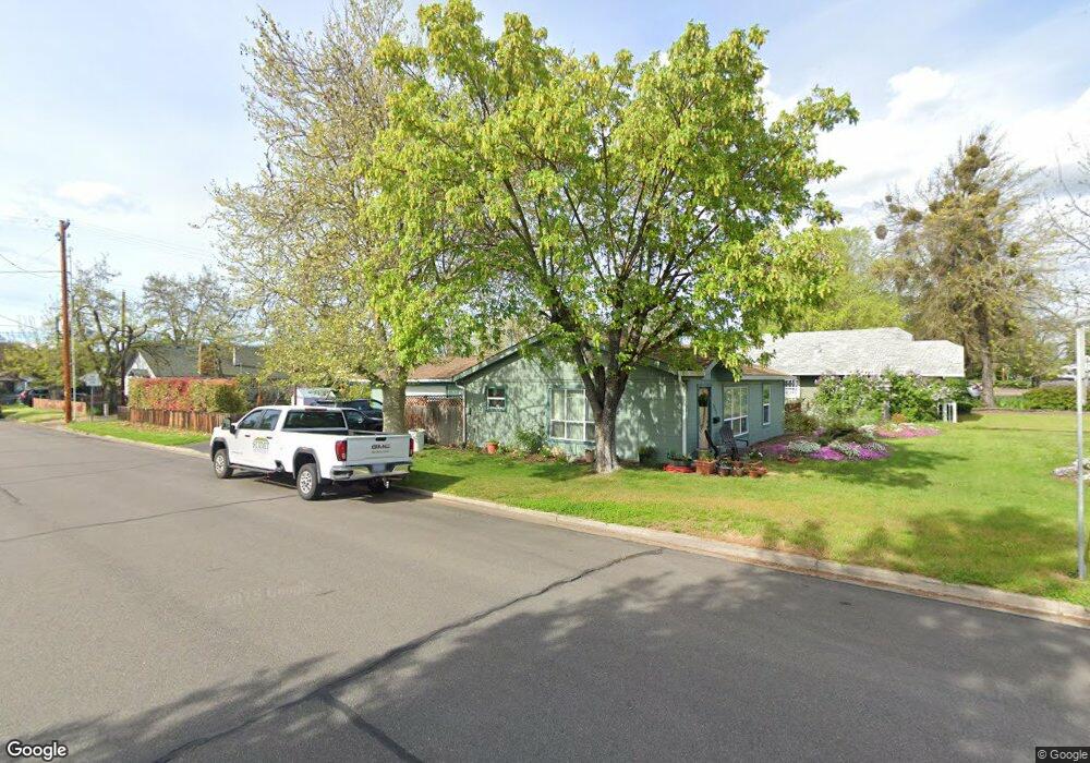
315 Ash St Central Point, OR 97502
Estimated Value: $257,000 - $353,166
2
Beds
1
Bath
952
Sq Ft
$344/Sq Ft
Est. Value
About This Home
This home is located at 315 Ash St, Central Point, OR 97502 and is currently estimated at $327,042, approximately $343 per square foot. 315 Ash St is a home located in Jackson County with nearby schools including Central Point Elementary School, Scenic Middle School, and Crater High School.
Ownership History
Date
Name
Owned For
Owner Type
Purchase Details
Closed on
Mar 28, 2002
Sold by
Ryerson Cheryl and Estate Of Norman A Oss
Bought by
Borror Cindy E
Current Estimated Value
Home Financials for this Owner
Home Financials are based on the most recent Mortgage that was taken out on this home.
Original Mortgage
$87,400
Outstanding Balance
$34,836
Interest Rate
6.84%
Estimated Equity
$292,206
Create a Home Valuation Report for This Property
The Home Valuation Report is an in-depth analysis detailing your home's value as well as a comparison with similar homes in the area
Purchase History
| Date | Buyer | Sale Price | Title Company |
|---|---|---|---|
| Borror Cindy E | $92,000 | First American Title Ins | |
| Borror Cindy E | $92,000 | First American Title Ins Co |
Source: Public Records
Mortgage History
| Date | Status | Borrower | Loan Amount |
|---|---|---|---|
| Open | Borror Cindy E | $87,400 |
Source: Public Records
Tax History
| Year | Tax Paid | Tax Assessment Tax Assessment Total Assessment is a certain percentage of the fair market value that is determined by local assessors to be the total taxable value of land and additions on the property. | Land | Improvement |
|---|---|---|---|---|
| 2026 | $3,168 | $191,430 | -- | -- |
| 2025 | $3,090 | $185,860 | $65,140 | $120,720 |
| 2024 | $3,090 | $180,450 | $63,240 | $117,210 |
| 2023 | $2,991 | $175,200 | $61,390 | $113,810 |
| 2022 | $2,921 | $175,200 | $61,390 | $113,810 |
| 2021 | $2,838 | $170,100 | $59,600 | $110,500 |
| 2020 | $2,755 | $165,150 | $57,870 | $107,280 |
| 2019 | $2,687 | $155,670 | $54,550 | $101,120 |
| 2018 | $2,605 | $151,140 | $52,960 | $98,180 |
| 2017 | $2,539 | $151,140 | $52,960 | $98,180 |
| 2016 | $2,465 | $142,470 | $49,920 | $92,550 |
| 2015 | $2,327 | $142,470 | $49,920 | $92,550 |
| 2014 | $2,224 | $134,310 | $47,060 | $87,250 |
Source: Public Records
Map
Nearby Homes
- 350 Alder St
- 220 S 3rd St
- 114 Cedar St
- 144 N 5th St
- 185 Logan Ave
- 555 Freeman Rd Unit 73
- 555 Freeman Rd Unit 254
- 555 Freeman Rd Unit 105
- 555 Freeman Rd Unit 209
- 140 N 8th St
- 436 Cheney Loop
- 755 S 4th St
- 731 Maple St
- 348 N 6th St
- 331 N 8th St
- 1189 Lindsey Ct
- 349 W Pine St
- 342 Hazel St
- 301 Freeman Rd Unit 30
- 301 Freeman Rd Unit 92
- 323 Ash St
- 229 S 3rd St
- 0 Ash St Unit TL901
- 248 S 4th St
- 247 Ash St
- 325 Ash St
- 248 S 3rd St
- 234 S 4th St
- 440 S 4th St Unit 102
- 440 S 4th St Unit 104
- 440 S 4th St Unit 107
- 440 S 4th St Unit 105
- 440 S 4th St Unit 103
- 440 S 4th St Unit 101
- 214 S 4th St
- 263 S 2nd St
- 247 S 2nd St
- 230 Alder St
- 265 S 4th St
- 214 Alder St
Your Personal Tour Guide
Ask me questions while you tour the home.