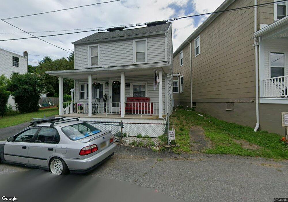
315 Bobb Alley Cumbola, PA 17930
Estimated Value: $90,000 - $138,000
6
Beds
2
Baths
2,016
Sq Ft
$57/Sq Ft
Est. Value
About This Home
This home is located at 315 Bobb Alley, Cumbola, PA 17930 and is currently estimated at $114,682, approximately $56 per square foot. 315 Bobb Alley is a home located in Schuylkill County with nearby schools including Saint Clair Area Elementary/Middle School, Gillingham Charter School, and ASSUMPTION BVM SCHOOL.
Ownership History
Date
Name
Owned For
Owner Type
Purchase Details
Closed on
Jun 30, 2023
Sold by
Davila Juan and Davila Veronica
Bought by
Schuylkill Real Estate Holdings Llc
Current Estimated Value
Home Financials for this Owner
Home Financials are based on the most recent Mortgage that was taken out on this home.
Original Mortgage
$56,000
Outstanding Balance
$54,475
Interest Rate
6.71%
Mortgage Type
Seller Take Back
Estimated Equity
$60,207
Purchase Details
Closed on
Nov 28, 2018
Sold by
Grady Thomas E and Grady Sandra A
Bought by
Davila Juan and Davila Veronica
Home Financials for this Owner
Home Financials are based on the most recent Mortgage that was taken out on this home.
Original Mortgage
$37,500
Interest Rate
4.8%
Mortgage Type
New Conventional
Create a Home Valuation Report for This Property
The Home Valuation Report is an in-depth analysis detailing your home's value as well as a comparison with similar homes in the area
Home Values in the Area
Average Home Value in this Area
Purchase History
| Date | Buyer | Sale Price | Title Company |
|---|---|---|---|
| Schuylkill Real Estate Holdings Llc | $70,000 | None Listed On Document | |
| Davila Juan | $50,000 | None Available |
Source: Public Records
Mortgage History
| Date | Status | Borrower | Loan Amount |
|---|---|---|---|
| Open | Schuylkill Real Estate Holdings Llc | $56,000 | |
| Previous Owner | Davila Juan | $37,500 |
Source: Public Records
Tax History Compared to Growth
Tax History
| Year | Tax Paid | Tax Assessment Tax Assessment Total Assessment is a certain percentage of the fair market value that is determined by local assessors to be the total taxable value of land and additions on the property. | Land | Improvement |
|---|---|---|---|---|
| 2025 | $1,646 | $26,220 | $3,000 | $23,220 |
| 2024 | $1,561 | $26,220 | $3,000 | $23,220 |
| 2023 | $1,561 | $26,220 | $3,000 | $23,220 |
| 2022 | $1,561 | $26,220 | $3,000 | $23,220 |
| 2021 | $1,576 | $26,220 | $3,000 | $23,220 |
| 2020 | $1,576 | $26,220 | $3,000 | $23,220 |
| 2018 | $1,544 | $26,220 | $3,000 | $23,220 |
| 2017 | $1,459 | $26,220 | $3,000 | $23,220 |
| 2015 | -- | $26,220 | $3,000 | $23,220 |
| 2011 | -- | $26,220 | $0 | $0 |
Source: Public Records
Map
Nearby Homes
- 201 Market St
- 199 Market St
- 0 Ridge Rd
- 15 Alliance St
- 235 Valley St
- 4 Federal St
- 2 Ridgeside Dr
- 542 3rd St
- 500 3rd St
- 337 Coal St
- 5 E Washington St
- 25 N Coal St
- 219 Pike St
- 103 Market St
- 665 Port Carbon Saint Clair Hwy
- 344 E Bacon St
- 0 Caroline Ave Unit PASK2022658
- 702 & 698 Port Carbon St Clair Hwy
- 211 E Bacon St
- 1409 E Norwegian St