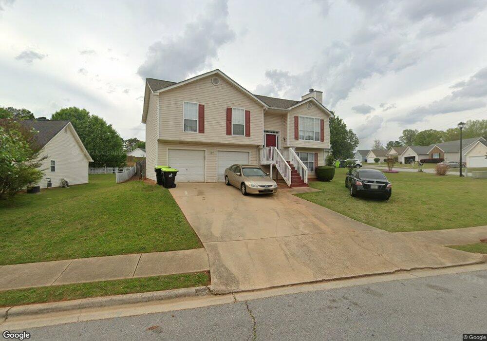
315 Brannans Ct McDonough, GA 30253
Estimated Value: $259,000 - $292,000
4
Beds
3
Baths
1,788
Sq Ft
$157/Sq Ft
Est. Value
About This Home
This home is located at 315 Brannans Ct, McDonough, GA 30253 and is currently estimated at $280,609, approximately $156 per square foot. 315 Brannans Ct is a home located in Henry County with nearby schools including Union Grove Middle School, Union Grove High School, and Hickory Flat Elementary School.
Ownership History
Date
Name
Owned For
Owner Type
Purchase Details
Closed on
Oct 12, 2017
Sold by
Speight Geoffrey
Bought by
Rukmatie Mangal
Current Estimated Value
Purchase Details
Closed on
Jun 19, 2017
Sold by
Speight Yashamia Y
Bought by
Speight Geoffrey
Purchase Details
Closed on
Jun 25, 2003
Sold by
Driskell Christopher S
Bought by
Speight Geoffrey
Home Financials for this Owner
Home Financials are based on the most recent Mortgage that was taken out on this home.
Original Mortgage
$125,582
Interest Rate
5.42%
Mortgage Type
FHA
Create a Home Valuation Report for This Property
The Home Valuation Report is an in-depth analysis detailing your home's value as well as a comparison with similar homes in the area
Home Values in the Area
Average Home Value in this Area
Purchase History
| Date | Buyer | Sale Price | Title Company |
|---|---|---|---|
| Rukmatie Mangal | $124,000 | -- | |
| Speight Geoffrey | -- | -- | |
| Speight Geoffrey | $127,600 | -- |
Source: Public Records
Mortgage History
| Date | Status | Borrower | Loan Amount |
|---|---|---|---|
| Previous Owner | Speight Geoffrey | $125,582 |
Source: Public Records
Tax History Compared to Growth
Tax History
| Year | Tax Paid | Tax Assessment Tax Assessment Total Assessment is a certain percentage of the fair market value that is determined by local assessors to be the total taxable value of land and additions on the property. | Land | Improvement |
|---|---|---|---|---|
| 2025 | $4,644 | $111,880 | $12,000 | $99,880 |
| 2024 | $4,644 | $107,720 | $12,000 | $95,720 |
| 2023 | $4,318 | $101,200 | $10,000 | $91,200 |
| 2022 | $3,309 | $80,520 | $10,000 | $70,520 |
| 2021 | $2,683 | $64,080 | $10,000 | $54,080 |
| 2020 | $2,439 | $57,680 | $8,000 | $49,680 |
| 2019 | $2,245 | $54,280 | $8,000 | $46,280 |
| 2018 | $2,066 | $49,600 | $7,539 | $42,061 |
| 2016 | $1,803 | $49,800 | $8,000 | $41,800 |
| 2015 | $1,715 | $46,520 | $8,000 | $38,520 |
| 2014 | $1,620 | $43,760 | $8,000 | $35,760 |
Source: Public Records
Map
Nearby Homes
- 209 Brannans Walk
- 248 Brannans Walk
- 153 Rockport Dr
- 152 Rockport Dr
- 796 Rock Ln
- 214 Kensington Trace
- 401 Crosshaven Way
- 228 Kensington Trace
- 200 Kensington Trace
- 248 Cranapple Ln
- 146 Himalaya Way
- 236 Himalaya Way
- 479 Crosshaven Way
- 601 Sawgrass Walk
- 1008 Carlyle Place
- 104 Riverside Close
- 418 Abbey Springs Way
- 441 Aviemore Loop
- 1150 Strath Clyde Way
- 129 Talon Place
- 325 Brannans Ct
- 309 Brannans Ct
- 335 Brannans Ct
- 316 Brannans Ct
- 305 Brannans Ct
- 312 Brannans Ct
- 308 Brannans Ct
- 320 Brannans Ct
- 218 Brannans Walk
- 328 Brannans Ct
- 339 Brannans Ct
- 332 Brannans Ct
- 222 Brannans Walk
- 301 Brannans Ct
- 222 Brannans Walk
- 324 Brannans Ct Unit 45
- 324 Brannans Ct
- 336 Brannans Ct
- 226 Brannans Walk
- 304 Brannans Ct