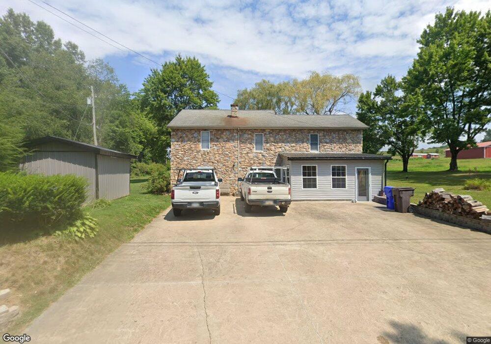
315 Browntown Rd Slippery Rock, PA 16057
Mercer Township NeighborhoodEstimated Value: $159,898 - $306,000
3
Beds
1
Bath
1,200
Sq Ft
$178/Sq Ft
Est. Value
About This Home
This home is located at 315 Browntown Rd, Slippery Rock, PA 16057 and is currently estimated at $213,725, approximately $178 per square foot. 315 Browntown Rd is a home with nearby schools including Slippery Rock Area High School.
Ownership History
Date
Name
Owned For
Owner Type
Purchase Details
Closed on
Aug 27, 2003
Sold by
Barnhart Ford E
Bought by
Buzard Wayland H
Current Estimated Value
Home Financials for this Owner
Home Financials are based on the most recent Mortgage that was taken out on this home.
Original Mortgage
$80,000
Outstanding Balance
$35,703
Interest Rate
5.69%
Mortgage Type
New Conventional
Estimated Equity
$178,022
Create a Home Valuation Report for This Property
The Home Valuation Report is an in-depth analysis detailing your home's value as well as a comparison with similar homes in the area
Home Values in the Area
Average Home Value in this Area
Purchase History
| Date | Buyer | Sale Price | Title Company |
|---|---|---|---|
| Buzard Wayland H | $102,000 | -- |
Source: Public Records
Mortgage History
| Date | Status | Borrower | Loan Amount |
|---|---|---|---|
| Open | Buzard Wayland H | $80,000 |
Source: Public Records
Tax History Compared to Growth
Tax History
| Year | Tax Paid | Tax Assessment Tax Assessment Total Assessment is a certain percentage of the fair market value that is determined by local assessors to be the total taxable value of land and additions on the property. | Land | Improvement |
|---|---|---|---|---|
| 2025 | $1,393 | $9,590 | $360 | $9,230 |
| 2024 | $1,338 | $9,590 | $360 | $9,230 |
| 2023 | $1,314 | $9,590 | $360 | $9,230 |
| 2022 | $1,285 | $9,590 | $360 | $9,230 |
| 2021 | $1,285 | $9,590 | $0 | $0 |
| 2020 | $1,285 | $9,590 | $360 | $9,230 |
| 2019 | $1,266 | $9,590 | $360 | $9,230 |
| 2018 | $1,266 | $9,590 | $360 | $9,230 |
| 2017 | $1,257 | $9,590 | $360 | $9,230 |
| 2016 | $372 | $9,590 | $360 | $9,230 |
| 2015 | $194 | $9,590 | $360 | $9,230 |
| 2014 | $194 | $9,590 | $360 | $9,230 |
Source: Public Records
Map
Nearby Homes
- 0 Browntown Rd
- 117 Saloom Ln
- 216 Edna St
- 0 Frampton Rd Unit 1707752
- 224 Boyers Rd
- 88 Fleming Rd
- --- Pink Rd
- *** Airport Rd
- 34 Westminster Place
- 594 E Main Street Extension
- 15 Willow Ln
- 573 E Main St Extension
- 17 Forest Glen Dr
- 0 Camp Ground Rd
- 554 E Main Street Extension
- 67 Hummel Blvd
- 727 Terrace Ave
- 716 Terrace Ave
- 409 Summit St
- 405 W Washington Blvd
- 318 Browntown Rd
- 311 Browntown Rd
- 000 Browntown Rd
- 327 Browntown Rd
- 900 Harmony Rd
- 910 Harmony Rd
- 0 Harmony Rd
- 292 Browntown Rd
- 891 Harmony Rd
- 290 Browntown Rd
- 289 Browntown Rd
- 866 Harmony Rd
- 921 Harmony Rd
- 351 Browntown Rd
- 998 Harmony Rd
- 857 Harmony Rd
- 360 Browntown Rd
- 361 Browntown Rd
- 265 Browntown Rd
- 251 Browntown Rd