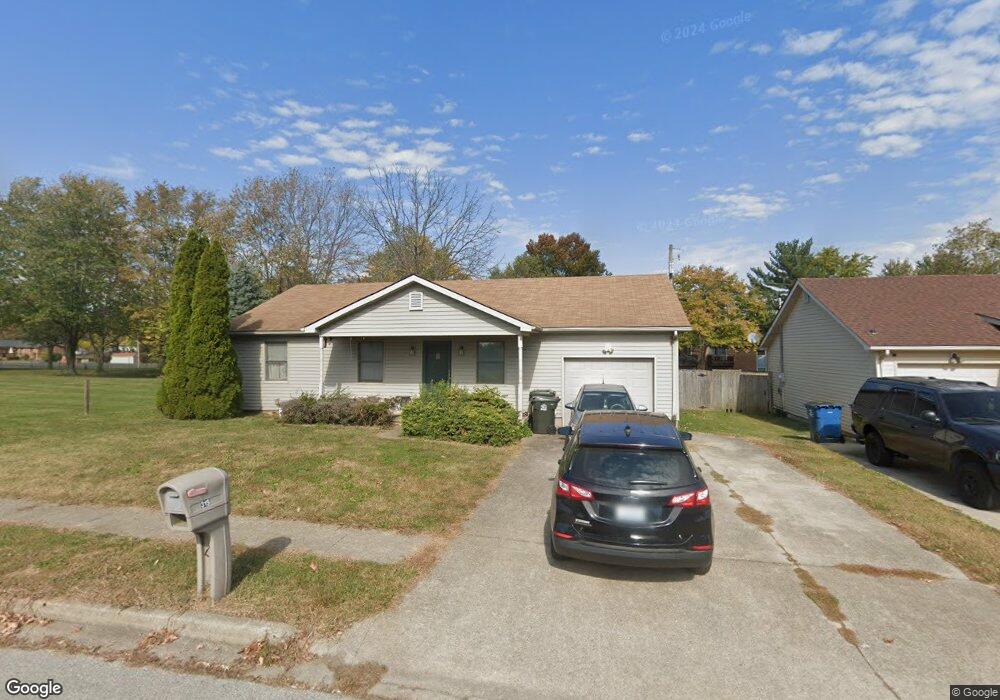
315 Bunker Hill Dr Georgetown, KY 40324
Mount Vernon NeighborhoodEstimated Value: $231,000 - $263,000
3
Beds
2
Baths
1,299
Sq Ft
$189/Sq Ft
Est. Value
About This Home
This home is located at 315 Bunker Hill Dr, Georgetown, KY 40324 and is currently estimated at $245,769, approximately $189 per square foot. 315 Bunker Hill Dr is a home located in Scott County with nearby schools including Southern Elementary School, Creekside Elementary School, and Georgetown Middle School.
Ownership History
Date
Name
Owned For
Owner Type
Purchase Details
Closed on
Jul 24, 2015
Sold by
Ford Amanda M
Bought by
Wisby Brian and Wisby Regina
Current Estimated Value
Home Financials for this Owner
Home Financials are based on the most recent Mortgage that was taken out on this home.
Original Mortgage
$130,612
Outstanding Balance
$102,480
Interest Rate
4.04%
Mortgage Type
New Conventional
Estimated Equity
$143,289
Create a Home Valuation Report for This Property
The Home Valuation Report is an in-depth analysis detailing your home's value as well as a comparison with similar homes in the area
Home Values in the Area
Average Home Value in this Area
Purchase History
| Date | Buyer | Sale Price | Title Company |
|---|---|---|---|
| Wisby Brian | $128,000 | Attorney |
Source: Public Records
Mortgage History
| Date | Status | Borrower | Loan Amount |
|---|---|---|---|
| Open | Wisby Brian | $130,612 |
Source: Public Records
Tax History Compared to Growth
Tax History
| Year | Tax Paid | Tax Assessment Tax Assessment Total Assessment is a certain percentage of the fair market value that is determined by local assessors to be the total taxable value of land and additions on the property. | Land | Improvement |
|---|---|---|---|---|
| 2024 | $1,644 | $182,800 | $0 | $0 |
| 2023 | $1,599 | $176,300 | $35,000 | $141,300 |
| 2022 | $1,335 | $157,000 | $30,000 | $127,000 |
| 2021 | $1,367 | $145,100 | $30,000 | $115,100 |
| 2020 | $1,168 | $136,000 | $30,000 | $106,000 |
| 2019 | $1,143 | $131,000 | $0 | $0 |
| 2018 | $1,111 | $128,000 | $0 | $0 |
| 2017 | $1,116 | $128,000 | $0 | $0 |
| 2016 | $1,031 | $128,000 | $0 | $0 |
| 2015 | $899 | $112,300 | $0 | $0 |
| 2014 | $931 | $112,255 | $0 | $0 |
| 2011 | $70 | $112,255 | $0 | $0 |
Source: Public Records
Map
Nearby Homes
- 230 E Showalter Dr
- 224 E Showalter Dr
- 1115 Southpoint Dr
- 139 E Showalter Dr
- 1338 Liberty Dr Unit A and B
- 1363 Bridges Creek Ct
- 127 E Chopin Way
- 145 Placid Dr
- 102 Browning Dr
- 107 Oconner Ct
- 155 Bill Perkins Ln
- 148 Bill Perkins Ln
- 1020 Parkside Dr
- 188 Ruth Miller Dr
- 145 Ruth Miller Dr
- 143 Ruth Miller Dr
- 1117 Pawnee Trail
- 174 Ruth Miller Dr
- 158 Ruth Miller Dr
- 140 Ruth Miller Dr
- 315 Bunker Hill St
- 317 Bunker Hill Dr
- 319 Bunker Hill Dr
- 319 Bunker Hill St
- 1363 Dorchester Dr
- 1144 Southpoint Dr
- 321 Bunker Hill Dr
- 1366 Dorchester Dr
- 1361 Dorchester Dr
- 307 Bunker Hill Dr
- 1142 Southpoint Dr
- 323 Bunker Hill Dr
- 1364 Dorchester Dr
- 306 Bunker Hill Dr
- 1143 Southpoint Dr
- 1359 Dorchester Dr
- 1140 Southpoint Dr
- 305 Bunker Hill Dr
- 1362 Dorchester Dr
- 1141 Southpoint Dr