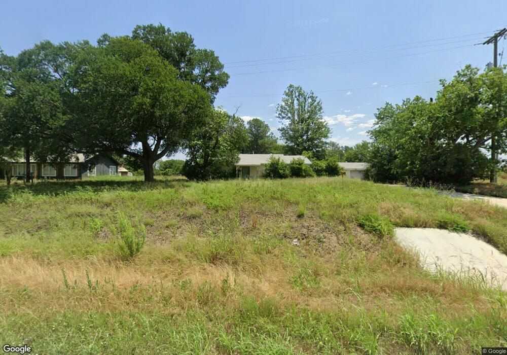
315 Center Point Rd Weatherford, TX 76087
Estimated Value: $463,000 - $1,075,000
--
Bed
--
Bath
1,252
Sq Ft
$593/Sq Ft
Est. Value
About This Home
This home is located at 315 Center Point Rd, Weatherford, TX 76087 and is currently estimated at $741,872, approximately $592 per square foot. 315 Center Point Rd is a home located in Parker County with nearby schools including Ikard Elementary School, Tison Middle School, and Weatherford High School.
Ownership History
Date
Name
Owned For
Owner Type
Purchase Details
Closed on
Dec 6, 2024
Sold by
Commercial Realty Fund Llc
Bought by
Rp-Cd Weatherford Point Lp
Current Estimated Value
Purchase Details
Closed on
Nov 28, 2018
Sold by
Pollard James H and Pollard Priscilla
Bought by
East West Development Group Llc
Home Financials for this Owner
Home Financials are based on the most recent Mortgage that was taken out on this home.
Original Mortgage
$285,000
Interest Rate
4.8%
Mortgage Type
New Conventional
Purchase Details
Closed on
Jun 7, 1991
Bought by
Pollard Pollard J and Pollard Priscilla
Create a Home Valuation Report for This Property
The Home Valuation Report is an in-depth analysis detailing your home's value as well as a comparison with similar homes in the area
Home Values in the Area
Average Home Value in this Area
Purchase History
| Date | Buyer | Sale Price | Title Company |
|---|---|---|---|
| Rp-Cd Weatherford Point Lp | -- | None Listed On Document | |
| East West Development Group Llc | -- | None Available | |
| Pollard Pollard J | -- | -- |
Source: Public Records
Mortgage History
| Date | Status | Borrower | Loan Amount |
|---|---|---|---|
| Previous Owner | East West Development Group Llc | $285,000 |
Source: Public Records
Tax History Compared to Growth
Tax History
| Year | Tax Paid | Tax Assessment Tax Assessment Total Assessment is a certain percentage of the fair market value that is determined by local assessors to be the total taxable value of land and additions on the property. | Land | Improvement |
|---|---|---|---|---|
| 2025 | $10,469 | $696,961 | $696,960 | $1 |
| 2024 | $10,469 | $543,140 | $392,040 | $151,100 |
| 2023 | $10,469 | $543,140 | $392,040 | $151,100 |
| 2022 | $8,342 | $376,090 | $294,030 | $82,060 |
| 2021 | $9,032 | $376,090 | $294,030 | $82,060 |
| 2020 | $9,087 | $376,090 | $294,030 | $82,060 |
| 2019 | $9,604 | $376,090 | $294,030 | $82,060 |
| 2018 | $2,588 | $100,880 | $30,000 | $70,880 |
| 2017 | $2,654 | $100,880 | $30,000 | $70,880 |
| 2016 | $684 | $26,000 | $26,000 | $0 |
| 2015 | $110 | $26,000 | $26,000 | $0 |
| 2014 | $128 | $87,350 | $26,000 | $61,350 |
Source: Public Records
Map
Nearby Homes
- Tbd Dean St
- 4011 E Bankhead Hwy
- 4014 E Bankhead Hwy
- 4004 Clearview Ct
- 2904 E Bankhead Hwy
- 132 Juan Ct
- 304 Newell Dr Unit R
- 304 Newell Dr Unit C
- 2045 Mason Pond Dr
- 207 Newell Dr
- 203 Newell Dr Unit R
- 214 Willow Creek Dr
- 109 Norene Ln
- 2911 Inspiration Dr
- TBA N Oakridge Dr
- 1917 Windowmere Trail
- 2217 Lorrie Ln
- 1525 Sand Dollar Trail
- 2122 Louis Tr
- 1520 Sidewinder Trail
- 311 Center Point Rd
- 309 Center Point Rd
- 312 Center Point Rd
- 320 Center Point Rd
- 308 Center Point Rd
- 301 Center Point Rd
- 2314 Dean St
- 229 Center Point Rd
- 501 Center Point Rd
- 225 Center Point Rd
- 2305 Dean St
- 221 Center Point Rd
- 503 Center Point Rd
- 2418 Ivie Ln
- 504 Center Point Rd
- 504 Center Point Rd Unit 1
- 2515 E I 20
- 505 Center Point Rd
- 2308 Ivie Ln
- 2424 Ivie Ln
