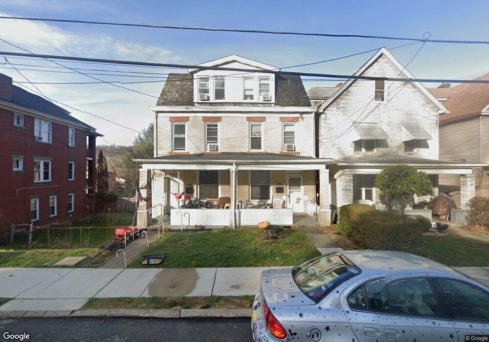
315 Duquesne Ave Unit 315 1/2 Trafford, PA 15085
Estimated Value: $157,000 - $191,000
--
Bed
--
Bath
--
Sq Ft
3,006
Sq Ft Lot
About This Home
This home is located at 315 Duquesne Ave Unit 315 1/2, Trafford, PA 15085 and is currently estimated at $175,333. 315 Duquesne Ave Unit 315 1/2 is a home located in Westmoreland County with nearby schools including Penn Trafford High School.
Ownership History
Date
Name
Owned For
Owner Type
Purchase Details
Closed on
May 29, 2018
Sold by
Powell Amy
Bought by
Lane Stephen P
Current Estimated Value
Home Financials for this Owner
Home Financials are based on the most recent Mortgage that was taken out on this home.
Original Mortgage
$57,439
Outstanding Balance
$49,675
Interest Rate
4.5%
Mortgage Type
FHA
Estimated Equity
$125,658
Purchase Details
Closed on
Sep 17, 2014
Sold by
Powell Michael L and Powell Amy
Bought by
Powell Amy
Purchase Details
Closed on
May 28, 2002
Sold by
Turacy Donald M and Turacy Heather M
Bought by
Turacy Donald M
Create a Home Valuation Report for This Property
The Home Valuation Report is an in-depth analysis detailing your home's value as well as a comparison with similar homes in the area
Home Values in the Area
Average Home Value in this Area
Purchase History
| Date | Buyer | Sale Price | Title Company |
|---|---|---|---|
| Lane Stephen P | $58,500 | None Available | |
| Powell Amy | -- | None Available | |
| Turacy Donald M | -- | -- |
Source: Public Records
Mortgage History
| Date | Status | Borrower | Loan Amount |
|---|---|---|---|
| Open | Lane Stephen P | $57,439 |
Source: Public Records
Tax History Compared to Growth
Tax History
| Year | Tax Paid | Tax Assessment Tax Assessment Total Assessment is a certain percentage of the fair market value that is determined by local assessors to be the total taxable value of land and additions on the property. | Land | Improvement |
|---|---|---|---|---|
| 2025 | $2,733 | $18,130 | $1,780 | $16,350 |
| 2024 | $2,715 | $18,130 | $1,780 | $16,350 |
| 2023 | $2,588 | $18,130 | $1,780 | $16,350 |
| 2022 | $2,561 | $18,130 | $1,780 | $16,350 |
| 2021 | $2,543 | $18,130 | $1,780 | $16,350 |
| 2020 | $2,524 | $18,130 | $1,780 | $16,350 |
| 2019 | $2,470 | $18,130 | $1,780 | $16,350 |
| 2018 | $2,443 | $18,130 | $1,780 | $16,350 |
| 2017 | $2,407 | $18,130 | $1,780 | $16,350 |
| 2016 | $2,345 | $18,130 | $1,780 | $16,350 |
| 2015 | $2,291 | $18,130 | $1,780 | $16,350 |
| 2014 | $2,254 | $18,130 | $1,780 | $16,350 |
Source: Public Records
Map
Nearby Homes
- 227 Duquesne Ave
- 204 2nd St
- 514 Cavitt Ave
- 403 Gilmore Ave
- 434 Fairmont Ave
- 107 Cavitt Ave
- 601 Brinton Ave
- 108 Hird Rd
- 100 Brownstone Ct Unit 1
- 1870 Haymaker Rd
- . Old Ramsey Rd
- 320 Penn Lear Ct
- 126 Penn Lear Dr
- 150 Westminster Dr
- 670 Division St
- 2047 Haymaker Rd
- 642 Irwin St
- 582 Forest Oaks Trail
- 129 Mayberry Dr
- 608 Dawson St
- 317 Duquesne Ave
- 311 Duquesne Ave
- 319 Duquesne Ave
- 309 Duquesne Ave
- 321 Duquesne Ave
- 307 Duquesne Ave
- 323 Duquesne Ave
- 323 Duquesne Ave
- 328 Cavitt Ave
- 316 Duquesne Ave
- 322 Duquesne Ave
- 305 Duquesne Ave
- 336 Cavitt Ave
- 310 Duquesne Ave
- 327 Duquesne Ave
- 303 Duquesne Ave
- 308 Duquesne Ave
- 306 Duquesne Ave
- 304 Duquesne Ave
- 321 Edgewood Ave