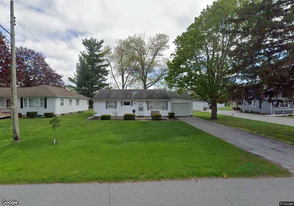
315 E Maple St Kentland, IN 47951
Estimated Value: $102,000 - $139,000
2
Beds
1
Bath
925
Sq Ft
$126/Sq Ft
Est. Value
About This Home
This home is located at 315 E Maple St, Kentland, IN 47951 and is currently estimated at $116,571, approximately $126 per square foot. 315 E Maple St is a home located in Newton County with nearby schools including South Newton Elementary School, South Newton Middle School, and South Newton Senior High School.
Create a Home Valuation Report for This Property
The Home Valuation Report is an in-depth analysis detailing your home's value as well as a comparison with similar homes in the area
Home Values in the Area
Average Home Value in this Area
Tax History
| Year | Tax Paid | Tax Assessment Tax Assessment Total Assessment is a certain percentage of the fair market value that is determined by local assessors to be the total taxable value of land and additions on the property. | Land | Improvement |
|---|---|---|---|---|
| 2025 | $1,580 | $83,900 | $12,000 | $71,900 |
| 2024 | $1,580 | $79,000 | $12,000 | $67,000 |
| 2023 | $1,460 | $73,000 | $12,000 | $61,000 |
| 2022 | $1,407 | $65,800 | $12,000 | $53,800 |
| 2021 | $1,142 | $57,100 | $12,000 | $45,100 |
| 2020 | $1,185 | $55,400 | $12,000 | $43,400 |
| 2019 | $1,105 | $51,700 | $12,000 | $39,700 |
| 2018 | $1,149 | $53,700 | $12,000 | $41,700 |
| 2017 | $1,126 | $52,600 | $7,200 | $45,400 |
| 2016 | $1,139 | $53,200 | $7,200 | $46,000 |
| 2014 | $916 | $45,800 | $7,200 | $38,600 |
| 2013 | $916 | $45,100 | $7,200 | $37,900 |
Source: Public Records
Map
Nearby Homes
- 710 N 2nd St
- 105 E Iroquois St
- 106 E Washington St
- 103 W Lincoln St
- 407 N 7th St
- 202 N 3rd St
- 106 E Allen St
- 204 S 1st St
- 105 E Allen St
- Vacant Land W Allen St
- 3569 W 1500 S
- 315 W Railroad St
- 1892 W 1800 S
- 455 E Main St
- 395 N 4th St
- 215 W Main St
- 315 W Main St
- 104 E 5th St
- 307 E 4th St
- 650 W Blue St
Your Personal Tour Guide
Ask me questions while you tour the home.