C
Seller's Agent in 2025
Cory Richmond
National Parks Realty - Bigfork
(406) 249-2537
6 in this area
14 Total Sales
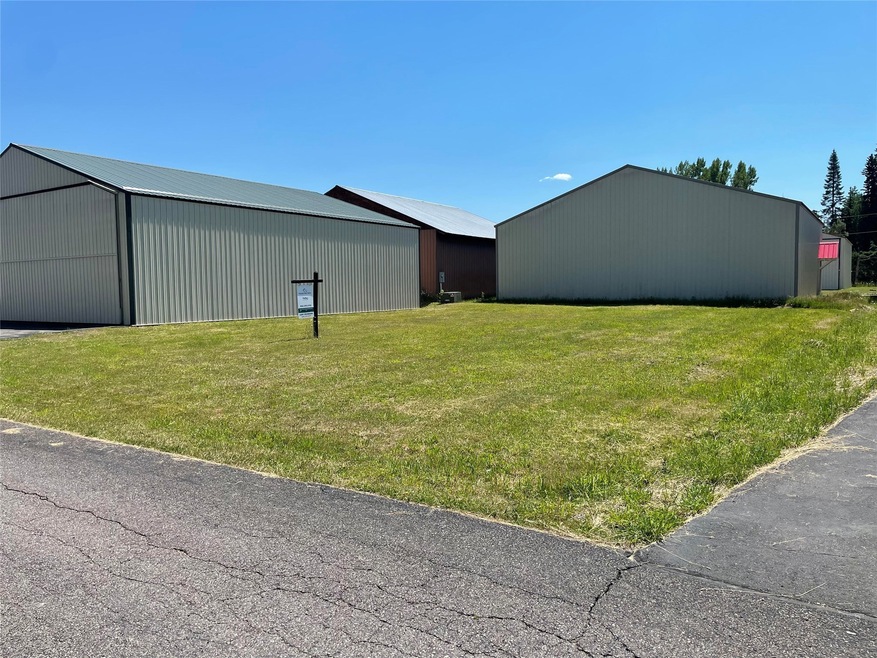
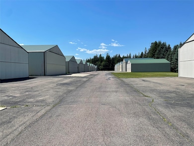
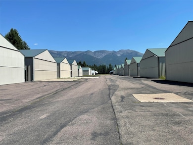
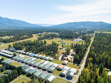
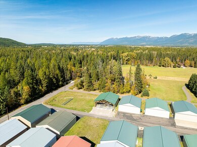
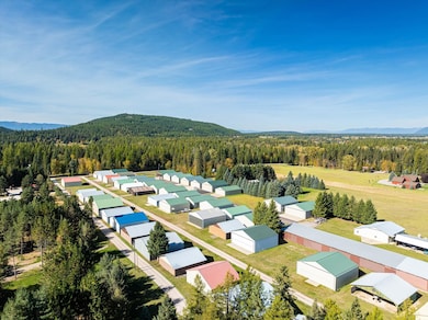

UNIQUELY FAVORABLE BUYER TERMS. Please contact agent for more details. Rare opportunity to purchase a Hangar approved undeveloped lot consisting of .138 acres in the Bolstad Hangars subdivision with access to the Ferndale Airfield. Ferndale Airfield (FAA LID: 53U) is a public use airport in Flathead County, Montana, United States. It is owned by the Flathead Municipal Airport Authority and located three nautical miles northeast of the central business district of Bigfork, Montana. The airfield is county-maintained year around at no cost to hangar owners and renters. Ferndale Airfield covers an area of 35 well maintained acres at an elevation of 3,072 feet above mean sea level. Per the CC&Rs the lot shall be used solely for airplane hangars and incidental storage. No water supply or sewage disposal allowed. It has one runway designated 15/33 with a turf surface measuring 3,500 by 95 feet. There is a 37.5 foot access easement in front of each lot used solely for access and taxing of airplanes.
Last Agent to Sell the Property
National Parks Realty - Bigfork License #RRE-RBS-LIC-87841 Listed on: 11/01/2024
Last Buyer's Agent
Glacier Sotheby's International Realty Bigfork License #RRE-BRO-LIC-5901

| Date | Type | Sale Price | Title Company |
|---|---|---|---|
| Warranty Deed | -- | Insured Titles | |
| Quit Claim Deed | -- | None Listed On Document | |
| Quit Claim Deed | -- | Fntc | |
| Warranty Deed | -- | None Available | |
| Warranty Deed | -- | None Available |
| Date | Event | Price | List to Sale | Price per Sq Ft |
|---|---|---|---|---|
| 06/20/2025 06/20/25 | Sold | -- | -- | -- |
| 11/01/2024 11/01/24 | For Sale | $139,000 | -- | -- |
| Year | Tax Paid | Tax Assessment Tax Assessment Total Assessment is a certain percentage of the fair market value that is determined by local assessors to be the total taxable value of land and additions on the property. | Land | Improvement |
|---|---|---|---|---|
| 2025 | $225 | $83,700 | $0 | $0 |
| 2024 | $242 | $50,800 | $0 | $0 |
| 2023 | $320 | $50,800 | $0 | $0 |
| 2022 | $194 | $30,400 | $0 | $0 |
| 2021 | $214 | $30,400 | $0 | $0 |
| 2020 | $228 | $26,000 | $0 | $0 |
| 2019 | $178 | $26,000 | $0 | $0 |
| 2018 | $163 | $22,000 | $0 | $0 |
| 2017 | $153 | $22,000 | $0 | $0 |
| 2016 | $249 | $34,900 | $0 | $0 |
| 2015 | $234 | $34,900 | $0 | $0 |
| 2014 | $256 | $19,716 | $0 | $0 |
C
Seller's Agent in 2025
Cory Richmond
National Parks Realty - Bigfork
(406) 249-2537
6 in this area
14 Total Sales
Buyer's Agent in 2025
Katie Brown
Glacier Sotheby's International Realty Bigfork
(406) 253-3222
63 in this area
148 Total Sales
Source: Montana Regional MLS
MLS Number: 30035946
APN: 07-3836-34-2-09-50-0000
Disclaimer: Certain information contained herein is derived from information provided by parties other than Homes.com. All information provided is deemed reliable, but is not guaranteed to be accurate and should be independently verified.
![]() IDX information is provided exclusively for personal, non-commercial use, and may not be used for any purpose other than to identify prospective properties consumers may be interested in purchasing. Information is deemed reliable but not guaranteed.
IDX information is provided exclusively for personal, non-commercial use, and may not be used for any purpose other than to identify prospective properties consumers may be interested in purchasing. Information is deemed reliable but not guaranteed.