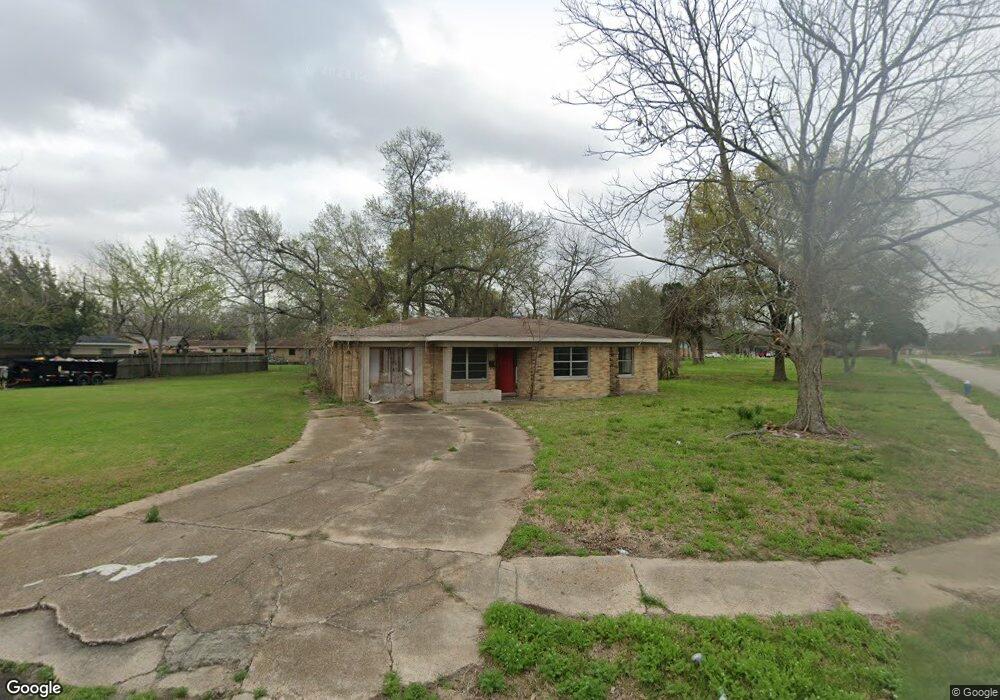
315 Glenburnie Dr Houston, TX 77022
Independence Heights NeighborhoodEstimated Value: $148,312 - $245,000
3
Beds
1
Bath
1,391
Sq Ft
$149/Sq Ft
Est. Value
About This Home
This home is located at 315 Glenburnie Dr, Houston, TX 77022 and is currently estimated at $207,828, approximately $149 per square foot. 315 Glenburnie Dr is a home located in Harris County with nearby schools including Kennedy Elementary School, Williams Middle, and Booker T Washington Sr High.
Ownership History
Date
Name
Owned For
Owner Type
Purchase Details
Closed on
Jan 8, 2018
Sold by
Fowler Joshua
Bought by
Barron Alfredo and Barron Eda M
Current Estimated Value
Purchase Details
Closed on
Dec 18, 2017
Sold by
Pfirman Richard
Bought by
Fowler Joshua
Purchase Details
Closed on
Oct 7, 2003
Sold by
Pfirman Richard L
Bought by
Pfirman Richard L
Purchase Details
Closed on
Oct 28, 1997
Sold by
Daiwa Finance Corp
Bought by
State Street Bank & Trust Company
Purchase Details
Closed on
Jan 26, 1993
Sold by
Goldome Credit Corp
Bought by
Daiwa Finance Corp
Create a Home Valuation Report for This Property
The Home Valuation Report is an in-depth analysis detailing your home's value as well as a comparison with similar homes in the area
Home Values in the Area
Average Home Value in this Area
Purchase History
| Date | Buyer | Sale Price | Title Company |
|---|---|---|---|
| Barron Alfredo | -- | None Available | |
| Fowler Joshua | -- | None Available | |
| Pfirman Richard L | $35,000 | -- | |
| State Street Bank & Trust Company | -- | -- | |
| Daiwa Finance Corp | -- | -- |
Source: Public Records
Tax History Compared to Growth
Tax History
| Year | Tax Paid | Tax Assessment Tax Assessment Total Assessment is a certain percentage of the fair market value that is determined by local assessors to be the total taxable value of land and additions on the property. | Land | Improvement |
|---|---|---|---|---|
| 2025 | $2,406 | $122,827 | $114,615 | $8,212 |
| 2024 | $2,406 | $115,000 | $114,615 | $385 |
| 2023 | $2,067 | $102,605 | $91,692 | $10,913 |
| 2022 | $2,210 | $98,000 | $91,692 | $6,308 |
| 2021 | $2,339 | $100,377 | $91,692 | $8,685 |
| 2020 | $1,375 | $0 | $0 | $0 |
| 2019 | $1,437 | $56,780 | $45,846 | $10,934 |
| 2018 | $822 | $32,500 | $26,744 | $5,756 |
| 2017 | $822 | $37,939 | $26,744 | $11,195 |
| 2016 | $876 | $34,656 | $19,103 | $15,553 |
| 2015 | $750 | $30,864 | $19,103 | $11,761 |
| 2014 | $750 | $29,161 | $19,103 | $10,058 |
Source: Public Records
Map
Nearby Homes
- 319 E Delz Dr
- 327 E Delz Dr
- 219 E Janisch Rd
- 5203 Burress Springs Ln
- 146 Hohldale St
- 423 Gammon Dr
- 330 Spell St
- 303 Victoria Dr
- 302 E Rogers St
- 202 Leago St
- 0 Leago St Unit 38076099
- 238 Betral St
- 103 E Janisch Rd
- 0 Victoria Unit 54691087
- 315 Hohldale St
- 5518 Cortlandt St Unit B
- 5518 Cortlandt St Unit A
- 313 E Tidwell Rd
- 627 Glenburnie Dr
- 405 Hohldale St
- 311 Glenburnie Dr
- 327 Glenburnie Dr
- 307 Glenburnie Dr
- 322 Acme Ct
- 333 Glenburnie Dr
- 326 Acme Ct
- 303 E Delz Dr
- 314 Glenburnie Dr
- 326 Glenburnie Dr
- 303 Glenburnie Dr
- 310 Glenburnie Dr
- 318 Glenburnie Dr
- 318 Acme Ct
- 306 Glenburnie Dr
- 339 Glenburnie Dr
- 334 Glenburnie Dr
- 302 Glenburnie Dr
- 330 Acme Ct
- 338 Glenburnie Dr
- 343 Glenburnie Dr