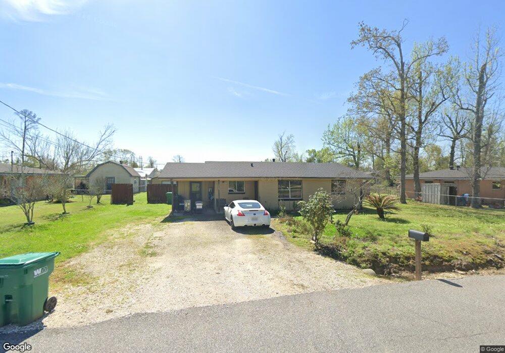
315 Goss Rd Westlake, LA 70669
Estimated Value: $115,148 - $170,000
3
Beds
1
Bath
1,342
Sq Ft
$106/Sq Ft
Est. Value
About This Home
This home is located at 315 Goss Rd, Westlake, LA 70669 and is currently estimated at $142,537, approximately $106 per square foot. 315 Goss Rd is a home located in Calcasieu Parish with nearby schools including Westwood Elementary School, Western Heights Elementary School, and S.P. Arnett Middle School.
Ownership History
Date
Name
Owned For
Owner Type
Purchase Details
Closed on
Mar 4, 2016
Sold by
Sonnier Vittorio Crystal Ann
Bought by
Vittorio Shawn Michael
Current Estimated Value
Home Financials for this Owner
Home Financials are based on the most recent Mortgage that was taken out on this home.
Original Mortgage
$83,200
Outstanding Balance
$66,157
Interest Rate
3.79%
Mortgage Type
New Conventional
Estimated Equity
$76,380
Purchase Details
Closed on
Feb 18, 2011
Sold by
Wold Kevin Michael
Bought by
Sonnier Vittorio Crystal Ann and Vittorio Shawn Michael
Home Financials for this Owner
Home Financials are based on the most recent Mortgage that was taken out on this home.
Original Mortgage
$88,082
Interest Rate
4.79%
Mortgage Type
New Conventional
Purchase Details
Closed on
Jul 30, 2010
Sold by
Baker Renee E
Bought by
Wold Kevin M
Create a Home Valuation Report for This Property
The Home Valuation Report is an in-depth analysis detailing your home's value as well as a comparison with similar homes in the area
Home Values in the Area
Average Home Value in this Area
Purchase History
| Date | Buyer | Sale Price | Title Company |
|---|---|---|---|
| Vittorio Shawn Michael | -- | Elite Title Services Llc | |
| Sonnier Vittorio Crystal Ann | $85,000 | Elite Title Insurance Agency | |
| Wold Kevin M | $30,000 | None Available |
Source: Public Records
Mortgage History
| Date | Status | Borrower | Loan Amount |
|---|---|---|---|
| Open | Vittorio Shawn Michael | $83,200 | |
| Previous Owner | Sonnier Vittorio Crystal Ann | $88,082 | |
| Closed | Wold Kevin M | $0 |
Source: Public Records
Tax History Compared to Growth
Tax History
| Year | Tax Paid | Tax Assessment Tax Assessment Total Assessment is a certain percentage of the fair market value that is determined by local assessors to be the total taxable value of land and additions on the property. | Land | Improvement |
|---|---|---|---|---|
| 2024 | $668 | $6,090 | $1,780 | $4,310 |
| 2023 | $668 | $6,090 | $1,780 | $4,310 |
| 2022 | $684 | $6,090 | $1,780 | $4,310 |
| 2021 | $667 | $6,090 | $1,780 | $4,310 |
| 2020 | $624 | $5,590 | $1,710 | $3,880 |
| 2019 | $689 | $5,960 | $1,650 | $4,310 |
| 2018 | $638 | $5,960 | $1,650 | $4,310 |
| 2017 | $657 | $5,960 | $1,650 | $4,310 |
| 2016 | $653 | $5,960 | $1,650 | $4,310 |
Source: Public Records
Map
Nearby Homes
- 2502 & 2504 German Rd
- 2518 Donnelly Rd
- 2525 Davis Rd
- 345 Fred Lutz Rd
- 590 Landry Rd
- 618 John Stine Rd
- 109 W Wayside Dr
- 2429 Duraso Dr
- 2526 Cox Rd
- 2425 Duraso Dr
- 0 W Wayside Dr Unit SWL25001592
- 125 Helen St
- 2524 Cox Rd
- 2725 Smith Ferry Rd
- 2034 Gus St
- 0 Davis Rd
- 0 Fletcher Rd
- 2201 Duke St
- 600 W Wayside Dr
- 0 Dewitt St