Estimated Value: $296,968 - $324,000
3
Beds
2
Baths
1,400
Sq Ft
$223/Sq Ft
Est. Value
About This Home
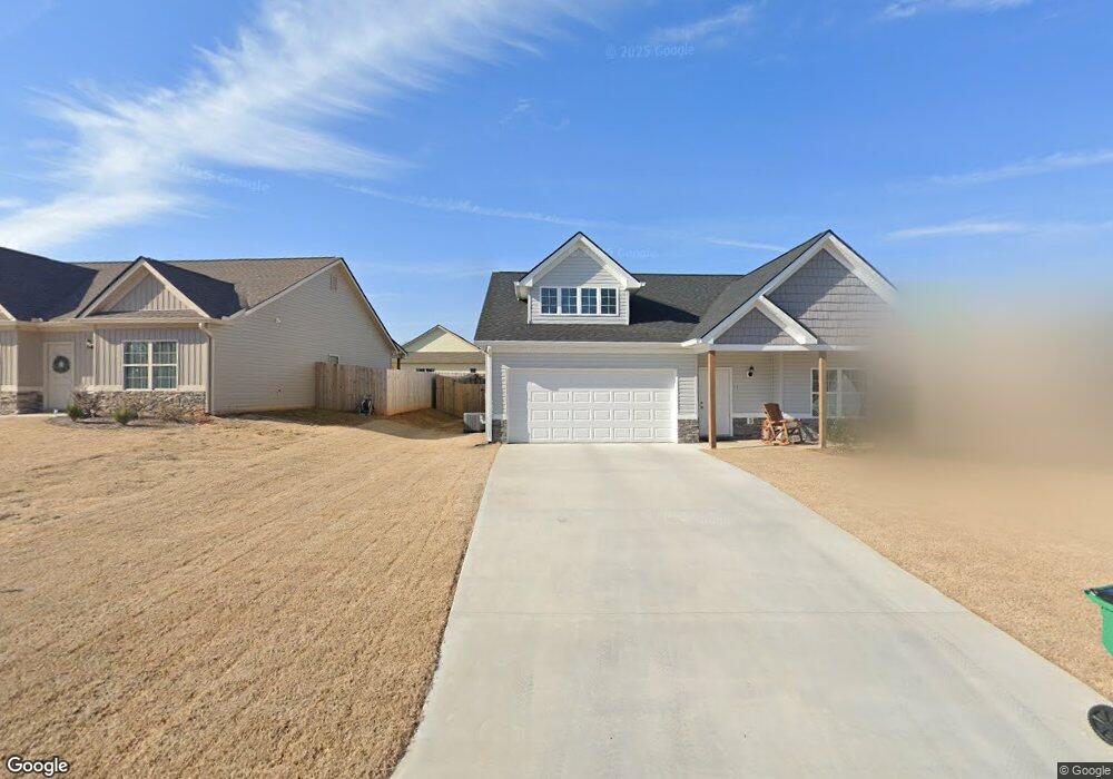
This home is located at 315 Highland Pointe Dr Unit 121, Alto, GA 30510 and is currently estimated at $311,742, approximately $222 per square foot. 315 Highland Pointe Dr Unit 121 is a home located in Habersham County with nearby schools including Level Grove Elementary School, South Habersham Middle School, and Habersham Success Academy.
Ownership History
Date
Name
Owned For
Owner Type
Purchase Details
Closed on
Jul 13, 2022
Sold by
Addis Allen
Bought by
Harrell Rachel and Harrell Maurice Eugene
Current Estimated Value
Purchase Details
Closed on
Jul 2, 2020
Sold by
A & R Homes Llc
Bought by
Addis Allen
Home Financials for this Owner
Home Financials are based on the most recent Mortgage that was taken out on this home.
Original Mortgage
$196,617
Interest Rate
3.1%
Mortgage Type
VA
Purchase Details
Closed on
Nov 29, 2018
Sold by
Hlpbd Llc
Bought by
Highland Pointe Investments Llc
Purchase Details
Closed on
Apr 1, 2007
Sold by
Not Provided
Bought by
Highland Point Development Llc
Create a Home Valuation Report for This Property
The Home Valuation Report is an in-depth analysis detailing your home's value as well as a comparison with similar homes in the area
Home Values in the Area
Average Home Value in this Area
Purchase History
| Date | Buyer | Sale Price | Title Company |
|---|---|---|---|
| Harrell Rachel | $291,000 | -- | |
| Addis Allen | $189,785 | -- | |
| Highland Pointe Investments Llc | $556,400 | -- | |
| Highland Point Development Llc | -- | -- |
Source: Public Records
Mortgage History
| Date | Status | Borrower | Loan Amount |
|---|---|---|---|
| Previous Owner | Addis Allen | $196,617 |
Source: Public Records
Tax History Compared to Growth
Tax History
| Year | Tax Paid | Tax Assessment Tax Assessment Total Assessment is a certain percentage of the fair market value that is determined by local assessors to be the total taxable value of land and additions on the property. | Land | Improvement |
|---|---|---|---|---|
| 2025 | $3,881 | $118,905 | $12,000 | $106,905 |
| 2024 | $2,479 | $95,512 | $12,000 | $83,512 |
| 2023 | $2,409 | $96,364 | $12,000 | $84,364 |
| 2022 | $2,148 | $82,380 | $12,000 | $70,380 |
| 2021 | $1,919 | $73,920 | $12,000 | $61,920 |
| 2020 | $215 | $8,000 | $8,000 | $0 |
| 2019 | $215 | $8,000 | $8,000 | $0 |
| 2018 | $155 | $5,800 | $5,800 | $0 |
| 2017 | $129 | $4,800 | $4,800 | $0 |
| 2016 | $104 | $10,000 | $4,000 | $0 |
| 2015 | $103 | $10,000 | $4,000 | $0 |
| 2014 | $105 | $10,000 | $4,000 | $0 |
| 2013 | -- | $4,000 | $4,000 | $0 |
Source: Public Records
Map
Nearby Homes
- 324 Highland Pointe Dr
- 752 Dawn Place
- 140 Highland Pointe Dr
- 738 Wilbanks Rd
- 0 State Route 365 Unit 10496178
- 0 State Route 365 Unit 10496183
- 3568 State Route 365
- 0 Hubert Harris
- 1307 Creasy Patch Rd
- 429 Hubert Harris Rd
- 179 Sunset Oaks Dr
- 190 Sunset Oaks Dr
- 1246 Duncan Bridge Rd
- 2000 Alto Mud Creek Rd
- 255 Laurel Place Dr
- 240 Woodmont Dr
- 450 Beachwood Dr
- 434 Beachwood Dr
- 135 Oak Terrace Dr
- 117 Oak Terrace Dr
- 315 Highland Pointe Dr
- 307 Highland Pointe Dr
- 307 Highland Pointe Dr Unit 120
- 323 Highland Pointe Dr
- 301 Highland Pointe Dr
- 329 Highland Pointe Dr Unit 123
- 329 Highland Pointe Dr
- 409 Highland Pointe Dr
- 409 Highland Pointe Dr Unit 133
- 403 Highland Pointe Dr
- 419 Highland Pointe Dr Unit 135
- 295 Highland Pointe Dr
- 318 Highland Pointe Dr Unit 20
- 413 Highland Pointe Dr
- 335 Highland Pointe Dr
- 306 Highland Pointe Dr Unit 18
- 306 Highland Pointe Dr
- 314 Highland Pointe Dr Unit 19
- 314 Highland Pointe Dr
- 397 Highland Pointe Dr