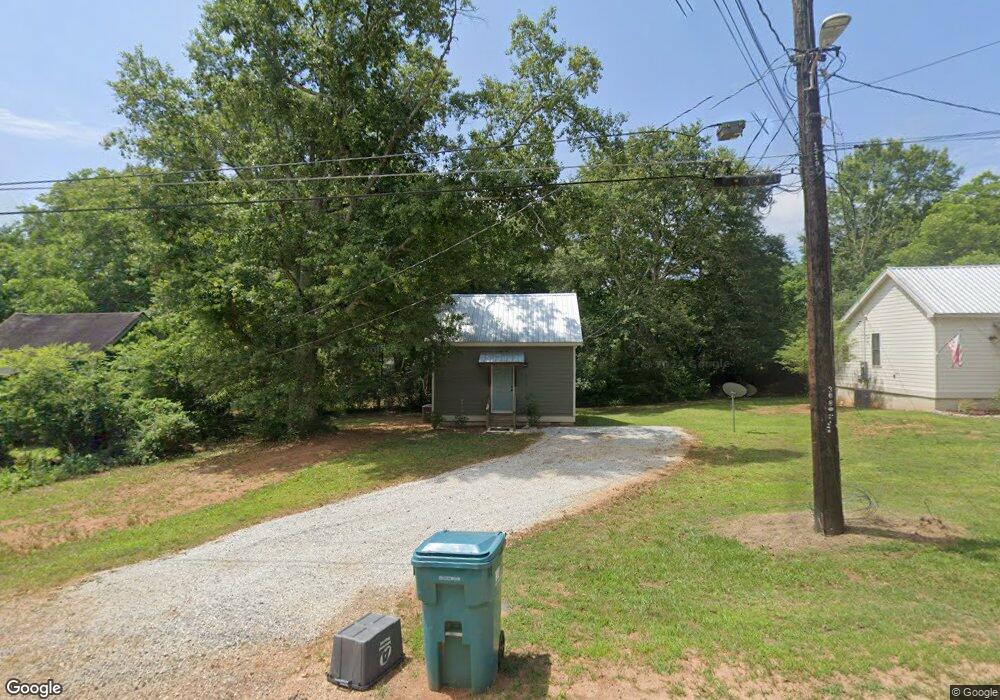
315 Jones Dr Social Circle, GA 30025
Estimated Value: $129,188 - $263,000
--
Bed
--
Bath
500
Sq Ft
$390/Sq Ft
Est. Value
About This Home
This home is located at 315 Jones Dr, Social Circle, GA 30025 and is currently estimated at $194,797, approximately $389 per square foot. 315 Jones Dr is a home with nearby schools including Social Circle Primary School, Social Circle Elementary School, and Social Circle Middle School.
Ownership History
Date
Name
Owned For
Owner Type
Purchase Details
Closed on
Jul 16, 2020
Sold by
Middleton Diane
Bought by
Rtcm Properties Lllp
Current Estimated Value
Home Financials for this Owner
Home Financials are based on the most recent Mortgage that was taken out on this home.
Original Mortgage
$155,025
Interest Rate
3.1%
Mortgage Type
New Conventional
Purchase Details
Closed on
Sep 7, 2005
Sold by
Strickland Herman
Bought by
Middleton Diane
Create a Home Valuation Report for This Property
The Home Valuation Report is an in-depth analysis detailing your home's value as well as a comparison with similar homes in the area
Home Values in the Area
Average Home Value in this Area
Purchase History
| Date | Buyer | Sale Price | Title Company |
|---|---|---|---|
| Rtcm Properties Lllp | $25,000 | -- | |
| Middleton Diane | -- | -- |
Source: Public Records
Mortgage History
| Date | Status | Borrower | Loan Amount |
|---|---|---|---|
| Closed | Rtcm Properties Lllp | $155,025 |
Source: Public Records
Tax History Compared to Growth
Tax History
| Year | Tax Paid | Tax Assessment Tax Assessment Total Assessment is a certain percentage of the fair market value that is determined by local assessors to be the total taxable value of land and additions on the property. | Land | Improvement |
|---|---|---|---|---|
| 2024 | $1,145 | $32,200 | $15,000 | $17,200 |
| 2023 | $1,047 | $28,960 | $13,200 | $15,760 |
| 2022 | $265 | $25,440 | $10,800 | $14,640 |
| 2021 | $243 | $23,360 | $10,800 | $12,560 |
| 2020 | $271 | $25,360 | $8,400 | $16,960 |
| 2019 | $252 | $20,720 | $8,400 | $12,320 |
| 2018 | $226 | $20,720 | $8,400 | $12,320 |
| 2017 | $730 | $17,480 | $6,000 | $11,480 |
| 2016 | $178 | $15,760 | $6,000 | $9,760 |
| 2015 | $163 | $14,520 | $6,000 | $8,520 |
| 2014 | -- | $15,120 | $6,000 | $9,120 |
Source: Public Records
Map
Nearby Homes
- 207 E Hightower Trail
- 238 Holly St NE
- Adrian Plan at Conner Springs
- Mira Plan at Conner Springs
- Tucker Front Porch Plan at Conner Springs
- Shiloh Plan at Conner Springs
- Sinclair Plan at Conner Springs
- Harding Plan at Conner Springs
- Hemingway Plan at Conner Springs
- 152 Orwell Dr
- 164 Orwell Dr
- 164 Orwell Dr Unit 104
- 217 Orwell Dr
- 231 Orwell Dr
- 177 ORWELL Drive
- 177 E Orwell Dr
- (GA)The Ava | Front Entry Plan at Weslyn Park
- (GA)The Everett | Front Entry Plan at Weslyn Park
- (GA) The Brooks | Front Entry Plan at Weslyn Park
- (GA)The Hunter | Front Entry Plan at Weslyn Park
- 311 Jones Dr
- 163 Spring St SE
- 140 Spring St SE
- 117 E Hightower Trail
- 185 Spring St SE
- 377 E Hightower Trail
- 337 Jones Dr SE
- 342 Jones Dr SE
- 333 Jones Dr SE
- 333 Jones Dr SE
- 370 Walnut Dr SE
- 336 Jones Dr SE
- 429 E Hightower Trail
- 364 Walnut Dr SE
- 328 Jones Dr
- 425 Walnut Dr SE
- 360 Walnut St
- 437 Walnut Dr SE
- 443 E Hightower Trail
- 443 E Hightower Trail