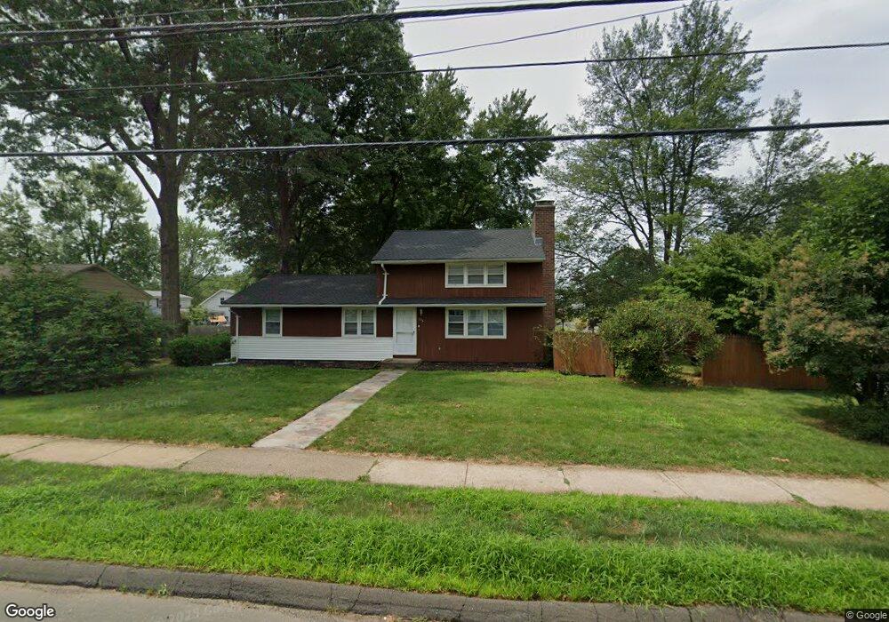
315 Maple Hill Ave Newington, CT 06111
Estimated Value: $342,000 - $405,000
4
Beds
3
Baths
1,656
Sq Ft
$230/Sq Ft
Est. Value
About This Home
This home is located at 315 Maple Hill Ave, Newington, CT 06111 and is currently estimated at $380,945, approximately $230 per square foot. 315 Maple Hill Ave is a home located in Hartford County with nearby schools including Anna Reynolds School, Martin Kellogg Middle School, and Newington High School.
Ownership History
Date
Name
Owned For
Owner Type
Purchase Details
Closed on
Oct 5, 2022
Sold by
Gallo Christopher
Bought by
Gallo Kenneth and Gallo Lanelle
Current Estimated Value
Home Financials for this Owner
Home Financials are based on the most recent Mortgage that was taken out on this home.
Original Mortgage
$265,050
Outstanding Balance
$254,468
Interest Rate
5.89%
Mortgage Type
Stand Alone Refi Refinance Of Original Loan
Estimated Equity
$126,477
Purchase Details
Closed on
Feb 25, 2014
Sold by
Gallo Joseph and Gallo Geraldine L
Bought by
Gallo Lanelle A and Gallo Kenneth M
Create a Home Valuation Report for This Property
The Home Valuation Report is an in-depth analysis detailing your home's value as well as a comparison with similar homes in the area
Home Values in the Area
Average Home Value in this Area
Purchase History
| Date | Buyer | Sale Price | Title Company |
|---|---|---|---|
| Gallo Kenneth | $279,000 | None Available | |
| Gallo Peter J | -- | None Available | |
| Gallo Lanelle A | -- | -- |
Source: Public Records
Mortgage History
| Date | Status | Borrower | Loan Amount |
|---|---|---|---|
| Open | Gallo Kenneth | $265,050 |
Source: Public Records
Tax History
| Year | Tax Paid | Tax Assessment Tax Assessment Total Assessment is a certain percentage of the fair market value that is determined by local assessors to be the total taxable value of land and additions on the property. | Land | Improvement |
|---|---|---|---|---|
| 2025 | $6,020 | $150,580 | $52,960 | $97,620 |
| 2024 | $5,974 | $150,580 | $52,960 | $97,620 |
| 2023 | $5,627 | $146,680 | $52,960 | $93,720 |
| 2022 | $5,646 | $146,680 | $52,960 | $93,720 |
| 2021 | $5,693 | $146,680 | $52,960 | $93,720 |
| 2020 | $5,348 | $136,140 | $50,930 | $85,210 |
| 2019 | $5,371 | $136,140 | $50,930 | $85,210 |
| 2018 | $5,241 | $136,140 | $50,930 | $85,210 |
| 2017 | $4,981 | $136,140 | $50,930 | $85,210 |
| 2016 | $4,867 | $136,140 | $50,930 | $85,210 |
| 2014 | $4,578 | $131,660 | $51,280 | $80,380 |
Source: Public Records
Map
Nearby Homes
- 24 Old Musket Dr
- 446 Maple Hill Ave
- 15 Lester St
- 1 Old Farm Dr
- 7 Old Farm Dr
- 9 Old Farm Dr
- 495 New Britain Ave
- 1235 East St Unit B
- 55 Coles Ave
- 77 Thorniley St
- 235 Lucille St
- 129 Glenview Dr
- 20 Browning Ave
- 116 Sunrise Ave
- 227 Amherst St
- 192 Market St
- 835 East St Unit 837
- 811 East St
- 17 Whiteside St
- 151 Newington Ave Unit 3A(5)
- 9 Liberty St
- 323 Maple Hill Ave
- 305 Maple Hill Ave
- 17 Liberty St
- 6 Styles Ave
- 316 Maple Hill Ave
- 16 Styles Ave
- 16 Liberty St
- 293 Maple Hill Ave
- 23 Liberty St
- 2 Birch St
- 20 Styles Ave
- 22 Styles Ave
- 291 Maple Hill Ave
- 7 Styles Ave
- 21 Styles Ave
- 336 Maple Hill Ave
- 26 Liberty St
- 20 Birch St
- 29 Liberty St
Your Personal Tour Guide
Ask me questions while you tour the home.