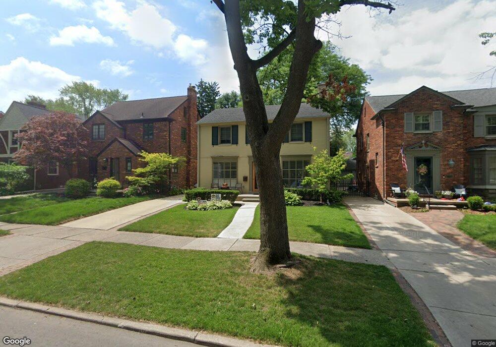
315 Merriweather Rd Grosse Pointe Farms, MI 48236
Estimated Value: $473,434 - $556,000
--
Bed
2
Baths
2,228
Sq Ft
$234/Sq Ft
Est. Value
About This Home
This home is located at 315 Merriweather Rd, Grosse Pointe Farms, MI 48236 and is currently estimated at $522,359, approximately $234 per square foot. 315 Merriweather Rd is a home located in Wayne County with nearby schools including Kerby Elementary School, Brownell Middle School, and Grosse Pointe South High School.
Ownership History
Date
Name
Owned For
Owner Type
Purchase Details
Closed on
Jul 25, 2013
Sold by
Currier Robert T
Bought by
Currier Melissa A
Current Estimated Value
Purchase Details
Closed on
Aug 29, 2003
Sold by
Sullivan Michael F and Sullivan Tami J
Bought by
Currier Robert T
Purchase Details
Closed on
Apr 28, 1998
Sold by
Mcma Bethany J and Mcma Kevin W
Bought by
Sullivan Michael F
Create a Home Valuation Report for This Property
The Home Valuation Report is an in-depth analysis detailing your home's value as well as a comparison with similar homes in the area
Home Values in the Area
Average Home Value in this Area
Purchase History
| Date | Buyer | Sale Price | Title Company |
|---|---|---|---|
| Currier Melissa A | -- | None Available | |
| Currier Robert T | $378,000 | Lawyers Title Insurance Comp | |
| Sullivan Michael F | $270,000 | -- |
Source: Public Records
Tax History Compared to Growth
Tax History
| Year | Tax Paid | Tax Assessment Tax Assessment Total Assessment is a certain percentage of the fair market value that is determined by local assessors to be the total taxable value of land and additions on the property. | Land | Improvement |
|---|---|---|---|---|
| 2025 | $3,847 | $223,900 | $0 | $0 |
| 2024 | $3,847 | $211,200 | $0 | $0 |
| 2023 | $3,665 | $193,800 | $0 | $0 |
| 2022 | $6,845 | $177,900 | $0 | $0 |
| 2021 | $6,466 | $168,600 | $0 | $0 |
| 2019 | $6,358 | $161,600 | $0 | $0 |
| 2018 | $3,254 | $151,400 | $0 | $0 |
| 2017 | $5,319 | $140,600 | $0 | $0 |
| 2016 | $5,576 | $134,200 | $0 | $0 |
| 2015 | $11,045 | $123,100 | $0 | $0 |
| 2013 | $10,700 | $107,000 | $0 | $0 |
| 2012 | $2,790 | $104,900 | $24,400 | $80,500 |
Source: Public Records
Map
Nearby Homes
- 317 Mount Vernon Ave
- 343 Mount Vernon Ave
- 341 Mcmillan Rd
- 314 Mount Vernon Ave
- 302 Mount Vernon Ave
- 352 Mckinley Ave
- 380 Merriweather Rd
- 276 Lewiston Rd
- 259 Mount Vernon Ave
- 827 Fisher Rd
- 194 Charlevoix Ave
- 415 Lothrop Rd
- 876 Washington Rd
- 218 Merriweather Rd
- 975 Fisher Rd
- 745 Lincoln Rd
- 240 Mckinley Ave
- 233 Mcmillan Rd
- 441 Manor St
- 216 Ridge Rd
- 317 Merriweather Rd
- 311 Merriweather Rd
- 321 Merriweather Rd
- 309 Merriweather Rd
- 316 Moran Rd
- 323 Merriweather Rd
- 307 Merriweather Rd
- 318 Moran Rd
- 314 Moran Rd
- 310 Moran Rd
- 320 Moran Rd
- 327 Merriweather Rd
- 305 Merriweather Rd
- 308 Moran Rd
- 316 Merriweather Rd Unit Bldg-Unit
- 316 Merriweather Rd
- 324 Moran Rd
- 318 Merriweather Rd
- 314 Merriweather Rd
- 320 Merriweather Rd