Estimated Value: $195,000 - $210,717
3
Beds
2
Baths
1,432
Sq Ft
$144/Sq Ft
Est. Value
About This Home
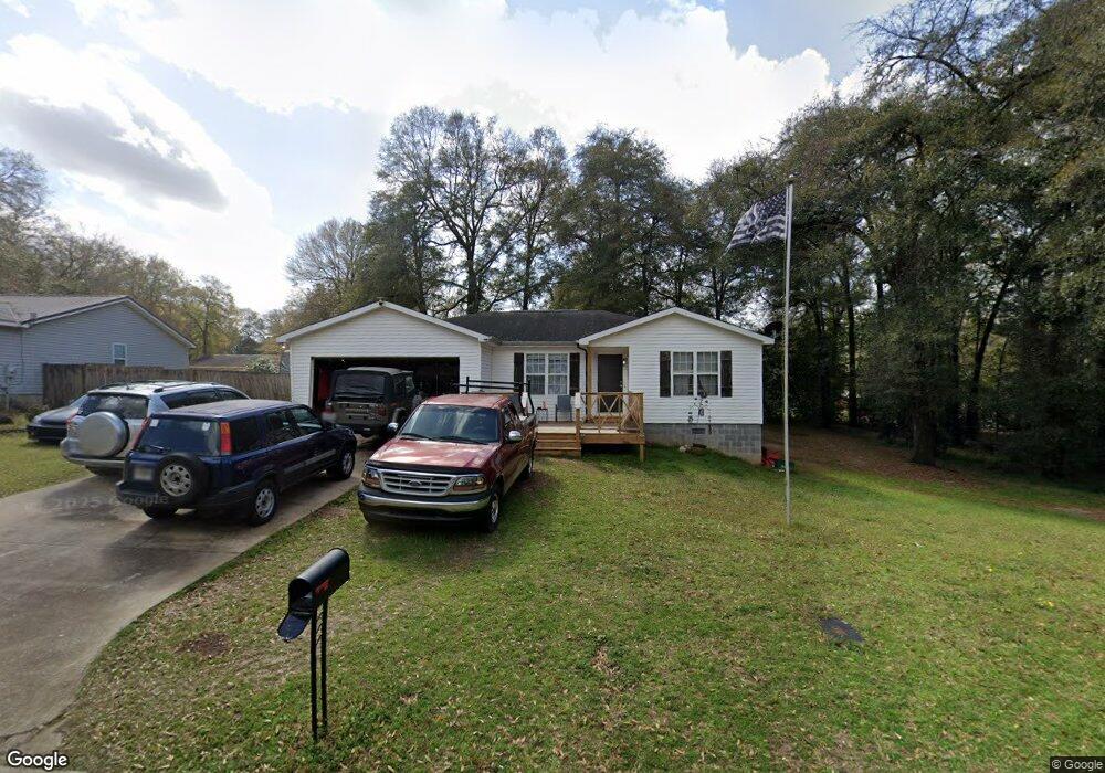
This home is located at 315 Merry Way, Perry, GA 31069 and is currently estimated at $205,679, approximately $143 per square foot. 315 Merry Way is a home located in Houston County with nearby schools including Langston Road Elementary School, Mossy Creek Middle School, and Perry High School.
Ownership History
Date
Name
Owned For
Owner Type
Purchase Details
Closed on
Jan 6, 2017
Sold by
Phillip Jon
Bought by
Wood Eric J
Current Estimated Value
Home Financials for this Owner
Home Financials are based on the most recent Mortgage that was taken out on this home.
Original Mortgage
$95,243
Outstanding Balance
$78,511
Interest Rate
4.13%
Mortgage Type
FHA
Estimated Equity
$127,168
Purchase Details
Closed on
Dec 29, 2015
Sold by
Lambert Deborah Richelle
Bought by
Lambert Jon Phillip
Home Financials for this Owner
Home Financials are based on the most recent Mortgage that was taken out on this home.
Original Mortgage
$82,500
Interest Rate
3.96%
Mortgage Type
New Conventional
Purchase Details
Closed on
Apr 25, 2003
Sold by
Barrett Lynward Etal
Bought by
Barrett Lynward Etal
Purchase Details
Closed on
Sep 19, 2001
Sold by
La Development Inc
Bought by
Barrett Lynward and Lambert Jon Phill
Create a Home Valuation Report for This Property
The Home Valuation Report is an in-depth analysis detailing your home's value as well as a comparison with similar homes in the area
Home Values in the Area
Average Home Value in this Area
Purchase History
| Date | Buyer | Sale Price | Title Company |
|---|---|---|---|
| Wood Eric J | $97,000 | -- | |
| Lambert Jon Phillip | -- | -- | |
| Barrett Lynward Etal | -- | -- | |
| Barrett Lynward | $69,700 | -- |
Source: Public Records
Mortgage History
| Date | Status | Borrower | Loan Amount |
|---|---|---|---|
| Open | Wood Eric J | $95,243 | |
| Previous Owner | Lambert Jon Phillip | $82,500 |
Source: Public Records
Tax History Compared to Growth
Tax History
| Year | Tax Paid | Tax Assessment Tax Assessment Total Assessment is a certain percentage of the fair market value that is determined by local assessors to be the total taxable value of land and additions on the property. | Land | Improvement |
|---|---|---|---|---|
| 2024 | $1,308 | $54,680 | $6,000 | $48,680 |
| 2023 | $1,103 | $45,640 | $6,000 | $39,640 |
| 2022 | $1,082 | $44,760 | $6,000 | $38,760 |
| 2021 | $938 | $38,600 | $6,000 | $32,600 |
| 2020 | $883 | $36,160 | $4,400 | $31,760 |
| 2019 | $883 | $36,160 | $4,320 | $31,840 |
| 2018 | $883 | $36,160 | $4,320 | $31,840 |
| 2017 | $876 | $35,840 | $4,320 | $31,520 |
| 2016 | $854 | $34,920 | $4,320 | $30,600 |
| 2015 | $856 | $34,920 | $4,320 | $30,600 |
| 2014 | -- | $34,920 | $4,320 | $30,600 |
| 2013 | -- | $38,080 | $7,200 | $30,880 |
Source: Public Records
Map
Nearby Homes
- 104 Arcadia Ln
- 436 Courtney Ln
- 113 Loneoak Trail
- 304 N Lake Dr
- 313 Ruger Place
- 201 Boulder Creek Rd
- 109 Village Blvd
- 205 Canvass Back Trail
- 203 Saraland Trail
- 115 Woody Dr
- 312 Cambrian Dr
- 107 Waldorf Dr
- 103 Waldorf Dr
- 425 Cambrian Dr
- 431 Sawtooth Ct
- 250 Hathersage Dr
- 251 Hathersage Dr
- 107 Gallberry Ln
- 107 Gallberry Ln Unit 50G
- 2327 U S 41