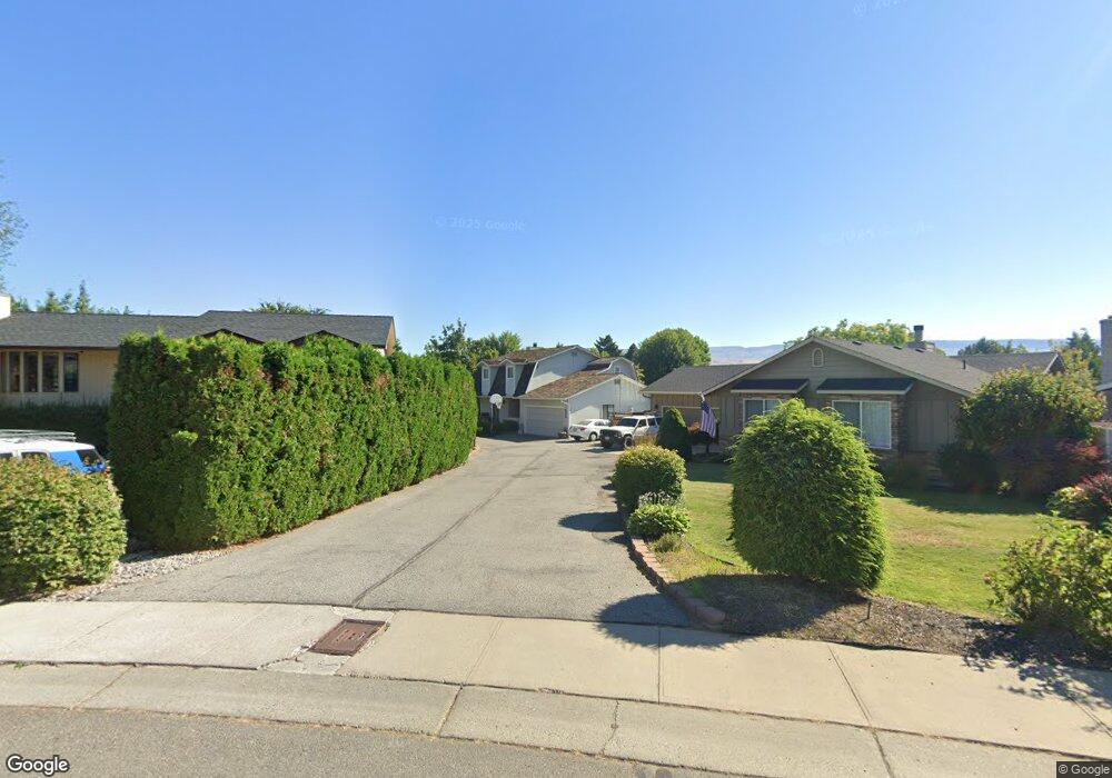
315 Michael Place Wenatchee, WA 98801
Estimated Value: $499,313 - $591,000
3
Beds
2
Baths
1,739
Sq Ft
$312/Sq Ft
Est. Value
About This Home
This home is located at 315 Michael Place, Wenatchee, WA 98801 and is currently estimated at $542,104, approximately $311 per square foot. 315 Michael Place is a home located in Chelan County with nearby schools including Washington Elementary School, Orchard Middle School, and Wenatchee High School.
Ownership History
Date
Name
Owned For
Owner Type
Purchase Details
Closed on
Apr 17, 2017
Sold by
Jeffries William J and Jeffries Valerie J
Bought by
Wells Greg L and Wells Ali B
Current Estimated Value
Home Financials for this Owner
Home Financials are based on the most recent Mortgage that was taken out on this home.
Original Mortgage
$277,874
Outstanding Balance
$232,238
Interest Rate
4.37%
Mortgage Type
FHA
Estimated Equity
$309,866
Purchase Details
Closed on
Mar 25, 2013
Sold by
St John Rebecca J
Bought by
Jeffries William J and Jeffries Valerie J
Home Financials for this Owner
Home Financials are based on the most recent Mortgage that was taken out on this home.
Original Mortgage
$198,000
Interest Rate
3.54%
Mortgage Type
VA
Create a Home Valuation Report for This Property
The Home Valuation Report is an in-depth analysis detailing your home's value as well as a comparison with similar homes in the area
Purchase History
| Date | Buyer | Sale Price | Title Company |
|---|---|---|---|
| Wells Greg L | $283,000 | First American Title | |
| Jeffries William J | $205,000 | Central Wash Title Svcs Inc |
Source: Public Records
Mortgage History
| Date | Status | Borrower | Loan Amount |
|---|---|---|---|
| Open | Wells Greg L | $277,874 | |
| Previous Owner | Jeffries William J | $198,000 |
Source: Public Records
Tax History
| Year | Tax Paid | Tax Assessment Tax Assessment Total Assessment is a certain percentage of the fair market value that is determined by local assessors to be the total taxable value of land and additions on the property. | Land | Improvement |
|---|---|---|---|---|
| 2025 | $3,370 | $538,071 | $128,000 | $410,071 |
| 2024 | $3,337 | $379,709 | $121,000 | $258,709 |
| 2023 | $3,337 | $380,716 | $77,400 | $303,316 |
| 2022 | $3,937 | $398,322 | $77,400 | $320,922 |
| 2021 | $3,430 | $389,631 | $45,000 | $344,631 |
| 2020 | $2,776 | $315,379 | $45,000 | $270,379 |
| 2019 | $2,544 | $257,209 | $45,000 | $212,209 |
| 2018 | $2,829 | $248,061 | $45,000 | $203,061 |
| 2017 | $2,684 | $226,951 | $52,965 | $173,986 |
| 2016 | $2,089 | $234,516 | $49,500 | $185,016 |
| 2015 | $2,089 | $213,711 | $45,000 | $168,711 |
| 2013 | $2,089 | $170,008 | $45,000 | $125,008 |
Source: Public Records
Map
Nearby Homes
- 9 Elliott Ave N
- 409 N Mills Ave
- 1625 Pleasant Ave
- 1628 Pleasant Ave
- 913 Meadow Ridge Dr
- 936 Vassar Ave
- 1003 Amherst Ave
- 1013 Amherst Ave
- 1030 Finch Ln Unit E2
- 1030 Finch Ln Unit D2
- 1030 Finch Ln Unit A3
- 1030 Finch Ln Unit H1
- 32 Furney St
- 1310 Castlerock Ave Unit 9
- 33 Furney St
- 300 S Elliott Ave Unit 29
- 1919 B Fifth St
- 340 Brandi Ln
- 1000 N Western Ave
- 143 Sienna Rd
- 311 Michael Place
- 319 Michael Place
- 336 Elliott Ave N
- 307 Michael Place
- 323 Michael Place
- 1421 1/2 Fifth St
- 305 Michael Place
- 303 Michael Place
- 306 Michael Place
- 320 Elliott Ave N
- 327 Michael Place
- 1417 5th St Unit Building 12
- 1417 5th St
- 330 Elliott Ave N
- 1500 4th St
- 400 Elliott Ave N
- 329 Michael Place
- 300 Elliott Ave N
- 406 N Elliott Ave
- 219 Michael Place
Your Personal Tour Guide
Ask me questions while you tour the home.