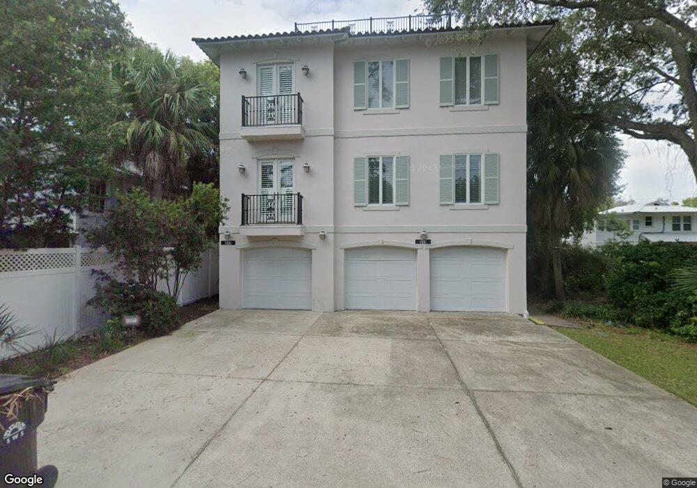
315 Myrtle St Saint Simons Island, GA 31522
Estimated Value: $936,735 - $1,171,000
3
Beds
4
Baths
2,268
Sq Ft
$476/Sq Ft
Est. Value
About This Home
This home is located at 315 Myrtle St, Saint Simons Island, GA 31522 and is currently estimated at $1,080,684, approximately $476 per square foot. 315 Myrtle St is a home located in Glynn County with nearby schools including St. Simons Elementary School, Glynn Middle School, and Glynn Academy.
Ownership History
Date
Name
Owned For
Owner Type
Purchase Details
Closed on
Mar 4, 2022
Sold by
Hewson Robert H
Bought by
Hunter George C
Current Estimated Value
Home Financials for this Owner
Home Financials are based on the most recent Mortgage that was taken out on this home.
Original Mortgage
$618,750
Outstanding Balance
$577,075
Interest Rate
3.92%
Mortgage Type
New Conventional
Estimated Equity
$503,609
Create a Home Valuation Report for This Property
The Home Valuation Report is an in-depth analysis detailing your home's value as well as a comparison with similar homes in the area
Home Values in the Area
Average Home Value in this Area
Purchase History
| Date | Buyer | Sale Price | Title Company |
|---|---|---|---|
| Hunter George C | $825,000 | -- |
Source: Public Records
Mortgage History
| Date | Status | Borrower | Loan Amount |
|---|---|---|---|
| Open | Hunter George C | $618,750 |
Source: Public Records
Tax History Compared to Growth
Tax History
| Year | Tax Paid | Tax Assessment Tax Assessment Total Assessment is a certain percentage of the fair market value that is determined by local assessors to be the total taxable value of land and additions on the property. | Land | Improvement |
|---|---|---|---|---|
| 2025 | $6,982 | $278,400 | $0 | $278,400 |
| 2024 | $6,982 | $278,400 | $0 | $278,400 |
| 2023 | $7,831 | $313,600 | $0 | $313,600 |
| 2022 | $5,995 | $278,400 | $0 | $278,400 |
| 2021 | $6,178 | $242,080 | $0 | $242,080 |
| 2020 | $6,234 | $242,080 | $0 | $242,080 |
| 2019 | $6,314 | $242,080 | $0 | $242,080 |
| 2018 | $6,314 | $242,080 | $0 | $242,080 |
| 2017 | $6,314 | $242,080 | $0 | $242,080 |
| 2016 | $7,838 | $368,080 | $130,000 | $238,080 |
| 2015 | $7,871 | $368,080 | $130,000 | $238,080 |
| 2014 | $7,871 | $326,000 | $130,000 | $196,000 |
Source: Public Records
Map
Nearby Homes
- 405 Everett St
- 1035 Beachview Dr Unit 19
- 1035 Beachview Dr Unit 201
- 1028 Beachview Dr Unit 5
- 1028 Beachview Dr Unit 2
- 1145 Park Ln
- 1153 Ocean Blvd
- 1055 College St
- 201 Neptune Rd Unit 255
- 201 Neptune Rd Unit 157
- 201 Neptune Rd Unit 258
- 1104 Sherman Ave
- 1017 Ocean View Ave
- 908 Ocean Blvd
- 907 Beachview Dr
- 322 5th St
- 1308 Oak St
- 1313 Beachview Dr
- 1320 Oak St
- 1332 Oak St Unit 9