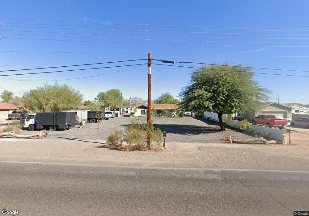
315 N Signal Butte Rd Apache Junction, AZ 85120
Northeast Mesa NeighborhoodEstimated Value: $294,027 - $374,000
Studio
--
Bath
--
Sq Ft
9,670
Sq Ft Lot
About This Home
This home is located at 315 N Signal Butte Rd, Apache Junction, AZ 85120 and is currently estimated at $334,014. 315 N Signal Butte Rd is a home located in Maricopa County with nearby schools including Sousa Elementary School, Franklin at Brimhall Elementary School, and Franklin West Elementary School.
Ownership History
Date
Name
Owned For
Owner Type
Purchase Details
Closed on
Aug 14, 2023
Sold by
Capital Investments Llc
Bought by
Rodriguez Alejandro Castro
Current Estimated Value
Purchase Details
Closed on
May 31, 2023
Sold by
Parsons Debra K
Bought by
Capital Investments Llc
Home Financials for this Owner
Home Financials are based on the most recent Mortgage that was taken out on this home.
Original Mortgage
$166,000
Interest Rate
6.39%
Mortgage Type
New Conventional
Purchase Details
Closed on
Nov 14, 2015
Sold by
Phillips Norman D and Phillips Silvia E
Bought by
Parsons Debra K
Home Financials for this Owner
Home Financials are based on the most recent Mortgage that was taken out on this home.
Original Mortgage
$92,012
Interest Rate
3.76%
Mortgage Type
FHA
Purchase Details
Closed on
Mar 28, 2014
Sold by
Phillips Norman
Bought by
The Phillips Family Living Trust and Phillips Sylvia E
Create a Home Valuation Report for This Property
The Home Valuation Report is an in-depth analysis detailing your home's value as well as a comparison with similar homes in the area
Home Values in the Area
Average Home Value in this Area
Purchase History
| Date | Buyer | Sale Price | Title Company |
|---|---|---|---|
| Rodriguez Alejandro Castro | $350,000 | First Integrity Title | |
| Capital Investments Llc | $175,000 | Clear Title Agency Of Arizona | |
| Parsons Debra K | $93,710 | Driggs Title Agency Inc | |
| The Phillips Family Living Trust | -- | None Available |
Source: Public Records
Mortgage History
| Date | Status | Borrower | Loan Amount |
|---|---|---|---|
| Previous Owner | Capital Investments Llc | $166,000 | |
| Previous Owner | Parsons Debra K | $92,012 |
Source: Public Records
Tax History
| Year | Tax Paid | Tax Assessment Tax Assessment Total Assessment is a certain percentage of the fair market value that is determined by local assessors to be the total taxable value of land and additions on the property. | Land | Improvement |
|---|---|---|---|---|
| 2025 | $32 | $428 | $428 | -- |
| 2024 | $33 | $407 | $407 | -- |
| 2023 | $33 | $2,130 | $2,130 | $0 |
| 2022 | $32 | $1,490 | $1,490 | $0 |
| 2021 | $32 | $1,270 | $1,270 | $0 |
| 2020 | $32 | $1,030 | $1,030 | $0 |
| 2019 | $29 | $930 | $930 | $0 |
| 2018 | $28 | $770 | $770 | $0 |
| 2017 | $27 | $690 | $690 | $0 |
| 2016 | $27 | $660 | $660 | $0 |
| 2015 | $25 | $520 | $520 | $0 |
Source: Public Records
Map
Nearby Homes
- 345 N Signal Butte Rd Unit 23
- 10813 E Boston St
- 535 N Bailey Cir
- 10620 E Caballero St
- 538 N 110th St
- 433 N 111th Place
- 10936 E Apache Trail Unit 121
- 11029 E Decatur St
- 11058 E Cholla Rd
- 11201 E Jupiter Dr
- 11100 E Apache Trail Unit 37
- 11100 E Apache Trail
- 11100 E Apache Trail Unit 8
- 11100 E Apache Trail Unit 16
- 11100 E Apache Trail Unit 48
- 10540 E Apache Trail Unit 15
- 10540 E Apache Trail Unit 6
- 10540 E Apache Trail Unit 91
- 10540 E Apache Trail Unit 93
- 10540 E Apache Trail Unit 127
- 315 N Signal Butte Rd
- 311 N Signal Butte Rd Unit 5
- 311 N Signal Butte Rd
- 331 N Signal Butte Rd
- 10812 E Mercury Dr
- 10804 E Mercury Dr
- 301 N Signal Butte Rd Unit 727
- 301 N Signal Butte Rd
- 322 N Keith St
- 335 N Signal Butte Rd
- 326 N Keith St
- 318 N Signal Butte Rd
- 312 N Keith St
- 328 N Signal Butte Rd
- 302 N Keith St
- 336 N Keith St
- 341 N Signal Butte Rd
- 308 N Signal Butte Rd
- 345 N Signal Butte Rd
- 342 N Keith St
Your Personal Tour Guide
Ask me questions while you tour the home.