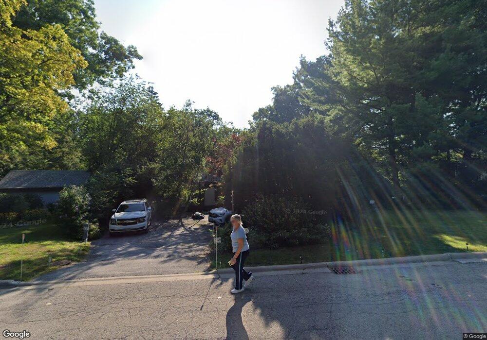
315 Oak Tree Ln Waukegan, IL 60085
Lyon Grove NeighborhoodEstimated Value: $307,000 - $378,000
2
Beds
2
Baths
3,508
Sq Ft
$102/Sq Ft
Est. Value
About This Home
This home is located at 315 Oak Tree Ln, Waukegan, IL 60085 and is currently estimated at $358,189, approximately $102 per square foot. 315 Oak Tree Ln is a home located in Lake County with nearby schools including H R McCall Elementary School, Miguel Juarez Middle School, and Waukegan High School.
Ownership History
Date
Name
Owned For
Owner Type
Purchase Details
Closed on
Jan 15, 2004
Sold by
Healy Janice S and Howard Friend Trust
Bought by
Kudesh Michael J and Kudesh Jennifer C
Current Estimated Value
Home Financials for this Owner
Home Financials are based on the most recent Mortgage that was taken out on this home.
Original Mortgage
$184,000
Interest Rate
5.91%
Mortgage Type
Purchase Money Mortgage
Purchase Details
Closed on
Apr 1, 1997
Sold by
Friend Howard and Friend Virginia V
Bought by
Friend Howard and Howard Friend Trust
Create a Home Valuation Report for This Property
The Home Valuation Report is an in-depth analysis detailing your home's value as well as a comparison with similar homes in the area
Home Values in the Area
Average Home Value in this Area
Purchase History
| Date | Buyer | Sale Price | Title Company |
|---|---|---|---|
| Kudesh Michael J | $30,000 | First American Title | |
| Friend Howard | -- | -- |
Source: Public Records
Mortgage History
| Date | Status | Borrower | Loan Amount |
|---|---|---|---|
| Closed | Kudesh Michael J | $184,000 |
Source: Public Records
Tax History Compared to Growth
Tax History
| Year | Tax Paid | Tax Assessment Tax Assessment Total Assessment is a certain percentage of the fair market value that is determined by local assessors to be the total taxable value of land and additions on the property. | Land | Improvement |
|---|---|---|---|---|
| 2024 | $9,790 | $127,551 | $18,446 | $109,105 |
| 2023 | $9,985 | $111,819 | $16,236 | $95,583 |
| 2022 | $9,985 | $108,134 | $22,353 | $85,781 |
| 2021 | $9,571 | $97,807 | $21,046 | $76,761 |
| 2020 | $9,649 | $91,119 | $19,607 | $71,512 |
| 2019 | $9,658 | $83,496 | $17,967 | $65,529 |
| 2018 | $7,659 | $65,620 | $18,085 | $47,535 |
| 2017 | $7,405 | $58,055 | $16,000 | $42,055 |
| 2016 | $6,869 | $50,447 | $13,903 | $36,544 |
| 2015 | $6,613 | $45,150 | $12,443 | $32,707 |
| 2014 | $5,810 | $40,315 | $8,050 | $32,265 |
| 2012 | $7,245 | $43,677 | $8,721 | $34,956 |
Source: Public Records
Map
Nearby Homes
- 28 N Saint James St
- 428 N Poplar St
- 511 Chestnut St
- 23 N Jackson St
- 522 N Poplar St
- 613 Washington St
- 452 North Ave
- 702 Franklin St
- 620 N Poplar St
- 1416 Hamilton Ct
- 557 W Water St
- 610 Bluff St
- 222 Grand Ave
- 215 S Park Ave
- 325 4th St
- 1109 Massena Ave
- 304 Powell Ave
- 1521 Catalpa Ave
- 613 Clarke Ave
- 824 N Butrick St
- 321 Oak Tree Ln
- 305 Oak Tree Ln
- 310 Oak Tree Ln
- 921 Rogers Ct
- 918 Rogers Ct
- 313 Oak Crest St
- 307 Oak Crest St
- 301 Oak Tree Ln
- 909 Oak Tree Ln
- 922 Rogers Ct
- 301 Oak Crest St
- 915 Oak Tree Ln
- 665 Mill Ct
- 926 Rogers Ct
- 921 Oak Tree Ln
- 665 Mill Ct
- 928 Rogers Ct
- 657 Mill Ct
- 906 W Clayton St
- 310 Oak Crest St
