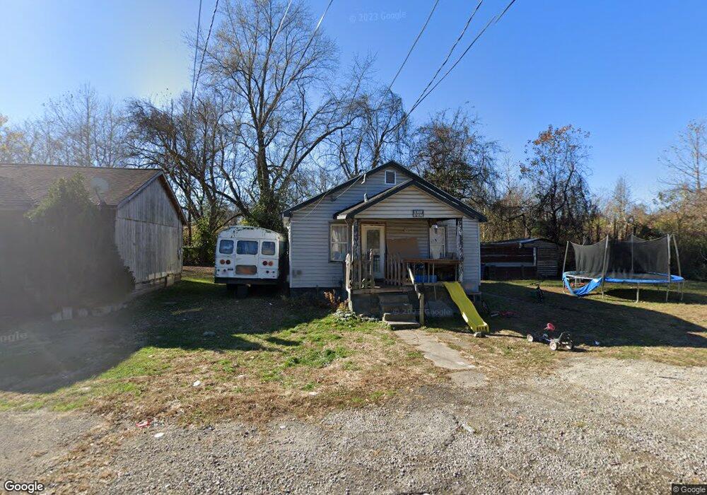
315 Ridgeway St Coal Grove, OH 45638
Estimated Value: $40,000 - $90,000
2
Beds
1
Bath
696
Sq Ft
$89/Sq Ft
Est. Value
About This Home
This home is located at 315 Ridgeway St, Coal Grove, OH 45638 and is currently estimated at $61,834, approximately $88 per square foot. 315 Ridgeway St is a home located in Lawrence County with nearby schools including Dawson-Bryant Elementary School, Dawson-Bryant Middle School, and Dawson-Bryant High School.
Ownership History
Date
Name
Owned For
Owner Type
Purchase Details
Closed on
Sep 23, 2024
Sold by
Thompson Brent E
Bought by
Jackson David A and Jackson Kelli Jean
Current Estimated Value
Purchase Details
Closed on
Mar 23, 2006
Sold by
Thompson Glenn and Thompson Glenn E
Bought by
Thompson Brent E
Purchase Details
Closed on
Oct 27, 1992
Bought by
Thompson Glenn and Thompson Alice J
Purchase Details
Closed on
Nov 15, 1991
Sold by
Wheeler Robert E
Bought by
Glenco, Inc.
Create a Home Valuation Report for This Property
The Home Valuation Report is an in-depth analysis detailing your home's value as well as a comparison with similar homes in the area
Home Values in the Area
Average Home Value in this Area
Purchase History
| Date | Buyer | Sale Price | Title Company |
|---|---|---|---|
| Jackson David A | $36,000 | None Listed On Document | |
| Jackson David A | $36,000 | None Listed On Document | |
| Thompson Brent E | -- | None Available | |
| Thompson Glenn | $600 | -- | |
| Glenco, Inc. | $19,500 | -- |
Source: Public Records
Tax History Compared to Growth
Tax History
| Year | Tax Paid | Tax Assessment Tax Assessment Total Assessment is a certain percentage of the fair market value that is determined by local assessors to be the total taxable value of land and additions on the property. | Land | Improvement |
|---|---|---|---|---|
| 2024 | -- | $14,990 | $2,800 | $12,190 |
| 2023 | $548 | $14,990 | $2,800 | $12,190 |
| 2022 | $556 | $14,990 | $2,800 | $12,190 |
| 2021 | $397 | $13,040 | $2,600 | $10,440 |
| 2020 | $498 | $13,040 | $2,600 | $10,440 |
| 2019 | $496 | $13,040 | $2,600 | $10,440 |
| 2018 | $501 | $13,040 | $2,600 | $10,440 |
| 2017 | $500 | $13,040 | $2,600 | $10,440 |
| 2016 | $469 | $13,040 | $2,600 | $10,440 |
| 2015 | $438 | $11,080 | $2,600 | $8,480 |
| 2014 | $412 | $11,080 | $2,600 | $8,480 |
| 2013 | $411 | $11,080 | $2,600 | $8,480 |
Source: Public Records
Map
Nearby Homes
- 805 1/2 High St
- 514 Lane St
- 519 Lane St
- 303 Pike St
- 125 Center St
- 119 Remy St
- 309 High St
- 309 High St Unit LAO-5
- 103 Carrico Dr
- 0 Central & Mlk
- 1003 Marion Pike
- 508 16th St
- 1100 Price St
- 1824 Carter Ave
- 1409 Hoods Creek Pike
- 0 18th Street & Central Ave
- 156 Township Road 181
- 0 Carter Ave
- 0 Kentucky 5
- 2088 State Route 243
- 313 Ridgeway St
- 309 Ridgeway St
- 322 Ridgeway St
- 307 Ridgeway St
- 310 Ridgeway St
- 305 Ridgeway St
- 308 Ridgeway St
- 900 High St
- 306 Ridgeway St
- 303 Ridgeway St
- 304 Ridgeway St
- 301 Ridgeway St
- 302 Ridgeway St
- 301 1/2 Ridgeway St
- 910 High St
- 202 Elm St
- 214 Ridgeway St
- 108 Fernwood Dr
- 215 Ridgeway St
- 109 Fernwood Dr