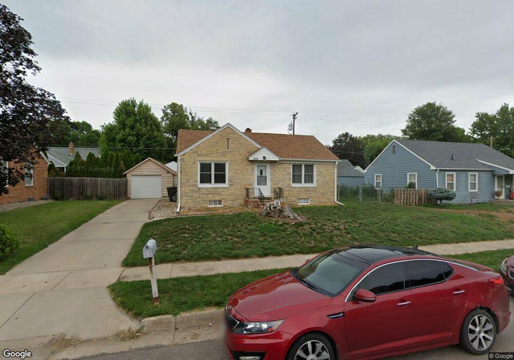
315 Ringland Rd Hastings, NE 68901
Estimated Value: $152,000 - $199,000
2
Beds
2
Baths
850
Sq Ft
$209/Sq Ft
Est. Value
About This Home
This home is located at 315 Ringland Rd, Hastings, NE 68901 and is currently estimated at $177,915, approximately $209 per square foot. 315 Ringland Rd is a home located in Adams County with nearby schools including Hastings Senior High School and St. Cecilia High School.
Ownership History
Date
Name
Owned For
Owner Type
Purchase Details
Closed on
Sep 15, 2024
Sold by
Oliver Bradley J and Oliver Kimberly K
Bought by
Markle Emma N and Kusek Adynn M
Current Estimated Value
Home Financials for this Owner
Home Financials are based on the most recent Mortgage that was taken out on this home.
Original Mortgage
$171,690
Outstanding Balance
$169,760
Interest Rate
6.47%
Mortgage Type
New Conventional
Estimated Equity
$8,155
Purchase Details
Closed on
Jun 11, 2021
Sold by
Dedrick David D and Dedrick Wendy
Bought by
Oliver Bradley J and Oliver Kimberly K
Home Financials for this Owner
Home Financials are based on the most recent Mortgage that was taken out on this home.
Original Mortgage
$126,000
Interest Rate
2.9%
Mortgage Type
New Conventional
Purchase Details
Closed on
Oct 31, 2012
Sold by
Nygren Lindsey M
Bought by
Dedrick David D
Create a Home Valuation Report for This Property
The Home Valuation Report is an in-depth analysis detailing your home's value as well as a comparison with similar homes in the area
Home Values in the Area
Average Home Value in this Area
Purchase History
| Date | Buyer | Sale Price | Title Company |
|---|---|---|---|
| Markle Emma N | $177,000 | Prairie Title | |
| Oliver Bradley J | $140,000 | Jerry Prairie Title | |
| Dedrick David D | $36,000 | None Available |
Source: Public Records
Mortgage History
| Date | Status | Borrower | Loan Amount |
|---|---|---|---|
| Open | Markle Emma N | $171,690 | |
| Previous Owner | Oliver Bradley J | $126,000 |
Source: Public Records
Tax History Compared to Growth
Tax History
| Year | Tax Paid | Tax Assessment Tax Assessment Total Assessment is a certain percentage of the fair market value that is determined by local assessors to be the total taxable value of land and additions on the property. | Land | Improvement |
|---|---|---|---|---|
| 2024 | $1,957 | $123,109 | $15,966 | $107,143 |
| 2023 | $2,469 | $119,652 | $15,966 | $103,686 |
| 2022 | $2,612 | $115,969 | $15,966 | $100,003 |
| 2021 | $2,078 | $94,742 | $11,708 | $83,034 |
| 2020 | $1,958 | $90,788 | $11,708 | $79,080 |
| 2019 | $1,937 | $90,788 | $11,708 | $79,080 |
| 2018 | $1,792 | $83,550 | $4,470 | $79,080 |
| 2017 | $1,694 | $79,075 | $0 | $0 |
| 2016 | $1,696 | $79,075 | $4,470 | $74,605 |
| 2011 | -- | $0 | $0 | $0 |
Source: Public Records
Map
Nearby Homes
- 208 Ringland Rd
- 234 Forest Blvd
- 216 Forest Blvd
- 1142 N Minnesota Ave
- 831 N Cedar Ave
- 411 University Ave
- 1113 N Colorado Ave
- 914 N Colorado Ave
- 1233 N Colorado Ave
- TBD Kansas Ave
- 903 N Saint Joseph Ave
- 1131 N Denver Ave
- 302 E 6th St
- 910 Ronan Dr
- 406 E 6th St
- 514 W 14th St
- 615 W 10th St
- 118 E 6th St
- 1101 N Hastings Ave
- 1407 N Denver Ave
- 319 Ringland Rd
- 314 E 12th St
- 309 Ringland Rd
- 318 E 12th St
- 308 E 12th St
- 221 Ringland Rd
- 302 E 12th St
- 314 Ringland Rd
- 232 Ringland Rd
- 318 Ringland Rd
- 217 Ringland Rd
- 228 Ringland Rd
- 216 E 12th St
- 317 E 12th St
- 401 Ringland Rd
- 224 Ringland Rd
- 303 E 12th St
- 400 E 12th St
- 213 Ringland Rd
- 220 Ringland Rd