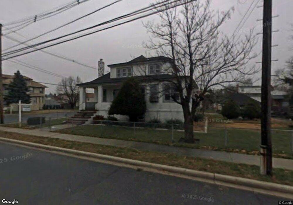
315 Roosevelt Ave Freeport, NY 11520
Estimated Value: $677,000 - $728,730
3
Beds
2
Baths
1,958
Sq Ft
$359/Sq Ft
Est. Value
About This Home
This home is located at 315 Roosevelt Ave, Freeport, NY 11520 and is currently estimated at $702,865, approximately $358 per square foot. 315 Roosevelt Ave is a home located in Nassau County with nearby schools including Columbus Avenue School, Caroline G. Atkinson Intermediate School, and John W Dodd Middle School.
Ownership History
Date
Name
Owned For
Owner Type
Purchase Details
Closed on
Nov 20, 2009
Sold by
Delilla Victoria and Delilla Thomas M
Bought by
Gilbert Wilky
Current Estimated Value
Home Financials for this Owner
Home Financials are based on the most recent Mortgage that was taken out on this home.
Original Mortgage
$309,294
Outstanding Balance
$202,060
Interest Rate
5.01%
Mortgage Type
FHA
Estimated Equity
$500,805
Purchase Details
Closed on
Apr 15, 2008
Sold by
Delilla Thomas
Bought by
Delilla Victoria
Create a Home Valuation Report for This Property
The Home Valuation Report is an in-depth analysis detailing your home's value as well as a comparison with similar homes in the area
Home Values in the Area
Average Home Value in this Area
Purchase History
| Date | Buyer | Sale Price | Title Company |
|---|---|---|---|
| Gilbert Wilky | $315,000 | -- | |
| Delilla Victoria | -- | None Available |
Source: Public Records
Mortgage History
| Date | Status | Borrower | Loan Amount |
|---|---|---|---|
| Open | Gilbert Wilky | $309,294 |
Source: Public Records
Tax History Compared to Growth
Tax History
| Year | Tax Paid | Tax Assessment Tax Assessment Total Assessment is a certain percentage of the fair market value that is determined by local assessors to be the total taxable value of land and additions on the property. | Land | Improvement |
|---|---|---|---|---|
| 2025 | $7,728 | $400 | $191 | $209 |
| 2024 | $853 | $400 | $191 | $209 |
| 2023 | $6,574 | $400 | $191 | $209 |
| 2022 | $6,574 | $400 | $191 | $209 |
| 2021 | $8,997 | $428 | $204 | $224 |
| 2020 | $7,058 | $501 | $482 | $19 |
| 2019 | $6,034 | $537 | $355 | $182 |
| 2018 | $6,339 | $781 | $0 | $0 |
| 2017 | $7,999 | $781 | $517 | $264 |
| 2016 | $9,171 | $781 | $517 | $264 |
| 2015 | $1,128 | $781 | $517 | $264 |
| 2014 | $1,128 | $781 | $517 | $264 |
| 2013 | $1,066 | $781 | $517 | $264 |
Source: Public Records
Map
Nearby Homes
- 31 Casino St Unit PH
- 171 Westside Ave
- 173 Cedar St
- 119 S Bay Ave
- 310 Miller Ave
- 322 Miller Ave
- 209 Nassau Ave
- 374 Miller Ave
- 159 Branch Ave
- 494 S Ocean Ave Unit 1H
- 494 S Ocean Ave Unit 3A
- 232 Nassau Ave
- 536 S Ocean Ave
- 226 Westside Ave Unit B
- 570 S Ocean Ave
- 587 S Bayview Ave
- 65 Adams St
- 479 Roosevelt Ave
- 16 Johnson Place
- 437 Ray St
- 319 Roosevelt Ave
- 498 S Long Beach Ave
- 502 S Long Beach Ave
- 365 Roosevelt Ave
- 1 Casino St
- 305 Roosevelt Ave
- 329 Roosevelt Ave
- 6 Casino St
- 324 Roosevelt Ave
- 514 S Long Beach Ave
- 28 Casino St
- 299 Roosevelt Ave
- 31 Casino St Unit 2J
- 31 Casino St Unit 4B
- 31 Casino St Unit 4K
- 31 Casino St Unit 2D
- 31 Casino St Unit 3-B
- 31 Casino St
- 31 Casino St
- 31 Casino St